Vector Maps of the Alabama : southeastern U.S. state that’s home to significant landmarks from the American Civil Rights Movement. The city of Birmingham’s 16th Street Baptist Church, now a museum, was a protest headquarters in the 1960s. Martin Luther King, Jr.’s church and the Rosa Parks Museum, dedicated to the activist, can be found in the capital of Montgomery.
Capital: Montgomery
Largest metro and urban areas: Greater Birmingham
Area
• Total 52,419 sq mi (135,765 km2)
• Land 50,744 sq mi (131,426 km2)
• Water 1,675 sq mi (4,338 km2) 3.2%
Dimensions
• Length 330 mi (531 km)
• Width 190 mi (305 km)
Elevation 500 ft (150 m)
Highest elevation Mount Cheaha 2,413 ft (735.5 m)
Lowest elevation Gulf of Mexico 0 ft (0 m)
Population
• Total 5,072,343
• Rank 24th
• Density 99.1/sq mi (38.4/km2)
All of our editable Alabama US vector maps are digital files,
which can be instantly downloaded in editable PDF or Adobe Illustrator format.
Objects on maps are usually divided into layers according to their types – lines, polygons, street names, object names (see map description!!!!)
Each of our Alabama US digital maps is available in Adobe Illustrator or editable PDF format, (or on request in any other known format for the same price)
which use a vector approach to display images,
you can easily enlarge any part of our maps without compromising text, line or graphic quality,
with any increase or decrease ratio.
Using a vector graphics editor such as Adobe Illustrator, CorelDraw, Inkscape, or Freehand
you can easily crop parts of the map, add custom characters, and change colors and font attributes as needed.
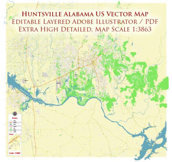
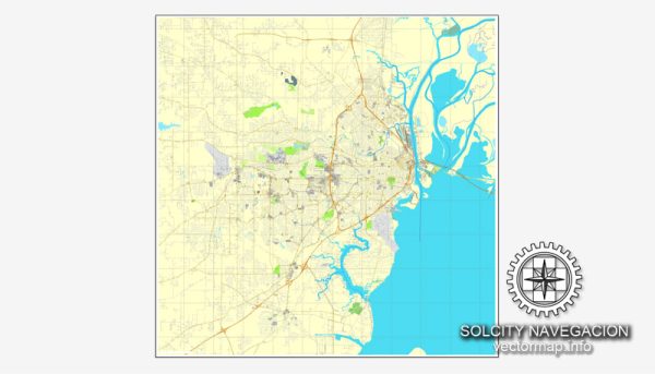
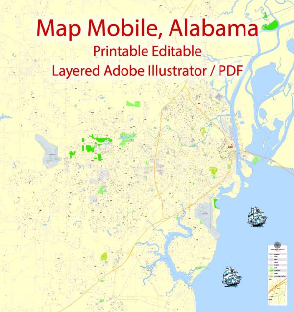
We have a variety of Alabama US vector maps with different levels of detail, from simple empty paths to highly detailed maps with roads and terrain layers.
| Free Vector Map Alabama State US Ai + PDF | Free Vector Map Alabama (Counties Areas) with names Ai + PDF + SVG |
|---|---|
List of Alabama counties |
List of Cities and towns by counties |
Autauga County ALAutauga County AL is a county in the US state of Alabama. Officially formed in 1818. As of 2020, the population was 58,805. The county seat is Prathville. |
|
Baldwin County ALBaldwin County AL is a county in Alabama, USA. The population according to the 2020 census is 231,767 people. The administrative center is Bay Minette. Officially formed in 1809. |
|
Barbour County ALBarbour County AL is a county in the state of Alabama, United States. The population according to the 2020 census is 25,223 people. The administrative center is Clayton. Named after the American politician, Virginia Governor James Barbour. |
|
Bibb County ALBibb County AL is a county in Alabama, USA. The population according to the 2020 census is 22,293 people. The county seat is Centerville. |
|
Blount County ALBlount County AL is a county in Alabama, USA. The population according to the 2020 census is 59,134 people. The administrative center is Oneonta. Officially formed in 1818. |
|
Bullock County ALBullock County AL is a county in the state of Alabama, United States. The population according to the 2020 census is 10,357 people. The administrative center is Union Springs. Officially formed in 1866. |
|
Butler County ALButler County AL is a county in the state of Alabama, United States. The population according to the 2020 census is 19,051 people. The county seat is Greenville. |
|
Calhoun County ALCalhoun County AL is a county in the US state of Alabama. As of 2000, the population was 112,249. The county seat is Anniston. Named after politician John Calhoun. |
|
Chambers County ALChambers County AL is a county in the US state of Alabama. As of 2000, the population was 36,583. The county seat is Lafayette. |
|
Cherokee County ALCherokee County AL is a county in the US state of Alabama. As of 2000, the population was 23,988. The county seat is Center. |
|
Chilton County ALChilton County AL is a county in the US state of Alabama. As of 2000, the population was 39,593. The county seat is Clanton. Named after lawyer William Clanton. |
|
Choctaw County ALChoctaw County AL is a county in the US state of Alabama. As of 2000, the population was 15,922. |
|
Clarke County ALClarke County AL is a county in the US state of Alabama. As of 2000, the population was 27,867. The county seat is Grove Hill. |
|
Clay County ALClay County AL is a county in the US state of Alabama. As of 2000, the population was 14,254. The county seat is Ashland. Named after Henry Clay. |
|
Cleburne County ALCleburne County AL is a county in the US state of Alabama. As of 2000, the population was 14,123. The county seat is Heflin. |
|
Coffee County ALCoffey County AL is a county in the US state of Alabama. As of 2000, the population was 43,615. |
|
Colbert County ALColbert County AL is a county in the US state of Alabama. As of 2000, the population was 54,984. The county seat is Tuscumbia. |
|
Conecuh County ALConecuh County AL is a county in the US state of Alabama. As of 2000, the population was 14,089. The county seat is Evergreen. |
|
Coosa County ALCoosa County AL is a county in the US state of Alabama. As of 2000, the population was 12,202. The county seat is Rockford. |
|
Covington County ALCovington County AL is a county in the US state of Alabama. As of 2000, the population was 37,631. |
|
Crenshaw County ALCrenshaw County AL is a county in the US state of Alabama. As of 2000, the population was 13,665. The county seat is Luverne. |
|
Cullman County ALCullman County AL is a county in the US state of Alabama. As of 2000, the population was 77,483. The county seat is Culman. |
|
Dale County ALDale County AL is a county in the US state of Alabama. As of 2000, the population was 49,129. The county seat is the Ozarks. |
|
Dallas County ALDallas County AL is a county in the state of Alabama, USA. The population according to the 2020 census is 38,462 people. The administrative center is Selma. Named after the 6th US Secretary of the Treasury, Alexander James Dallas. |
|
DeKalb County ALDeKalb County AL is a county in Alabama, United States. As of 2010, the population was 71,115. The administrative center is Fort Payne. |
|
Elmore County ALElmore County AL is a county in Alabama, United States. As of 2010, the population was 79,303. |
|
Escambia County ALEscambia County AL is a county in Alabama, United States. As of 2010, the population was 38,319. |
|
Etowah County ALEtowah County AL is a county in the state of Alabama, United States. |
|
Fayette County ALFayette County AL County is located in Alabama, USA. As of 2010, the population was 17,241. |
|
Franklin County ALFranklin County AL is a county in the US state of Alabama. As of 2010, the population was 31,704. It got its name in honor of the American politician Benjamin Franklin. |
|
Geneva County ALGeneva County AL is a county in the state of Alabama, United States. As of 2010, the population was 26,790. The administrative center is Geneva. |
|
Greene County ALGreene County AL is a county in the state of Alabama, United States. The population according to the 2020 census is 7730 people. The administrative center is Eutaw. It got its name in honor of General Nathaniel Green. |
|
Hale County ALHale County AL is a county in Alabama, USA. As of 2010, the population was 15,760. |
|
Henry County ALHenry County AL is a county in Alabama, United States. The population according to the 2020 census is 17,146 people. The administrative center is Abbeville. It got its name in honor of the American politician Patrick Henry. |
|
Houston County ALHouston County AL is a county in the state of Alabama, USA. |
|
Jackson County ALJackson County AL is a county in the US state of Alabama. As of 2000, the population was 53,926. The county seat is Scottsboro. |
|
Jefferson County ALJefferson County AL is a county in the US state of Alabama. As of 2013, the population was 659,479. It got its name from the third President of the United States, Thomas Jefferson. The administrative center is Birmingham. |
|
Lamar County ALLamar County AL is a county in Alabama, United States. As of 2010, the population was 14,564. The administrative center is Vernon. |
|
Lauderdale County ALLauderdale County AL is a county in the state of Alabama, USA. As of 2010, the population was 92,709. |
|
Lawrence County ALLawrence County AL is a county in the US state of Alabama. As of 2010, the population was 34,339. It got its name from the American politician James Lawrence. |
|
Lee County ALLee County AL is a county in Alabama, USA. |
|
Limestone County ALLimestone County AL is a county in Alabama, USA. As of 2010, the population was 82,782. The county seat is Athens. |
|
Lowndes County ALLowndes County AL is a county in the state of Alabama, United States. As of 2010, the population was 11,299. |
|
Macon County ALMacon County AL is a county in the state of Alabama, USA. As of 2010, the population was 21,452. |
|
Madison County ALMadison County AL is a county in the US state of Alabama. As of 2000, the population was 276,700. Named for James Madison, the fourth President of the United States, the first president to visit Alabama. |
|
Marengo County ALMarengo County AL is a county in the state of Alabama, United States. As of 2010, the population was 21,027. |
|
Marion County ALMarion County AL is a county in the US state of Alabama. As of 2010, the population was 30,776. It got its name in honor of the American military leader and participant in the US Revolutionary War Francis Marion. |
|
Marshall County ALMarshall County AL is a county in the US state of Alabama. As of 2010, the population was 93,019. It got its name in honor of the American politician John Marshall. |
|
Mobile County ALMobile County AL is a county in the state of Alabama. |
|
Monroe County ALMonroe County AL is a county in the US state of Alabama. As of 2010, the population was 23,068. It got its name from the fifth President of the United States, James Monroe. |
|
Montgomery County ALMontgomery County AL is a county in the US state of Alabama. As of 2010, the population was 229,363. The county was named after Lemuel P. Montgomery, a veteran of the Creek War. |
|
Morgan County ALMorgan County AL is a county in the US state of Alabama. As of 2000, the population was 111,064. Morgan County is among the counties in Alabama with active prohibition laws or restrictions on the sale of liquor. |
|
Perry County ALPerry County AL is a county in Alabama, USA. As of 2010, the population was 10,591. |
|
Pickens County ALPickens County AL is a county in Alabama, United States. As of 2010, the population was 19,746. |
|
Pike County ALPike County AL is a county in the US state of Alabama. As of 2010, the population was 32,899. It got its name in honor of the American brigadier general and explorer Zebulon Pike. |
|
Randolph County ALRandolph County AL is a county in Alabama, USA. As of 2010, the population was 22,913. |
|
Russell County ALRussell County AL is a county in the US state of Alabama. As of 2010, the population was 52,947. It got its name in honor of the American soldier, member of the Creek War, Gilbert S. Russell. |
|
Saint Clair County ALSaint Clair County AL is a county in the state of Alabama, USA. As of 2010, the population was 85,593. The county has 2 administrative centers: Asheville and Pell City. Named after Arthur St. Clair. |
|
Shelby County ALShelby County AL is a county in Alabama, USA. |
|
Sumter County ALSumter County AL is a county in Alabama, United States. As of 2010, the population was 13,763. |
|
Talladega County ALTalladega County AL is a county in the state of Alabama, United States. As of 2010, the population was 82,291. |
|
Tallapoosa County ALTallapoosa County AL is a county in the state of Alabama, United States. As of 2010, the population was 41,616. |
|
Tuscaloosa County ALTuscaloosa County AL is a county in the state of Alabama, United States. As of 2010, the population was 194,656. |
|
Walker County ALWalker County AL is a county in Alabama, United States. As of 2010, the population was 67,023. |
|
Washington County ALWashington County AL is a county in the state of Alabama, USA. The population according to the 2020 census is 15,388 people. The administrative center is Chatom. It got its name in honor of the first President of the United States, George Washington. |
|
Wilcox County ALWilcox County AL is a county in the state of Alabama, USA. As of 2010, the population was 11,670. |
|
Winston County ALWinston County AL is a county in Alabama, USA. As of 2010, the population was 24,484. |
Don’t see exactly what you’re looking for? Contact us to receive a special offer for an individual Alabama US map for your project.

 Author: Kirill Shrayber, Ph.D.