Editable Vector Map of the Richmond Virginia US in SVG format.
Can be edited in the following programs: Adobe Illustrator, CorelDraw, InkScape
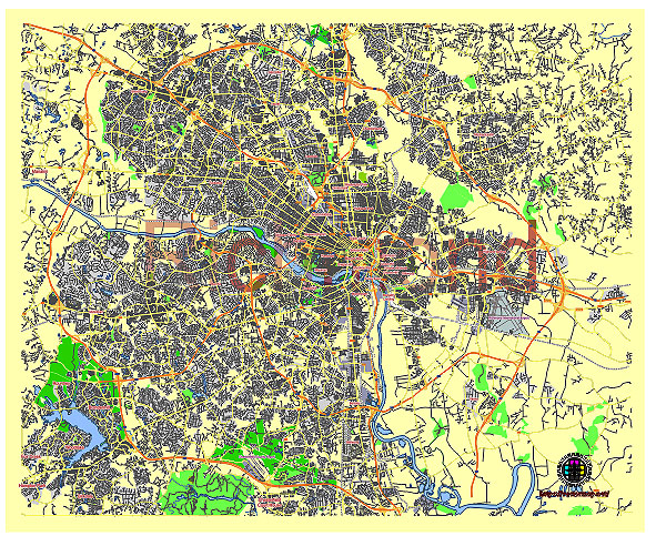
Principal streets and roads, names places, residential streets and roads, road number labels, water objects, land use areas.
Richmond Virginia US vector map svg free
DOWNLOAD ARCHIVE FOR FREE >>>
Distributed with Creative Commons CC-Zero = Creative Commons CC0 1.0 Universal Public Domain Dedication International License
SEE ALSO FULL VERSION OF THE Richmond Virginia US vector map (Adobe Illustrator, PDF etc.)
Richmond, Virginia, is a historically rich city with several notable streets, roads, and districts. Here are some of the principal ones:
Streets and Roads:
- Broad Street – One of the main east-west thoroughfares through downtown Richmond, known for its historic buildings, shops, and restaurants.
- Monument Avenue – Famous for its statues of Confederate leaders, though some have been removed, this avenue is lined with grand homes and is a designated National Historic Landmark.
- Main Street – Runs parallel to Broad Street and is home to a variety of businesses, restaurants, and historic sites.
- Cary Street – Located in the Carytown neighborhood, known for its eclectic mix of shops, boutiques, and dining options.
- Belvidere Street – Connects downtown Richmond with the Fan District and is a major route for traffic coming from Interstate 95.
- Interstate 95 – A major north-south highway passing through Richmond, connecting the city with other major cities along the East Coast.
Districts and Neighborhoods:
- The Fan District – Known for its grid of streets that fan out from Monroe Park, lined with rowhouses and historic architecture.
- Church Hill – One of Richmond’s oldest neighborhoods, known for its historic significance and panoramic views of the city.
- Shockoe Bottom – Located near the James River, historically an industrial and transportation hub, now known for its restaurants, nightlife, and historic sites.
- Scott’s Addition – A former industrial area now known for its breweries, cideries, distilleries, and adaptive reuse of industrial buildings.
- Jackson Ward – Known as the “Harlem of the South” due to its historic significance as a center of African-American culture and business in the early 20th century.
- Museum District – Home to several museums, including the Virginia Museum of Fine Arts, and known for its tree-lined streets and historic homes.
- Downtown – The central business district of Richmond, home to government buildings, financial institutions, and cultural attractions.
These streets, roads, and districts collectively showcase Richmond’s rich history, diverse culture, and vibrant community life.
 Author: Kirill Shrayber, Ph.D. FRGS