Editable Vector Map of the Ottawa Canada in SVG format.
Can be edited in the following programs: Adobe Illustrator, CorelDraw, InkScape
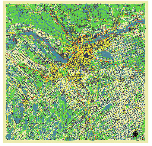
Principal streets and roads, names places, residential streets and roads, road number labels, water objects, land use areas.
Ottawa Canada vector map svg free
DOWNLOAD ARCHIVE FOR FREE >>>
Distributed with Creative Commons CC-Zero = Creative Commons CC0 1.0 Universal Public Domain Dedication International License
SEE ALSO FULL VERSION OF THE Ottawa Canada vector map (Adobe Illustrator, PDF etc.)
Ottawa, the capital city of Canada, has several principal streets, roads, and city districts that are significant for various reasons, such as history, culture, business, and government functions. Here’s an overview:
Principal Streets and Roads:
- Wellington Street:
- Location: Runs west-east through downtown Ottawa.
- Significance: Home to many important government buildings including Parliament Hill, the Supreme Court of Canada, and the Bank of Canada.
- Elgin Street:
- Location: Runs north-south from Wellington Street to the Queensway.
- Significance: Known for its restaurants, bars, and shops, as well as key landmarks such as the National War Memorial and Confederation Park.
- Bank Street:
- Location: Extends from Wellington Street in the north to the southern suburbs.
- Significance: A major commercial street with various shops, restaurants, and cultural institutions like the Canadian Museum of Nature.
- Rideau Street:
- Location: Runs east-west through downtown Ottawa.
- Significance: A major commercial thoroughfare with the Rideau Centre shopping mall, ByWard Market, and the University of Ottawa.
- Sussex Drive:
- Location: Extends from Rideau Street to the Prime Minister’s residence at 24 Sussex Drive.
- Significance: Known for housing several embassies, the National Gallery of Canada, and Rideau Hall (the Governor General’s residence).
- Queen Street:
- Location: Parallel to Wellington Street, running east-west through downtown.
- Significance: Part of the central business district with many office buildings and close to Parliament Hill.
- Albert and Slater Streets:
- Location: Run parallel to each other east-west through downtown.
- Significance: Key routes for OC Transpo (Ottawa’s public transit) with many office buildings and hotels.
City Districts:
- ByWard Market:
- Description: One of Ottawa’s oldest neighborhoods and a vibrant area known for its farmers’ market, boutiques, restaurants, and nightlife.
- Location: East of Sussex Drive, north of Rideau Street.
- Centretown:
- Description: A densely populated area with a mix of residential and commercial properties, featuring Elgin Street and Bank Street.
- Location: South of Parliament Hill and the Ottawa River.
- Glebe:
- Description: A trendy, historic neighborhood known for its beautiful residential streets, shops, and the Lansdowne Park complex.
- Location: South of downtown, along Bank Street.
- Westboro:
- Description: A suburban district that has become one of Ottawa’s trendiest areas, with outdoor activities along the Ottawa River, as well as restaurants and shops.
- Location: West of downtown along Richmond Road.
- Hintonburg:
- Description: A hip, revitalized neighborhood with a mix of art galleries, coffee shops, and boutiques.
- Location: West of downtown, along Wellington Street West.
- Kanata:
- Description: A major suburb known for its high-tech business sector and the Canadian Tire Centre, home of the Ottawa Senators hockey team.
- Location: Far west of the city center.
- Orleans:
- Description: A large suburban district with a strong Francophone community, numerous parks, and recreational facilities.
- Location: East of downtown Ottawa.
- Nepean:
- Description: A large suburban area with a mix of residential, commercial, and industrial zones.
- Location: South and west of downtown Ottawa.
These streets and districts form the backbone of Ottawa, reflecting its historical roots, cultural diversity, and modern development.
 Author: Kirill Shrayber, Ph.D. FRGS