Editable Vector Map of the New York City Greater NY US in SVG format.
Can be edited in the following programs: Adobe Illustrator, CorelDraw, InkScape
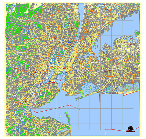
Principal streets and roads, names places, residential streets and roads, road number labels, water objects, land use areas.
New York City Greater NY US vector map svg free
DOWNLOAD ARCHIVE FOR FREE >>>
Distributed with Creative Commons Attribution 4.0 International License
SEE ALSO FULL VERSION OF THE New York City Greater NY US vector map (Adobe Illustrator, PDF etc.)
The Greater New York City area is extensive and includes five boroughs: Manhattan, Brooklyn, Queens, the Bronx, and Staten Island. Each borough is further divided into neighborhoods and districts, many of which have notable streets and landmarks. Here are some principal streets, roads, and districts across these boroughs:
Manhattan:
- Broadway – Famous for theaters and entertainment, runs the length of Manhattan.
- Fifth Avenue – Known for high-end shopping and landmarks like the Empire State Building.
- Wall Street – Financial center of the world, located in the Financial District.
- Central Park – Large urban park stretching from Midtown to Harlem.
- Times Square – Iconic for its bright lights and Broadway theaters.
- Harlem – Historic neighborhood known for its cultural institutions and vibrant community.
Brooklyn:
- Atlantic Avenue – Major thoroughfare connecting Brooklyn Heights to Downtown Brooklyn.
- Williamsburg – Trendy neighborhood known for its arts scene and waterfront.
- Coney Island – Famous for its beach, boardwalk, and amusement park.
- Park Slope – Residential neighborhood with tree-lined streets and Prospect Park nearby.
Queens:
- Queens Boulevard – Major east-west thoroughfare passing through diverse neighborhoods.
- Flushing – Known for its large Asian-American community and bustling Chinatown.
- Astoria – Diverse neighborhood with Greek and Middle Eastern influences.
- Jamaica – Commercial and transportation hub in eastern Queens.
The Bronx:
- Grand Concourse – Major thoroughfare lined with Art Deco apartment buildings.
- Arthur Avenue – Known as the “Real Little Italy” of the Bronx, famous for Italian cuisine.
- Yankee Stadium – Home of the New York Yankees, located in the South Bronx.
Staten Island:
- Hylan Boulevard – Main north-south artery running through the island.
- St. George – Transportation hub with the Staten Island Ferry Terminal.
- South Beach – Beachfront neighborhood known for its boardwalk and views of Manhattan.
These are just a few highlights, as each borough of Greater New York City is rich with its own unique streets, roads, and districts that contribute to the vibrant tapestry of the city.
 Author: Kirill Shrayber, Ph.D. FRGS