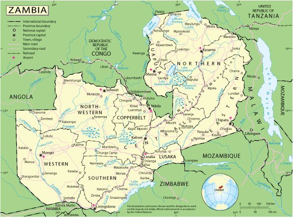
Free vector map Zambia Adobe Illustrator, download now maps vector clipart >>>>>
Map for design, projects, presentation free to use as you need.

Zambia
Country, East Africa
Zambia is a landlocked country in South Africa, located on a plateau and known for its many parks and safari areas, home to a variety of wild animals. On the Zambezi River on the border with Zimbabwe is the famous Victoria Falls, which the indigenous people since ancient times call Mosi-oa-Tunya (Thundering Smoke). It plunges into the narrow gorge of Batoka from a height of 108 meters. Just below the waterfall, the Victoria Falls Bridge was built, which offers stunning views.
Capital: Lusaka
Population: 18.38 million
All Free World Vector Maps >>>>
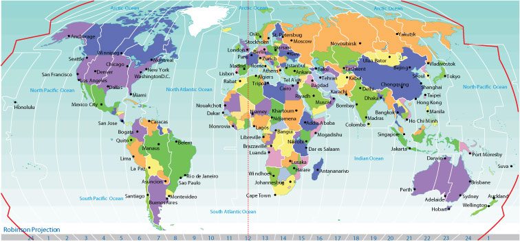
Free vector map World Time Zones Political map 2, Adobe Illustrator, download now maps vector clipart
Map for design, projects, presentation free to use as you need.

Free vector map World Time Zones Political map 2, Adobe Illustrator, download now maps vector clipart Map for design, projects, presentation free to use as you need.
Zambia, unlike most of its neighbours, has managed to avoid the war and upheaval that has marked much of Africa’s post-colonial history, earning itself a reputation for political stability.
The landlocked country has experienced rapid economic growth over the last decade as Africa’s second largest copper producer after the DR Congo. But its over-reliance on copper has made it vulnerable to falling commodity prices.
Zambia also has one of the world’s fastest growing populations with the UN projecting that its population of 13 million will triple by 2050.
But economic growth and massive Chinese investment have failed to improve the lives of most Zambians, with two-thirds still living in poverty.

 Author: Kirill Shrayber, Ph.D. FRGS