Free vector map World Time Zones Political map 2, Adobe Illustrator, download now maps vector clipart >>>>>
Map for design, projects, presentation free to use as you need.
Full Versions World Maps: here are! >>>>>
All Free Vector World Map Collection >>>>>>>
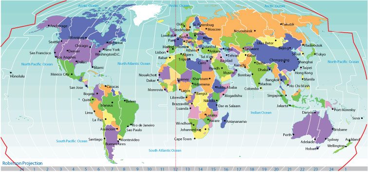
A time zone is a region that observes a uniform standard time for legal, commercial, and social purposes. Time zones tend to follow the boundaries of countries and their subdivisions because it is convenient for areas in close commercial or other communication to keep the same time.
Most of the time zones on land are offset from Coordinated Universal Time (UTC) by a whole number of hours (UTC−12 to UTC+14), but a few are offset by 30 or 45 minutes (for example Newfoundland Standard Time is UTC−03:30, Nepal Standard Time is UTC+05:45, and Indian Standard Time is UTC+05:30). Some higher latitude and temperate zone countries use daylight saving time for part of the year, typically by changing clocks by an hour. Many land time zones are skewed toward the west of the corresponding nautical time zones. This also creates a permanent daylight saving time effect.
 Author: Kirill Shrayber, Ph.D. FRGS