Free vector map State Texas US Adobe Illustrator and PDF download
Free vector map State Texas US Adobe Illustrator download now >>>
Free vector map State Texas US Adobe PDF download now >>>
Texas See also: Full version high detailed vector maps of the State territory, and Cities
US State
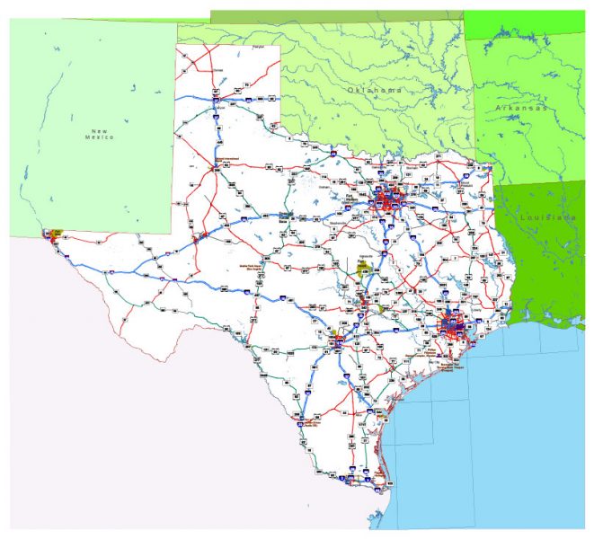
Texas is the second largest state in the United States by both area and population. Geographically located in the South Central region of the country, Texas shares borders with the U.S. states of Louisiana to the east, Arkansas to the northeast, Oklahoma to the north, New Mexico to the west, and the Mexican states of Chihuahua, Coahuila, Nuevo León, and Tamaulipas to the southwest, and has a coastline with the Gulf of Mexico to the southeast.
Population: 28.7 million
Capital: Austin
Area: 695,662 km²
Zip code: 75457
 Author: Kirill Shrayber, Ph.D. FRGS