Free vector map State Rhode Island US Adobe Illustrator and PDF download
Free vector map State Rhode Island US Adobe Illustrator download now >>>
Free vector map State Rhode Island US Adobe PDF download now >>>
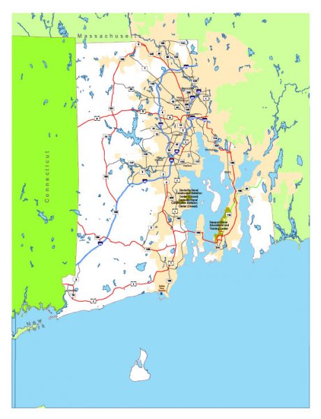
Rhode Island See also: Full version high detailed vector maps of the State territory, and Cities
US State
Rhode Island, a U.S. state in New England, is known for sandy shores and seaside Colonial towns. It’s home to several large cities, including Newport, which is famed for sailing and Gilded Age mansions, such as The Breakers. Providence, it’s capital, is home to Brown University, green Roger Williams Park, landscaped Waterplace Park and Riverwalk, with the famed WaterFire art installation.
Capital: Providence
Area: 3,140 km²
Population: 1.057 million
 Author: Kirill Shrayber, Ph.D. FRGS