Free vector map State Illinois US Adobe Illustrator and PDF download
Free vector map State Illinois US Adobe Illustrator download now >>>
Free vector map State Illinois US Adobe PDF download now >>>
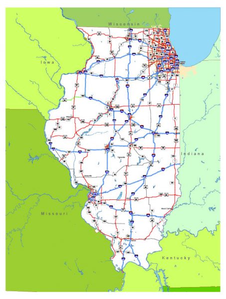
Illinois See also: Full version high detailed vector maps of the State territory, and Cities
US State
Illinois is a Midwestern state bordering Indiana in the east and the Mississippi River in the west. Nicknamed “the Prairie State,” it’s marked by farmland, forests, rolling hills and wetlands. Chicago, one of the largest cities in the U.S, is in the northeast on the shores of Lake Michigan. It’s famous for its skyscrapers, such as sleek, 1,451-ft. Willis Tower and the neo-Gothic Tribune Tower.
Capital: Springfield
 Author: Kirill Shrayber, Ph.D. FRGS