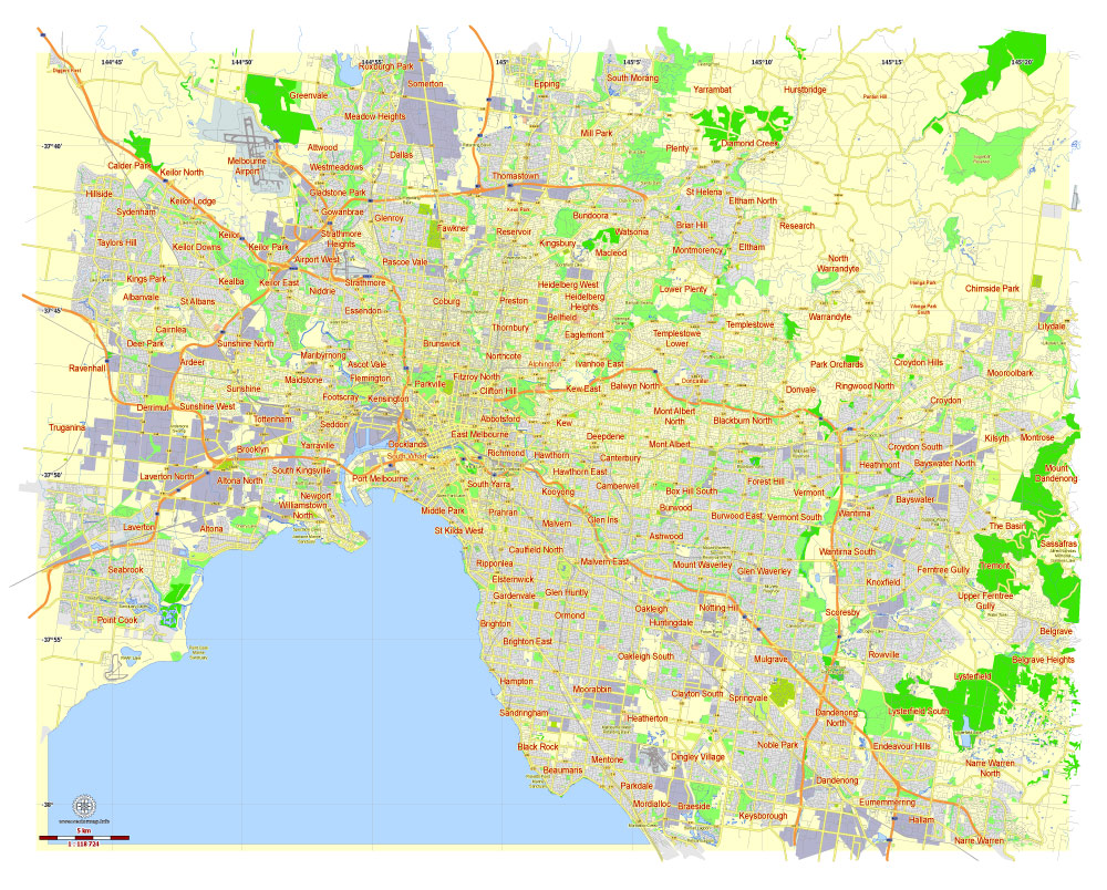
Free Printable Map Melbourne, Australia, exact vector street map, fully editable Adobe Illustrator, Adobe PDF, SVG, G-View Level 12 (5000 meters scale), full vector, scalable, editable, text format names
District names, main objects. Map for publishing, design, printing, publications, arts, projects, presentations, for architects, designers and builders, business, logistics.
Separated layers: streets and roads, color fills, road labels, names, halo, scales.
Free Download : free_vector_map_melbourne_au_g_view_level_12-ai
Free Download : free_vector_map_melbourne_au_g_view_level_12-pdf
Free Download : free_vector_map_melbourne_au_g_view_level_12-svg

This work is licensed under a Creative Commons Attribution 4.0 International License.
See also full versions
Level 13 (2000 meters scale)
https://vectormap.net/product/printable-map-melbourne-australia-exact-vector-street-map-v27-11-fully-editable-adobe-illustrator-g-view-level-13-2000-meters-scale-full-vector/
Level 17 (100 meters scale)
https://vectormap.net/product/printable-map-melbourne-australia-exact-vector-street-map-v27-11-fully-editable-adobe-illustrator-g-view-level-17-100-meters-scale-full-vector/
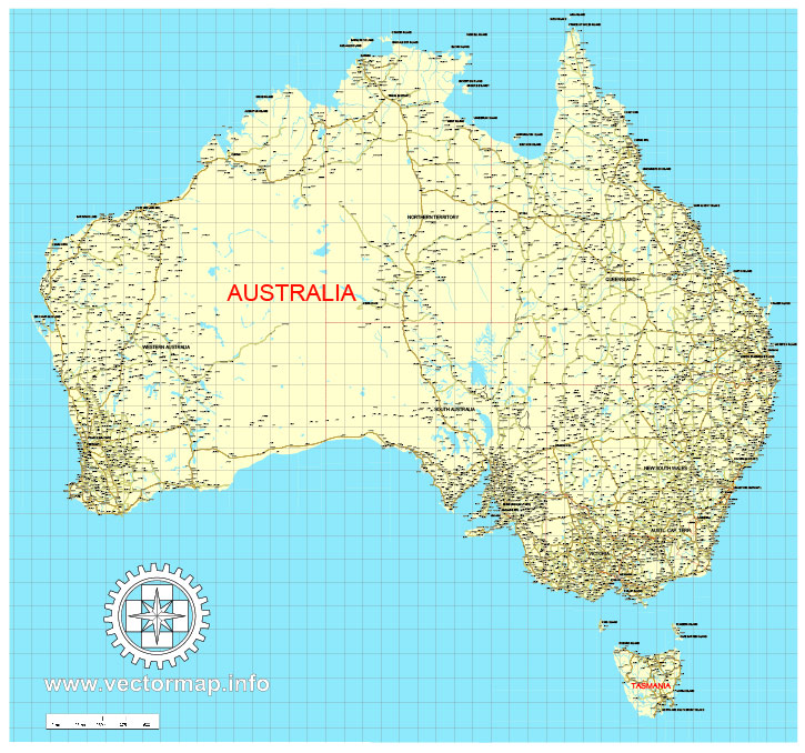
Free download vector map Australia, Adobe Illustrator, download now Free maps vector clipart >>>>>
Map for design, projects, presentation free to use as you like.
Share it!
Small guide: How to work with the vector map?
You can: Mass select objects by type and color – for example, the objects type “building” (they are usually dark gray) – and remove them from the map, if you do not need them in your print or design project. You can also easily change the thickness of lines (streets), just bulk selection the road by the line color.
The streets are separated by type, for example, type “residential road” are usually white with a gray stroke. Highway usually orange with a brown or dark gray stroke.
It is easy to change the font of inscriptions, all or each individually. Also, just can be make and any other manipulation of objects on the vector map in Adobe illustrator format.
Important: All the proportions on the map are true, that is, the relative sizes of the objects are true, because Map is based on an accurate GPS projection, and It transated into the (usual for all) the Mercator projection.
You can easily change the color, stroke and fill of any object on the map, zoom without loss of quality Image Verification.
Select object

Bulk selection the same objects on the vector map

See the bulk selected objects on the vector map

Bulk delete buildungs from the vector map

Select residencial road (small street) on the vector map

Bulk selection the same lines (streets, roads) on the full map

Create fat lines of the streets on the vector maps (bulk action) 1

Create fat lines of the streets on the vector maps (bulk action) 2

Create fat lines of the streets on the vector maps (bulk action) 3

You can easily change the color, stroke and fill of any object on the map, zoom without loss of quality Image Verification.
 Author: Kirill Shrayber, Ph.D. FRGS