Editable Vector Map of the Dallas Texas US in SVG format.
Can be edited in the following programs: Adobe Illustrator, CorelDraw, InkScape
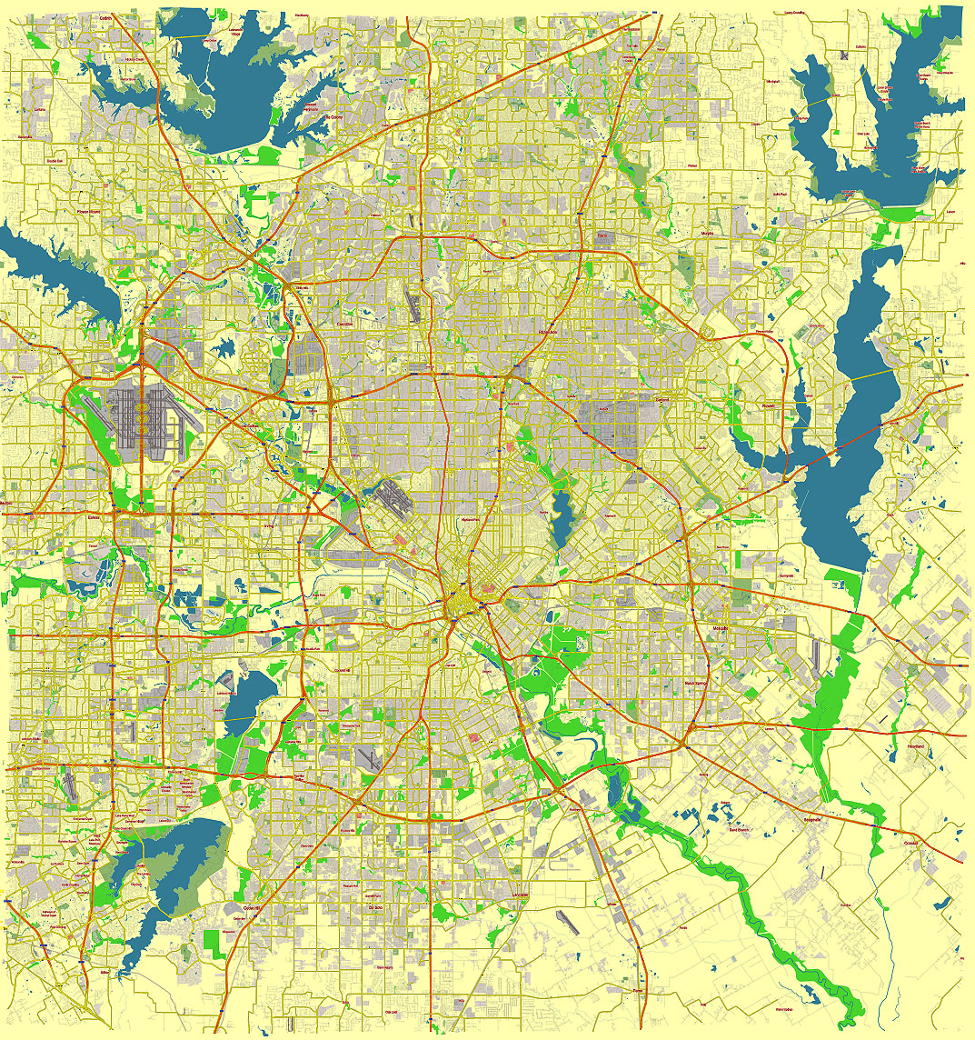
Principal streets and roads, names places, residential streets and roads, road number labels, water objects, land use areas.
Dallas Texas US editable vector map svg free
DOWNLOAD ARCHIVE FOR FREE >>>
Distributed with Creative Commons Attribution 4.0 International License
SEE ALSO FULL VERSION OF THE Dallas Texas US vector map (Adobe Illustrator, PDF etc.)
Dallas, Texas, is a sprawling metropolis known for its diverse neighborhoods and extensive network of streets and roads. Here are some of the principal streets, roads, and city districts in Dallas:
Principal Streets and Roads
- Interstate Highways:
- I-35E: Runs north-south through Dallas, connecting to Denton in the north and to the south as it continues through Waco and Austin.
- I-30: Runs east-west through Dallas, connecting to Fort Worth in the west and to Texarkana in the east.
- I-45: Starts in downtown Dallas and runs southeast towards Houston.
- I-635 (LBJ Freeway): Encircles the northern and eastern parts of Dallas, acting as a loop.
- US Highways:
- US 75 (Central Expressway): Runs north-south, connecting Dallas to Sherman in the north.
- US 67: Runs southwest to southeast, connecting to Midlothian and beyond.
- State Highways:
- State Highway 121: Known as the Sam Rayburn Tollway in certain sections.
- State Highway 114: Runs northwest from downtown Dallas towards Grapevine.
- Major City Streets:
- Main Street: A key street in downtown Dallas, lined with historic buildings and modern skyscrapers.
- Elm Street: Known for Dealey Plaza and the site of JFK’s assassination.
- Commerce Street: Another major downtown street with numerous restaurants and shops.
- Ross Avenue: Connects downtown to East Dallas and is home to the Dallas Arts District.
- Mockingbird Lane: Runs east-west, connecting areas like Highland Park and SMU.
City Districts
- Downtown Dallas:
- Arts District: Includes museums, performance halls, and public art installations.
- West End Historic District: Known for its red-brick warehouses, many of which have been converted into restaurants and shops.
- Deep Ellum: A vibrant area known for live music, street art, and nightlife.
- Uptown:
- A bustling area north of downtown known for its upscale shopping, dining, and high-rise apartments.
- Oak Lawn:
- A lively district with a significant LGBTQ+ community, offering a mix of bars, restaurants, and cultural events.
- Bishop Arts District:
- Located in North Oak Cliff, this area is known for its eclectic mix of independent shops, eateries, and art galleries.
- East Dallas:
- Includes neighborhoods like Lakewood, known for its historic homes and proximity to White Rock Lake.
- North Dallas:
- Includes affluent neighborhoods such as Preston Hollow and areas along the Dallas North Tollway.
- South Dallas/Fair Park:
- Home to Fair Park, which hosts the annual State Fair of Texas.
- West Dallas:
- An area experiencing significant redevelopment, particularly around the Margaret Hunt Hill Bridge and Trinity Groves.
These streets, roads, and districts contribute to the diverse and dynamic character of Dallas, making it a unique place to live and visit.
 Author: Kirill Shrayber, Ph.D. FRGS