Editable Vector Map of the Bern Switzerland in SVG format.
Can be edited in the following programs: Adobe Illustrator, CorelDraw, InkScape
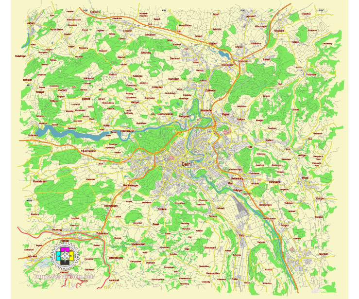
Principal streets and roads, names places, residential streets and roads, road number labels, water objects, land use areas.
Bern Switzerland editable vector map svg free
DOWNLOAD ARCHIVE FOR FREE >>>
Distributed with Creative Commons Attribution 4.0 International License
SEE ALSO FULL VERSION OF THE Bern Switzerland vector map (Adobe Illustrator, PDF etc.)
Bern, the capital of Switzerland, is known for its well-preserved medieval city center, which is a UNESCO World Heritage Site. The city is organized into several districts, each with its own unique character and attractions. Here are some of the principal streets, roads, and city districts of Bern:
Principal Streets and Roads
- Kramgasse: This is one of the main streets in Bern’s Old Town, lined with beautiful arcades, fountains, and historic buildings. The Zytglogge, a famous medieval clock tower, is located here.
- Marktgasse: Another significant street in the Old Town, known for its shops and cafes. It connects with Kramgasse and is a bustling area for both locals and tourists.
- Gerechtigkeitsgasse: This street features more of Bern’s characteristic arcades and historical architecture, leading to the Nydegg Bridge.
- Bubenbergplatz: A central square that acts as a transportation hub, linking various trams and buses. It’s named after Adrian von Bubenberg, a famous figure in Bernese history.
- Bundesplatz: Located in front of the Federal Palace (Bundeshaus), this square is the political heart of Switzerland, often hosting markets and political events.
- Länggassstrasse: This street runs through the Länggasse district, a vibrant student area due to its proximity to the University of Bern.
- Seilerstrasse: Connecting with the main train station, this street is important for local traffic and access to key city facilities.
Principal Districts
- Innere Stadt (Old City): The historic core of Bern, featuring medieval architecture, the Cathedral (Münster), the Federal Palace, and the famous Bear Park (Bärengraben).
- Kirchenfeld-Schosshalde: A district known for its cultural institutions, including the Bern Historical Museum, the Swiss Alpine Museum, and the Natural History Museum.
- Länggasse-Felsenau: Home to the University of Bern and the Botanical Garden, this area is popular with students and academics.
- Breitenrain-Lorraine: A diverse residential district with vibrant markets, parks, and the Stade de Suisse football stadium.
- Mattenhof-Weissenbühl: A mixed residential and commercial area, with the Gurten, a local mountain offering panoramic views and recreational activities.
- Bümpliz-Oberbottigen: Known for its industrial and residential zones, this district has seen significant development and modernization.
- Wabern: A suburban area with access to the Gurten funicular railway, offering easy access to the recreational mountain.
Bern’s layout, with its blend of historical and modern elements, offers a rich experience for residents and visitors alike.
 Author: Kirill Shrayber, Ph.D. FRGS