Editable Vector Map of the Auburn + Lewiston Maine US in SVG format.
Can be edited in the following programs: Adobe Illustrator, CorelDraw, Inkscape
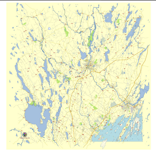
Principal streets and roads, names places, residential streets and roads, road number labels, water objects, landuse areas.
Auburn + Lewiston Maine US editable vector map svg free
DOWNLOAD ARCHIVE FOR FREE >>>
Distributed with Creative Commons Attribution 4.0 International License
SEE ALSO FULL VERSION OF THE Auburn + Lewiston Maine US vector map (Adobe Illustrator, PDF etc.)
Auburn and Lewiston, located in Androscoggin County, Maine, are known as the “Twin Cities” due to their close proximity and interconnected communities. Here are some principal streets, roads, and city districts in both cities:
Auburn
Principal Streets and Roads:
- Center Street (Route 4): A major commercial thoroughfare with shopping centers, restaurants, and businesses.
- Court Street (Route 202): Runs through the downtown area and connects with Lewiston.
- Minot Avenue (Route 11/121): Connects Auburn to nearby towns and is a key route for local traffic.
- Washington Street (Route 202/4): A significant industrial and commercial road.
- Hotel Road: A residential and commercial road with access to various amenities.
City Districts:
- Downtown Auburn: The central business district with shops, restaurants, and the Auburn Public Library.
- New Auburn: A historic neighborhood with a mix of residential and commercial properties.
- Danville: A rural district with agricultural land and residential areas.
Lewiston
Principal Streets and Roads:
- Lisbon Street: A major commercial street with a variety of businesses, restaurants, and shops.
- Main Street (Route 202/11/100): Connects Lewiston to Auburn and other nearby towns, running through the heart of the city.
- Sabattus Street (Route 126): A key road with residential areas and local businesses.
- Russell Street (Route 196): An important connector road within the city.
- College Street: Runs past Bates College and features residential areas and local businesses.
City Districts:
- Downtown Lewiston: The central hub for business, government buildings, and cultural institutions like the Public Theatre.
- Little Canada: A historic neighborhood with a strong Franco-American heritage.
- Bates College Area: The district surrounding Bates College, with educational institutions, residential areas, and parks.
- Riverfront Island: An area undergoing revitalization, with parks, trails, and the historic canal system.
Both cities are known for their rich history, vibrant communities, and ongoing development efforts aimed at enhancing the quality of life for residents and visitors alike.
 Author: Kirill Shrayber, Ph.D. FRGS