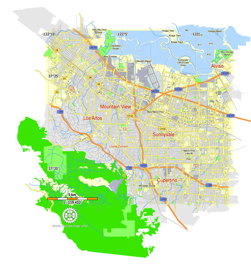
Mountain View, California, Free Printable Map in Adobe Illustrator and PDF. Level 12 (5000 meter scale) map, G-VIEW, fully editable, full vector, scalable, editable text format of street names.
Map for publishing, design, printing, publications, arts, projects, presentations, for architects, designers and builders, business, logistics. The most exact and detailed map of the city. Royalty Free.
Download free Mountain View, California, Printable Map in PDF, Level 12 (2 Mb).
Download free Mountain View, California, Printable Map in Illustrator, Level 12 (0.2 Mb).

This work is licensed under a Creative Commons Attribution 4.0 International License.
Live Twitpic Google Map
Twitpic
Twitpic are featuring a live Google Map that animates between the latest photographs uploaded to the Twitter photo sharing site. Need something special? Please see Mountain View, California, Printable Map, US, exact vector street G-View Level 17 map (100 meters scale), full editable, Adobe Illustrator. It seems appropriate that Twitpic should have their own live animated map as the innovative Twittervision, which shows Twitter posts in real time, was the map that first popularised this kind of real-time Google Maps mashup.
Here’s a short screencast showing the Twipic map in action:
Twitpic from Keir Clarke on Vimeo.
Other Twitter Maps
- Weather Tweet – the latest weather tweets
- TweetMapper -create your own map of tweets
- Tmeet.me – send a Tweet about where you want to meet.
- TwitterVision – real time map of Twitter messages. Messages are mapped to the profile locations of members.
- Swearing on Twitter Map – map of Tweets that have swear words.
- Bail Out Chatter on Twitter – the latest Twitter comments about the bail out
- Barnabu Twitter Snow – Google Earth Browser weather map using #UKsnow updates
- Create Your Own Twitter Map – a great article on how to create your own Twitter Map by Tony Hirst
- Twitters – a Twitter map which shows the plotted Twitter members in a sidebar beside the map
- Hot Trends and Twitter – who is Twittering about Google’s Hot Trends
- Twitter Spy – real-time Twitters on a Google Map
- Hot Trends and Twitter -Map of Twitter messages that mentions any of the current Google hot trends
- Schmap GeoTweeter for iPhone – automatically include a ‘schmap.me’ link when Twittering from your iPhone
Or purchase a detailed version of Mountain View, California, Printable Map in Adobe Illustrator (17 Level, 100 meters).
Free vector maps:

Free download Vector Map US Interstate roads, Adobe PDF, V.2 Free_Map_US_Interstates_Roads_2.pdf
Free download Vector Map US Interstate roads, Adobe Illustrator, V.2 Free_Map_US_Interstates_Roads_2.ai

Free Download Vector Map US County and State Adobe Illustrator
Free_Vector_Map_US_States_County_Map.ai
Free Download Vector Map US County and State Adobe PDF
Free_Vector_Map_US_States_County_Map.pdf

Free Vector Map US Census Data Top US Ancestries by County Adobe Illustrator
Free_Vector_Map_US_Census-Data-Top-US-Ancestries-by-County.ai
Free Vector Map US Census Data Top US Ancestries by County Adobe PDF
Free_Vector_Map_US_Census-Data-Top-US-Ancestries-by-County.pdf
 Author: Kirill Shrayber, Ph.D. FRGS