Menlo Park, California, Free Printable Map in Adobe Illustrator and PDF. Level 12 (5000 meter scale) map, fully editable, full vector, scalable, editable text format of street names.
Map for publishing, design, printing, publications, arts, projects, presentations, for architects, designers and builders, business, logistics. The most exact and detailed map of the city. Royalty Free.
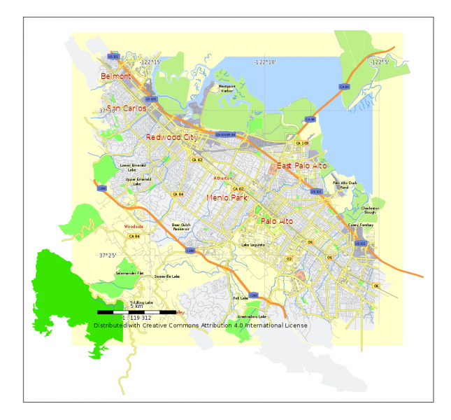
Download free Menlo Park, California, Printable Map in PDF, Level 12 (1.4 Mb).
Download free Menlo Park, California, Printable Map in Illustrator, Level 12 (0.7 Mb).

This work is licensed under a Creative Commons Attribution 4.0 International License.
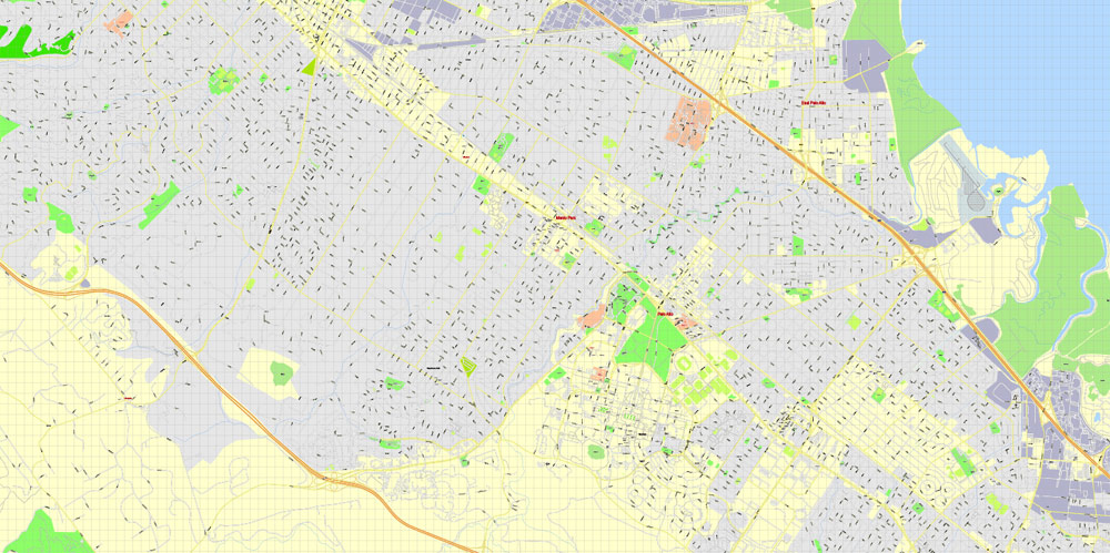
Or purchase a detailed version of Menlo Park, California, Printable Map in Adobe Illustrator (17 Level, 100 meters).
Stay of Execution for Google Maps API v2
“Next month thousands of Google Maps around the world were scheduled to die. Or you can also try Printable Map Menlo Park, California, exact vector street G-View Level 17 (100 meter scale) map, fully editable, Adobe Illustrator. May 19, 2013 was the day that maps using version 2 of the Google Maps API were meant to be shut down but Google has now decided to extend the deprecation time-line for v2 maps by six months.
There is even better news for those who are determined not to convert their v2 maps into v3 maps. Google says that on November 19, 2013 they “”will attempt to automagically turn remaining v2 maps into v3 maps, by way of a JavaScript wrapper””. Google says that they expect the wrapper to work with simple v2 maps but to be safe they encourage you to migrate your maps to v3 ahead of this date.
To help you migrate v2 maps Google have prepared an upgrade guide to help make the migration process as painless as possible. Source.
Free vector maps:

Free download Vector Map US Interstate roads, Adobe PDF, V.2 Free_Map_US_Interstates_Roads_2.pdf
Free download Vector Map US Interstate roads, Adobe Illustrator, V.2 Free_Map_US_Interstates_Roads_2.ai

Free Download Vector Map US County and State Adobe Illustrator
Free_Vector_Map_US_States_County_Map.ai
Free Download Vector Map US County and State Adobe PDF
Free_Vector_Map_US_States_County_Map.pdf

Free Vector Map US Census Data Top US Ancestries by County Adobe Illustrator
Free_Vector_Map_US_Census-Data-Top-US-Ancestries-by-County.ai
Free Vector Map US Census Data Top US Ancestries by County Adobe PDF
Free_Vector_Map_US_Census-Data-Top-US-Ancestries-by-County.pdf
 Author: Kirill Shrayber, Ph.D. FRGS