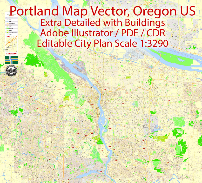
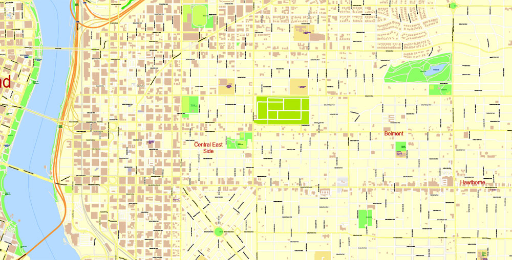
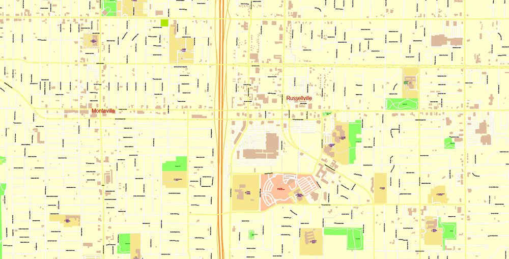
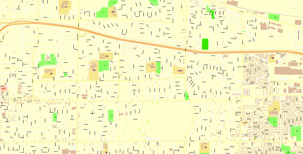
Urban plan Portland Oregon Vancouver Washington pdf Editable City Map
Gallery of Images "Urban plan Portland Oregon Vancouver Washington pdf":
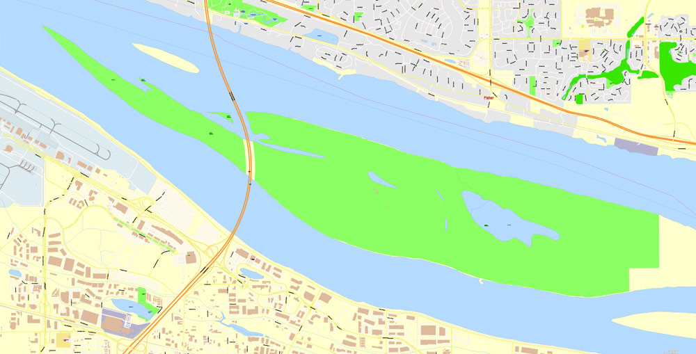
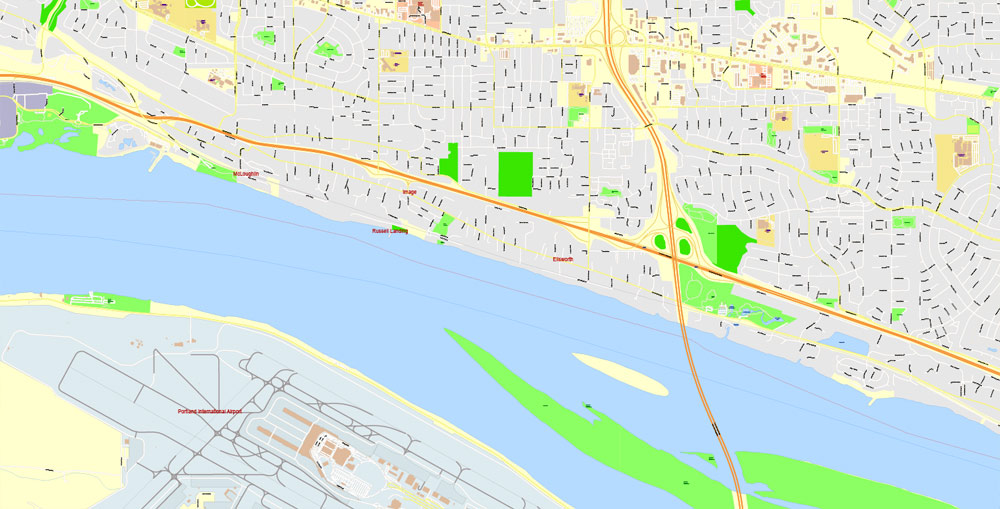
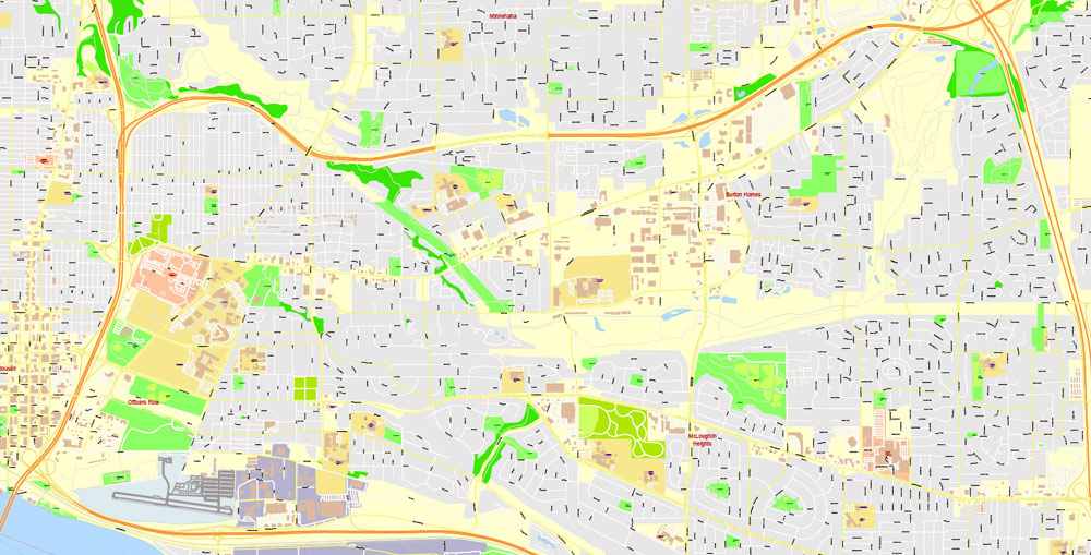
City Plan Portland Oregon: Maps for projects


Vancouver, Washington Editable Vector Maps for Printing


Urban plan Portland Oregon Vancouver Washington pdf
Portland is located in the northwestern part of the United States, the largest city in the state of Oregon. As of 2013, the population of Portland was 609 thousand people, which allowed it to enter the 30 largest cities in the United States. In total, more than 2.2 million people live in the suburbs (the urban agglomeration of Portland).
For centuries before the arrival of white people, Indian tribes lived in the territories of modern Portland. They fished, gathered, hunted. Since the 1830s, white traders and hunters have been using a small area along the Willamette River as a place for trade and parking. The founders of Portland are considered to be a pioneer from Tennessee William Overton and a lawyer from Massachusetts Asa Lovejoy, who in 1843 acquired and began to develop a piece of land. Tired of the endless laying of roads and cutting down trees, William Overton in 1845 sold his half to Francis Pettygrove for $ 50. When it came time to choose a name for the new town, Pettigrove and Lovejoy could not agree. The fate of the name was decided by the luck of Pettigrove, who won by tossing a coin. Being born in Maine, Pettigrove chose the name "Portland" in honor of the largest city in that state. Today, the historical coin, named "Portland Penny", is on display at the Museum of the Oregon Historical Society.
Portland is the largest city between San Francisco and Seattle. It is located in the northern part of Oregon near the confluence of the Willamette and Columbia Rivers. The Willamette River flows north and divides Portland into two parts. The western part is older, more densely built-up and partly lies on the hills. The eastern part of the city is flat, mostly low-rise, stretches far to the east. About 80 km to the east of the city lies the Mount Hood volcano, which in many ways creates a spectacular background in the images of Portland.
Being 100 km from the Pacific Ocean, Portland is accessible for sea cargo transportation and is a truly port city. The port terminals located along both rivers are connected by rail, road, and river transport. In total, about a thousand companies are directly or indirectly connected with shipping. The main goods exported through the port are wheat, imported goods are cars and steel. The total volume of exports/imports is estimated at $ 14 billion.
Portland International Airport is located 20 minutes northeast of downtown Portland near the Columbia River. Portland Airport is the largest in the state of Oregon and serves over 13 million passengers annually.
Important areas of the region's economy: woodworking, industry (including heavy), transportation. Approximately 1,200 high-tech companies operate in the urban agglomeration of Portland. Intel is the largest private employer in the region.
Public transport: high-speed trams (light rail), trams (streetcar), buses. For tourists, a cable car (Portland Aerial Tram) with a length of 1000 meters and a height difference of 150 meters may be of interest.
Statistics for 2021
Racial composition:
White - 71.4%
Hispanic (of any race) - 10.0%
Asian - 7.5%
African American - 5.8%
Native American - 0.5%
Pacific Islander - 0.4%
Mixed Race - 4.2%
Socio-economic indicators in Portland:
the average income per person is $32,915
population living below the poverty line - 18.2%
unemployment (June 2014) - 5.9%
cost of living index - 103.3 (100 - US average)
It is worth noting the relatively high cost of living compared to the average values in the United States. On the other hand, Oregon is one of the five states that does not have a sales tax.
Evidence:
The most common nickname of Portland is "The City of Roses", which has been recognized as official since 2003. The climate of Portland is ideal for growing roses.
8.8% of the population in the city belongs to sexual minorities. This is the 7th indicator in the country.
There are more than 40 breweries in Portland.
In 2008, Businessweek ranked Portland at the top of the list of the most "unlucky cities in the USA". The study was based on factors such as the level of depression, the number of suicides and divorces, the level of crime and unemployment, weather, and green spaces, as well as others.
Attractions
Portland has a wonderful combination of historical and modern architecture, however, the main pride of the city is parks and gardens. Portland is really a very green city, large areas of the territory are well maintained, preserve the natural beauty, and protect from urbanization.
Forest Park, which stretches on the slopes along the Willamette River in close proximity to residential areas, is considered one of the largest such parks in the country. The total length of pedestrian and bicycle paths inside the park exceeds 100 km, the longest of them is the Wildwood Trail - more than 40 km in length. Another important green area in Washington Park. Located near the city center, this park is home to the Oregon Zoo, the Portland Japanese Garden, and the oldest rose garden in the United States, the International Rose Test Garden, where more than 550 varieties of these flowers are grown. Another popular park area, Tom McCall Waterfront Park, is located downtown on the Willamette River embankment. The classic Chinese garden Lan Su Chinese Garden, located in Portland's Chinatown, as well as Mount Tabor Park, located on a real volcano, deserve mention.
Other sights and interesting places
Portland Art Museum is a city art museum, has several outstanding collections and regularly updates temporary exhibitions;
Oregon Museum of Science and Industry (OMSI) which includes the diesel-electric submarine USS Blueback, which participated not only in combat operations but also in the filming of the famous film "The Hunt for Red October";
Powell's City of Books is one of the largest bookstores in the world, occupying an entire block. Contains more than 1.5 million books in 3,500 different sections;
Portlandia - the statue "Portlandia", embodying the origins, spirit, and culture of the city;
Popular annual events
Portland Rose Festival is the largest event in Portland, taking place annually in early June and lasting 2 weeks. The culmination of the festival is the Grand Floral Parade. Other events include flower shows, parades, fireworks, boat races.
Every year, the Oregon International Air Show, the largest in the Western United States, takes place in the western suburb of Portland, called Hillsboro.
PDX Soapbox Derby is a very popular race on the slopes of Mount Tabor volcano. Incredible vehicles, brave racers and a sea of emotions.
In professional sports, Portland is represented by 2 teams. Basketball Portland Trail Blazers, playing in the NBA, holds its home games at the multifunctional arena Rose Garden. Portland Timbers (European football), playing in MLS, plays home matches at the Jeld-Wen Field stadium.
Climate
The climate in Portland is temperate with a lot of ocean influence. Summers are warm, sunny, and relatively dry. The warmest month is August with an average temperature of 20.3 C. In July-August, periods of intense heat are possible, when the temperature can rise to 38 C, however, this happens infrequently. It is rainy and cloudy for 9 months from the end of September to June.
Winters in Portland are mild and humid. In the coldest months (December, January), the average daily temperatures vary around 4.5 C. Despite the fact that temperatures usually do not drop to 0 at night, severe frosts sometimes occur when the temperature can reach -10 C -15 C. However, such cold spells are rare. Snow falls in Portland only a few times a year, mostly in winter it rains, although sometimes heavy snowfalls can occur. Spring can bring quite unpredictable weather to the city.
Gallery of Images "Urban plan Portland Oregon Vancouver Washington pdf":
Urban Plan Portland Oregon Vancouver Washington: Digital cartography for Real Estate Business, Logistics
Portland Oregon + Vancouver Washington US: Digital City Vector Maps
- Urban plan Beijing China AI 15 eng
- Urban plan Adelaide Australia
- Urban plan Jerusalem Israel 17 english AI
- Urban plan Poland Admin
- Urban plan Derry Ireland
- Urban plan Dominica Full PDF
- Urban plan Tampere Finland PDF
- Urban plan Springfield DXF
- Urban plan Novokuznetsk PDF Russia
- Urban plan Amiens France PDF
- Urban plan New Haven Connecticut PDF
- Urban plan Dover Delaware PDF
- Urban plan Portland Oregon Vancouver Washington pdf
- Urban plan Liege Belgium pdf
- Urban plan Vancouver metro Canada low PDF
- Urban plan Onancock Virginia
- Urban plan Italy Admin
- Urban plan Edmonton CA
- Urban plan Manila Grande Philippines 13 ai
- Urban plan Richmond Virginia PDF
- Urban plan Toowoomba Australia PDF
- Urban plan Moscow low detailed pdf
- Urban plan Eilat Israel Aqaba Jordan PDF
- Urban plan Antwerpen Belgium PDF
- Urban plan Naples Napoli Italy
- Urban plan Boston Massachusetts low
- Urban plan Venezia Venice
- Urban plan Quebec City Canada 13 PDF
- Urban plan Edmonton PDF
- Urban plan Bohol Panglao Philippines PDF
- Urban plan Lawrence Kansas
- Urban plan Guangzhou China ENG AI
- Urban plan Oakland Berkeley California
- Urban plan Adelaide Metro DWG
- Urban plan Astrakhan
- Urban plan Shanghai China PDF ENG
- Urban plan Relief US flat
- Urban plan Essen Germany pdf
- Urban plan Aston Birmingham
- Urban plan Vladimir pdf
- Urban plan Austria Admin
- Urban plan Pierre South Dakota
- Urban plan Belfast PDF
- Urban plan Kiev Ukraine
- Urban plan Orlando Florida PDF
- Urban plan Quebec City Canada
- Urban plan Charleston South Carolina 3 10 PDF Center
- Urban plan Kharkiv Ukraine
- Urban plan Adelaide Australia pdf
- Urban plan Milwaukee Wisconsin PDF low
- Urban plan Washington DC pdf
- Urban plan Golden Gate Park San Francisco
- Urban plan Flagstaff Arizona PDF
- Urban plan Tallinn Estonia PDF
- Urban plan Darwin Australia PDF
- Urban plan Wind Point Wisconsin
- Urban plan Madrid Spain AI
- Urban plan Austria Vector Relief Roads
- Urban plan Liege Belgium PDF 13
- Urban plan San Diego Tijuana California
- Urban plan Ulianovsk pdf
- Urban plan Montgomery County Texas PDF
- Urban plan Portland Oregon 25
- Urban plan San Jose California PDF
- Urban plan Dominican Republic Detailed AI
- Urban plan Perth Australia 13 PDF
- Urban plan Minsk Belarus
- Urban plan Madison Wisconsin
- Urban plan Seattle Washington PDF
- Urban plan Toulouse France
- Urban plan University California Berkeley SVG
- Urban plan Springfield CDR