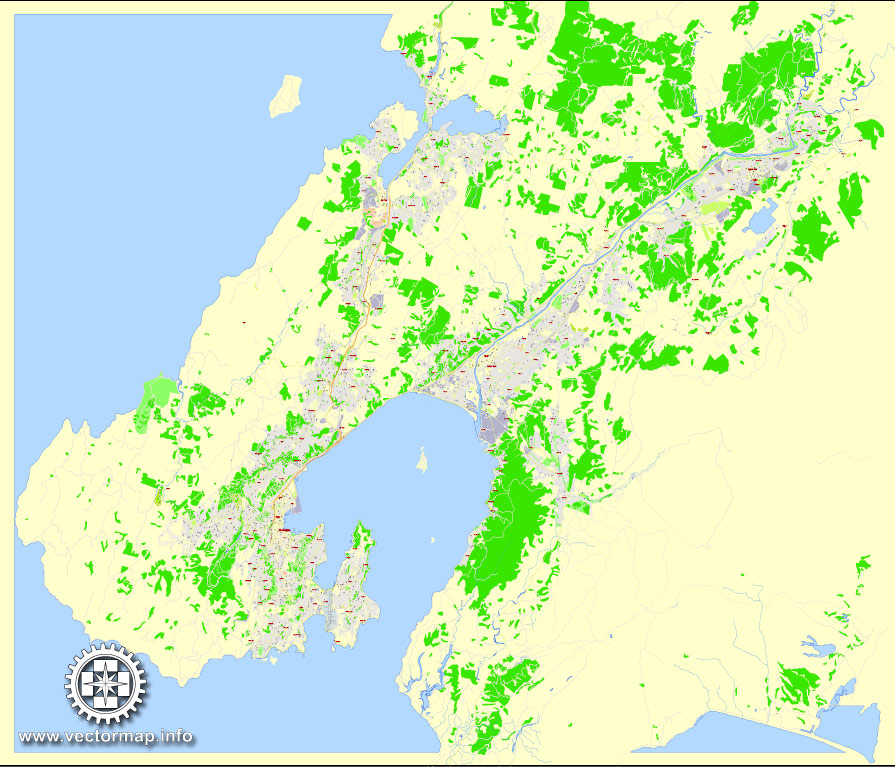
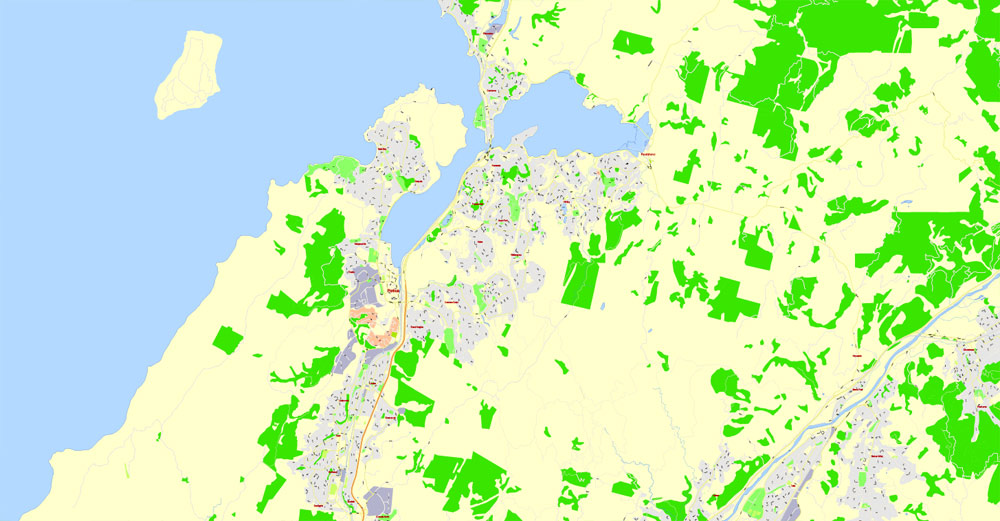
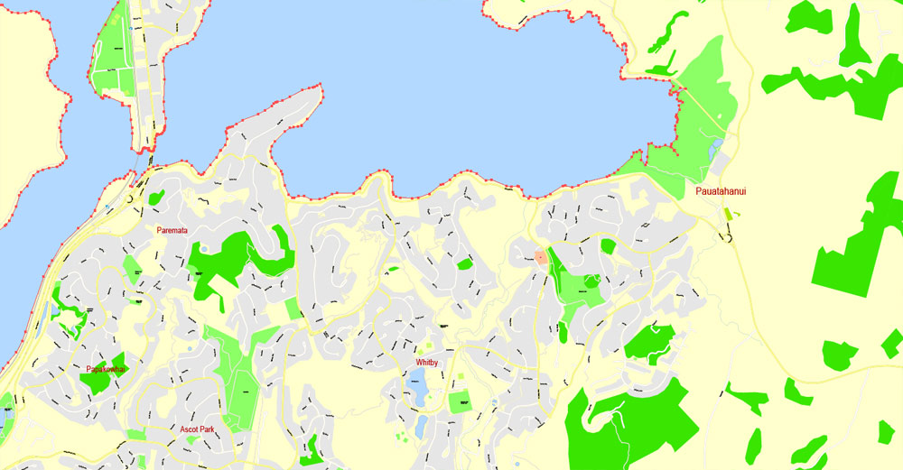
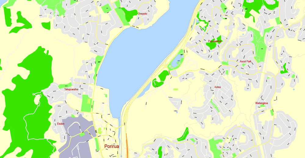
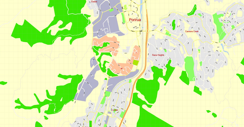
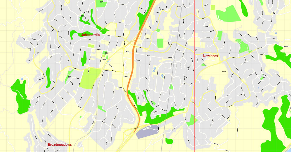
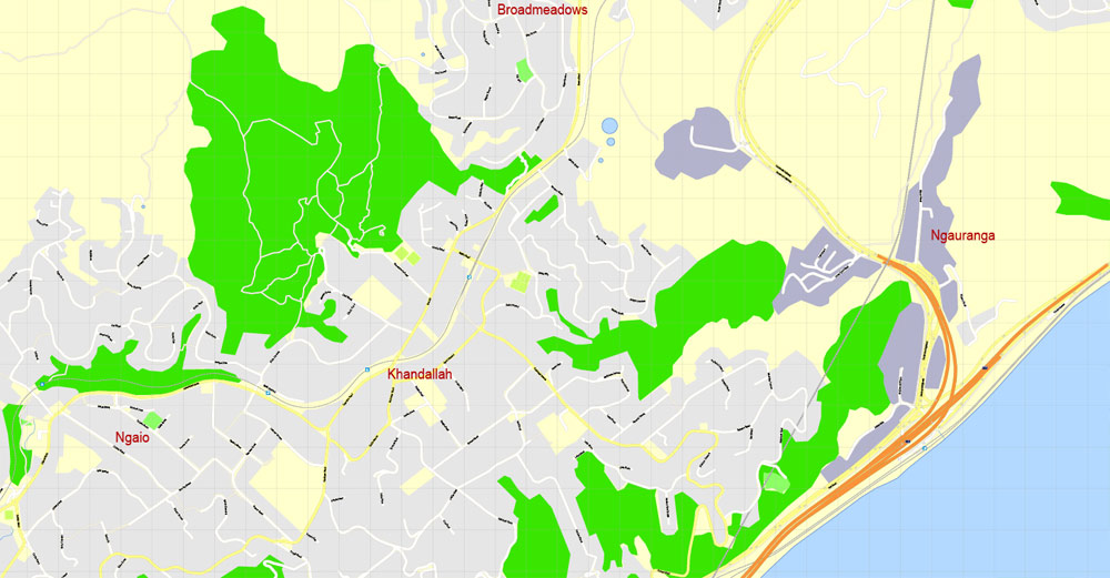
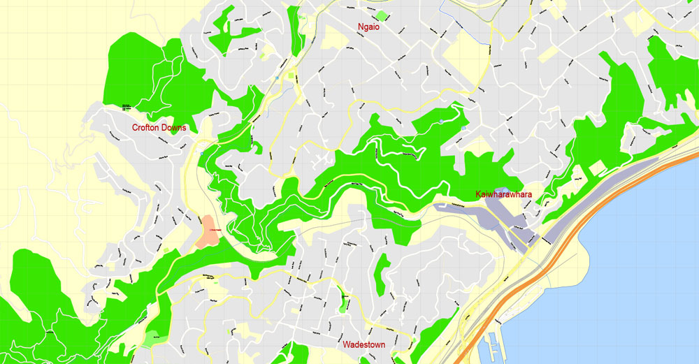
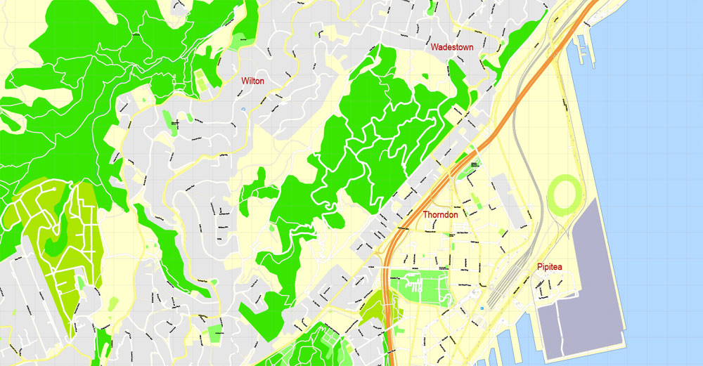
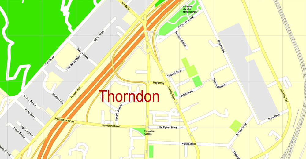
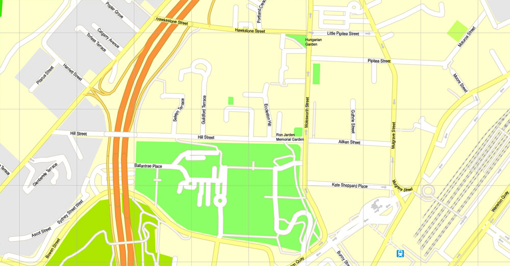
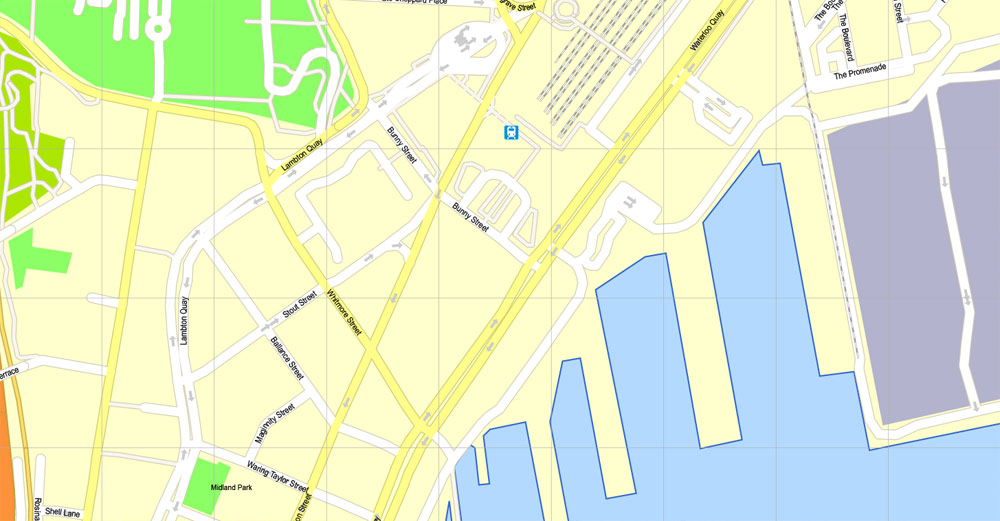
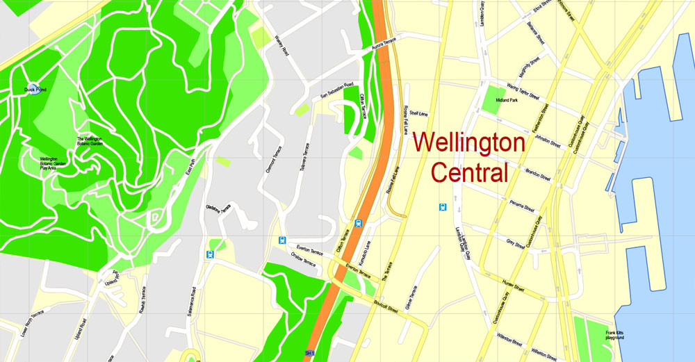
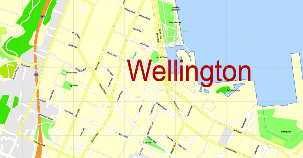
Wellington, New Zealand, PDF Map, exact vector street map V3.11, G-View, fully editable, Adobe PDF, Level 17 (100 meters), full vector, scalable, editable text format of street names, 17 Mb ZIP.
All streets named, NO buildings, main objects. Map for publishing, design, printing, publications, arts, projects, presentations, for architects, designers and builders, business, logistics. The most exact and detailed map of the city.
Separated layers: streets and roads, color fills, road labels, street arrows, objects, names 1,2,3, scales. Royalty Free.
DWG, DXF, CDR and other formats – by request, same price, please contact.
Wellington, New Zealand.
This vector map of Wellington is used as a basis for design, editing, and further printing.
This is the most detailed, exact map of Wellington for high-quality printing and polygraphy. You can always clarify the map development date by contacting us.
For your convenience, all objects on Wellington vector map are divided into layers. And the editing is very easy – colors, lines, etc.
You can easily add any objects needed (e.g. shops, salons, sale points, gas station or attraction) on any layer of Wellington vector map.
Wellington is the capital city and second most populous urban area of New Zealand, with 418,500 residents. It is located at the south-western tip of the North Island, between Cook Strait and the Remutaka Range. Wellington is the major population centre of the southern North Island, and is the administrative centre of the Wellington Region, which also includes the Kapiti Coast and Wairarapa. Its latitude is 41°17′S, making it the world’s southernmost capital of a sovereign state. Wellington features a temperate maritime climate and is the world’s windiest city, with an average wind speed of over 26 km/h (16 mph).
One of the advantages of Wellington vector maps of our production is the relevance of cartographic data, we constantly update all our products.
This vector map of Wellington is used by:
designers, layout designers, printers, advertisers and architects. Our product – vector maps – is designed for further editing and printing in large formats – from @Wall format (a few meters) to A-0 and A-1, A-2, A-3.
Wellington map in vector format is used for design, urban planning, presentations and media visualizations.
Advertising and presentation map of Wellington (usually the final designer marks the routes, and puts the client’s objects (shops, saloons, gas stations etc.)
The undoubted advantage is that people will NEVER throw out this advertising product – the map. In fact, as an advertising medium, a map is the most “long-playing” of the well-known polygraphic advertising media, with the longest lifespan, and the maximum number of interactions with the customer.
For travelers, maps are sold at the airports and gas stations around the world. Often the source is our vector maps.
Take a look, who purchases our vector maps of Wellington in “Our Clients and Friends” page – these are large and small companies, from super-brands like Volvo and Starbucks, to small design studios and printing houses.
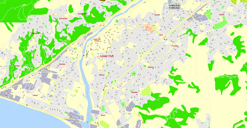
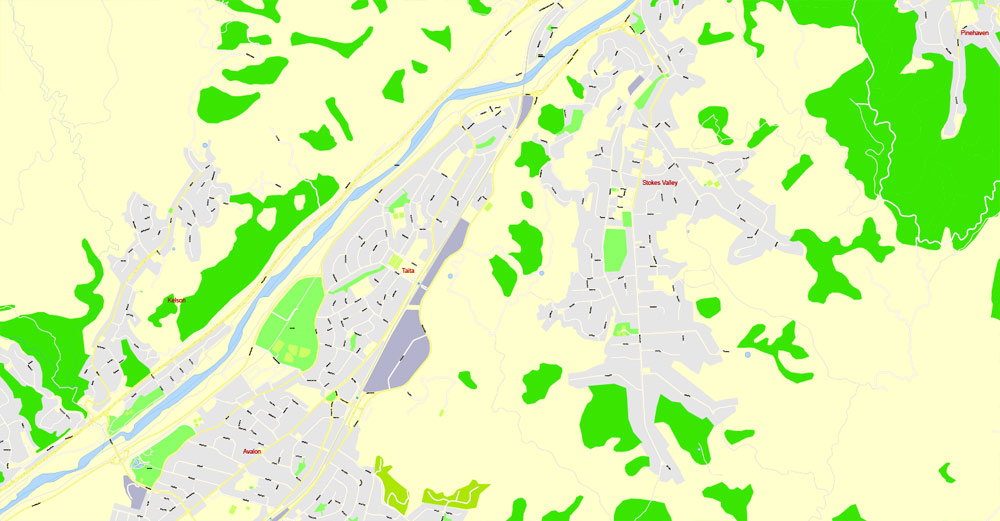
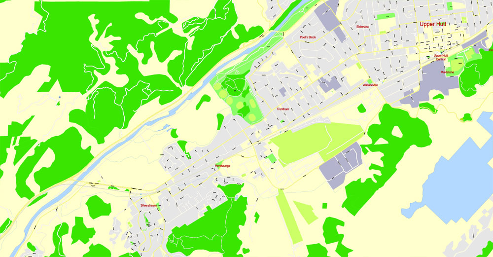
The Wellington urban area comprises four local authorities: Wellington City, on the peninsula between Cook Strait and Wellington Harbour, contains the central business district and about half the population; Porirua on Porirua Harbour to the north is notable for its large Māori and Pacific Island communities; Lower Hutt and Upper Hutt are largely suburban areas to the northeast, together known as the Hutt Valley.
It’s very easy to work with vector maps of Wellington, even for a not very experienced designer who can turn on and off the map layers, add new objects, change the colors of fill and lines according to customer requirements.
The undoubted advantage of Wellington vector maps in printing is an excellent and detailed visualization, when customer can expand a large paper map and instantly define his location, find a landmark, an object or address on map, unlike using the popular electronic formats of Google and Yandex maps for example.
Printable vector maps of Wellington are much more convenient and efficient than any electronic maps on your smartphone, because ALL DETAILS are displayed in the entire space of Wellington map.
Useful tips on working with vector maps of cities and countries in Adobe Illustrator.
«V» – launches the Selection tool (cursor, black arrow), which makes active any vector line.
«А» – launches the Direct Selection tool (white cursor), allows you to select curve elements and drag them to the desired place.
«R» – activates the Rotate tool, which helps you rotating selected objects around the center point by 360 degrees.
«E» – gives you the opportunity to use the Eraser tool and erase unnecessary parts.
«X» – switches between Fill and Stroke in the Tools section. Try to get used to this hot key and
you will quickly understand that you can’t live and work without it.
Guides are not limited to vertical and horizontal in Adobe Illustrator. You can also create a diagonal guide for example. Moreover, you can turn any contours into guides. Select the outline and go to View > Guides > Make Guides (Create Guides), or simply press Cmd/Ctrl + 5. You can also turn the guides back into an editable object. Go to menu, View > Guides > Unlock Guides (Release Guides), select the guide you want to edit and select View > Guides > Release Guides (Reset Guides), or just press Cmd/Ctrl + Option / Alt + 5).
You will probably want to change the color scheme used on our Wellington vector map.
To quickly and effectively play with colors.
Of course, you can do it manually, all objects in our Wellington vector map are divided according to types and layers, and you can easily change the color gamma of vector objects in groups and layers.
But there is more effective way of working with the whole VECTOR MAP of Wellington and all layers:
The overview dialog «Edit colors»/«Repaint Graphic Object» (this dialog box name can change depending on the context):
If you have selected a part or a layer of Wellington vector map and open the dialog box by clicking the icon in the Control panel, on the Samples palette or the Color Catalog, or if you choose Edit > Edit Colors> Repaint Graphic Object, then the «Repaint Graphic Object» dialog box appears, and you get access to «Assign» and «Edit» tabs.
If a picture or a map fragment is not selected, and you open the dialog box by clicking the icon in the Control panel, on the Samples palette or in the Color Catalog, the «Edit Colors» dialog box appears and you can only access the «Edit» tab.
Regardless of the name at the top of the dialog box, the right-hand side always displays the color group of the current document, as well as two default color groups: Print Color and Grayscale. These color groups can be selected and used any time.
Create and edit color groups of Wellington vector map, and also assign colors using the «Edit Colors»/ а «Repaint Graphic Object» dialog box.
A. Creating and editing of a color group on the «Edit» tab
B. Assigning colors on the «Assign» tab
C. Select a group of colors from the «Color groups» list
The option «Repaint a graphic object» in the lower part of the dialog box allows you to preview the colors on a selected layer of Vector map, or a group of elements, and specify whether its colors will be redefined when the dialog box is closed.
The main areas of the dialog box are:
«Edit»
The «Edit» tab is designed to create a new or edit the existing color groups.
The harmony rules Menu and the Color Wheel are used to conduct experiments with color harmonies. The color wheel shows how colors are related in color harmony, and the color bars allow you to view and manipulate an individual color values. In addition, you can adjust the brightness, add and remove colors, save color groups and view colors on the selected Vector Map of Wellington or a separated layers.
«Assign»
The «Assign» tab is used to view and control on how the original colors are replaced with colors from the color group like your corporate colors in the Vector Map of Wellington.
The assign color ability is provided only if the entire map, layer or fragment is selected in the document. You can specify which of new colors replace the current colors, whether the spot colors should be preserved and how colors are replaced (for example, you can replace colors completely or changing the color tone while maintaining the brightness). The «Assign» tab allows you to redefine colors in the Vector Map of Wellington, or in separate layers and fragments using the current color group or reducing the number of colors in the current Vector Map.
Color groups
Is a list of all saved color groups for current document (the same groups appear in the «Samples» palette). You can edit and delete the existing color groups, as well as creating a new ones using the list of “Color Groups” in the dialog box. All changes appear in the «Samples» palette.
The highlighted color group shows, which color group is currently edited.
Any color group can be selected and edited, or used to redefine the colors in the selected vector map of Wellington , its fragments or elements.
Saving a color group adds this group to the specified list.
Opening the «Edit Colors»/«Repaint Graphic Object» dialog box.
Open the «Edit Colors»/«Repaint Graphic Object» dialog box using one of the following methods:
«Edit»> «Edit Colors»> «Repaint Graphic object» or «Repaint With Style».
Use these commands if you need to edit the colors in the selected vector map of Wellington city.
«Repaint Graphic object» button on the «Control» panel.
Use this button if you need to adjust colors of Wellington vector map using the а «Repaint graphic object» dialog box.
The specified button is available if the selected vector map or its fragment contains two or more colors.
Note. This color editing method is convenient for global color adjustment in a vector map, if global colors were not used when creating a Map of Wellington.
The «Edit colors» button or «Edit or apply colors» on the «Color Catalog» palette
Click this button if you need to edit colors on the «Color Catalog» palette or edit and then apply them to the selected Vector Map of Wellington or its fragment.
The «Edit color group» button or «Edit or apply color group» on the «Samples» palette.
Click this button if you need to edit the colors in the specific color group or edit and apply them to the selected Vector Map of Wellington or a group of its elements, for example, the whole layer “Streets and lines”. You can also double-click the color group in the Samples panel to open the dialog box.
If the map file is too large and your computer freezes or even can’t open it quickly:
1. Try to reduce the color resolution of the video card (display) to 256 colors while working with a large map.
2. Using Windows Task Manager, select all the application you don’t need, while working with map, just turn them off.
3. Launch Adobe Illustrator. (DO NOT OPEN the vector map file)
4. Start the Windows Task Manager using administrator rights > Find the “Illustrator” process > set the «real time» priority,
5. Open the file. When you see the LEGACY FONT popup window – click “OK” (do not update). You can restore the TEXT later.
6. Can also be useful: When file is opened – Edit > Settings > Basic Settings > disable smoothing. /// It looks scary, but works quickly)))
We recommend saving the file in Adobe Illustrator 10 version. It’s much more stable when working with VERY BIG size files.
Situated near the geographic centre of the country, Wellington was well placed for trade. In 1839 it was chosen as the first major planned settlement for British immigrants coming to New Zealand. The settlement was named in honour of Arthur Wellesley, the first Duke of Wellington and victor of the Battle of Waterloo.
As the nation’s capital since 1865, the New Zealand Government and Parliament, Supreme Court and most of the public service are based in the city. Architectural sights include the Government Building—one of the largest wooden buildings in the world—as well as the iconic Beehive. Wellington is also home to several of the largest and oldest cultural institutions in the nation such the National Archives, the National Library, the Museum of New Zealand Te Papa Tongarewa, and numerous theatres. It plays host to many artistic and cultural organisations, including the New Zealand Symphony Orchestra and Royal New Zealand Ballet. One of the world’s most liveable cities, the 2014 Mercer Quality of Living Survey ranked Wellington 12th in the world.
Wellington’s economy is primarily service-based, with an emphasis on finance, business services, and government. It is the centre of New Zealand’s film and special effects industries, and increasingly a hub for information technology and innovation, with two public research universities. Wellington is one of New Zealand’s chief seaports and serves both domestic and international shipping. The city is served by Wellington International Airport, the third busiest airport in the country. Wellington’s transport network includes train and bus lines which reach as far as the Kapiti Coast and Wairarapa, and ferries connect the city to the South Island.
Geography
Wellington is at the south-western tip of the North Island on Cook Strait, separating the North and South Islands. On a clear day the snowcapped Kaikoura Ranges are visible to the south across the strait. To the north stretch the golden beaches of the Kapiti Coast. On the east the Remutaka Range divides Wellington from the broad plains of the Wairarapa, a wine region of national notability. With a latitude of 41° 17′ South, Wellington is the southernmost capital city in the world. It is also the most remote capital city, the farthest away from any other capital. It is more densely populated than most other cities in New Zealand due to the restricted amount of land that is available between its harbour and the surrounding hills. It has very few open areas in which to expand, and this has brought about the development of the suburban towns. Because of its location in the Roaring Forties and its exposure to the winds blowing through Cook Strait, Wellington is the world’s windiest city, with an average wind speed of 27 km/h (17 mph), and so is known by the nickname “Windy Wellington”.
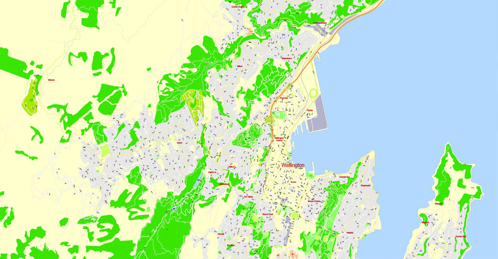
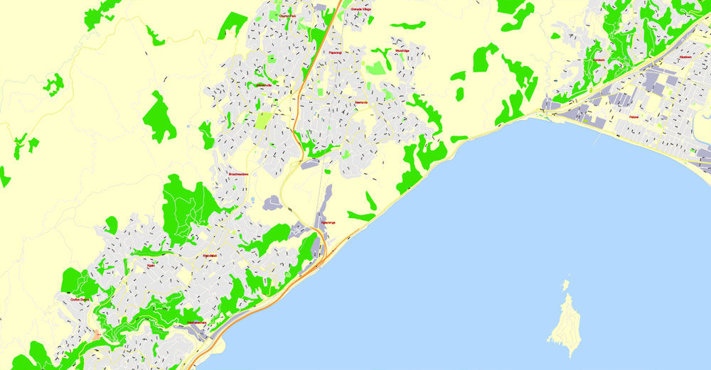
Wellington’s scenic natural harbour and green hillsides adorned with tiered suburbs of colonial villas are popular with tourists. The CBD is close to Lambton Harbour, an arm of Wellington Harbour, which lies along an active geological fault, clearly evident on its straight western shore. The land to the west of this rises abruptly, meaning that many suburbs sit high above the centre of the city. There is a network of bush walks and reserves maintained by the Wellington City Council and local volunteers. These include Otari-Wilton’s Bush, dedicated to the protection and propagation of native plants. The Wellington region has 500 square kilometres (190 sq mi) of regional parks and forests. In the east is the Miramar Peninsula, connected to the rest of the city by a low-lying isthmus at Rongotai, the site of Wellington International Airport.
The narrow entrance to the harbour is to the east of the Miramar Peninsula, and contains the dangerous shallows of Barrett Reef, where many ships have been wrecked (notably the inter-island ferry TEV Wahine in 1968). The harbour has three islands: Matiu/Somes Island, Makaro/Ward Island and Mokopuna Island. Only Matiu/Somes Island is large enough for habitation. It has been used as a quarantine station for people and animals, and was an internment camp during World War I and World War II. It is a conservation island, providing refuge for endangered species, much like Kapiti Island farther up the coast. There is access during daylight hours by the Dominion Post Ferry.
Wellington is primarily surrounded by water, but some of the nearby locations are listed below.

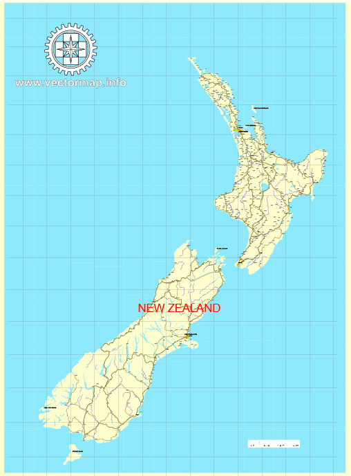
Free vector map New Zealand, Adobe Illustrator, download now maps vector clipart >>>>>
Wellington, New Zealand
Wellington is the capital city and second most populous urban area of New Zealand, with 405,000 residents. It is at the south-western tip of the North Island, between Cook Strait and the Rimutaka Range. Wellington is the major population centre of the southern North Island and is the administrative centre of the Wellington Region, which also includes the Kapiti Coast and Wairarapa. As the nation’s centre of government, the New Zealand Parliament, Supreme Court and most of the civil service are based in the city.
The Wellington urban area comprises four cities: Wellington City, on the peninsula between Cook Strait and Wellington Harbour, contains the central business district and about half the population; Porirua on Porirua Harbour to the north is notable for its large Māori and Pacific Island communities; Lower Hutt and Upper Hutt are largely suburban areas to the northeast, together known as the Hutt Valley.
Despite being much smaller than Auckland, Wellington is often referred to as New Zealand’s cultural capital. It is home to the National Archives, the National Art Gallery, the National Library, the Museum of New Zealand Te Papa Tongarewa, numerous theatres and two universities. Wellington has many notable buildings including the Government Building – one of the largest wooden buildings in the world – as well as the iconic Beehive. It also plays host to the annual World of Wearable Arts, the Wellington Sevens, New Zealand Symphony Orchestra and the Royal New Zealand Ballet. Wellington’s cafe culture is internationally recognised and the city is known for its large number of coffee shops and roasteries. It is also the centre of New Zealand’s film and special effects industries, and increasingly a hub for information technology and innovation.
One of the world’s most livable cities, the 2014 Mercer Quality of Living Survey ranked Wellington 12th in the world. In 2011 Lonely Planet Best in Travel 2011 named Wellington as fourth in its Top 10 Cities to Visit in 2011, referring to it as the “coolest little capital in the world”.
The main airport serving the city and region is Wellington International Airport, which is the country’s third biggest airport and offers domestic flights as well as connections to Australia and the Pacific. Wellington’s transport network includes train and bus lines which reach as far as the Kapiti Coast and Wairarapa, and ferries connect the city to the South Island town of Picton. Wellington is also the world’s windiest city, with an average wind speed of over 26 km/h, and the world’s southernmost capital city of a sovereign state.
Geography of Wellington, New Zealand
Wellington is at the south-western tip of the North Island on Cook Strait, separating the North and South Islands. On a clear day the snowcapped Kaikoura Ranges are visible to the south across the strait. To the north stretch the golden beaches of the Kapiti Coast. On the east the Rimutaka Range divides Wellington from the broad plains of the Wairarapa, a wine region of national notability. With a latitude of 41° 17′ South, Wellington is the southernmost capital city in the world. It is also the most remote capital city, the farthest away from any other capital. It is more densely populated than most other cities in New Zealand due to the restricted amount of land that is available between its harbour and the surrounding hills. It has very few open areas in which to expand, and this has brought about the development of the suburban towns. Because of its location in the Roaring Forties and its exposure to the winds blowing through Cook Strait, Wellington is known as “Windy Wellington”. It is often called the world’s windiest city, with an average wind speed of 27 km/h (17 mph).
The Wellington Urban Area (pink) is administered by four city councils
Wellington‘s scenic natural harbour and green hillsides adorned with tiered suburbs of colonial villas are popular with tourists. The CBD is close to Lambton Harbour, an arm of Wellington Harbour, which lies along an active geological fault, clearly evident on its straight western shore. The land to the west of this rises abruptly, meaning that many suburbs sit high above the centre of the city. There is a network of bush walks and reserves maintained by the Wellington City Council and local volunteers. These include Otari-Wilton’s Bush, dedicated to the protection and propagation of native plants. The Wellington region has 500 square kilometres (190 sq mi) of regional parks and forests. In the east is the Miramar Peninsula, connected to the rest of the city by a low-lying isthmus at Rongotai, the site of Wellington International Airport.
The narrow entrance to the harbour is to the east of the Miramar Peninsula, and contains the dangerous shallows of Barrett Reef, where many ships have been wrecked (notably the inter-island ferry TEV Wahine in 1968). The harbour has three islands: Matiu/Somes Island, Makaro/Ward Island and Mokopuna Island. Only Matiu/Somes Island is large enough for habitation. It has been used as a quarantine station for people and animals, and was an internment camp during World War I and World War II. It is a conservation island, providing refuge for endangered species, much like Kapiti Island farther up the coast. There is access during daylight hours by the Dominion Post Ferry.
Wellington is primarily surrounded by water, but some of near-by locations are listed below.
https://en.wikipedia.org/wiki/Wellington#Geography


 Author: Kirill Shrayber, Ph.D. FRGS
 Street Map editable Adobe Illustrator in layers")

