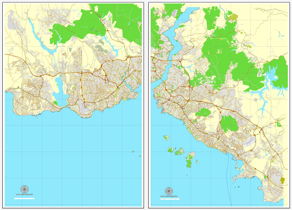
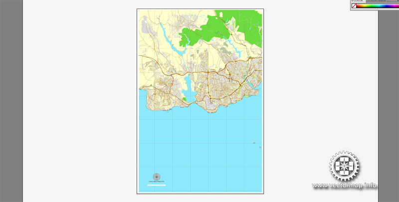
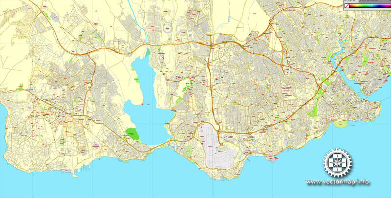
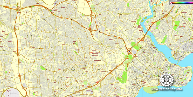
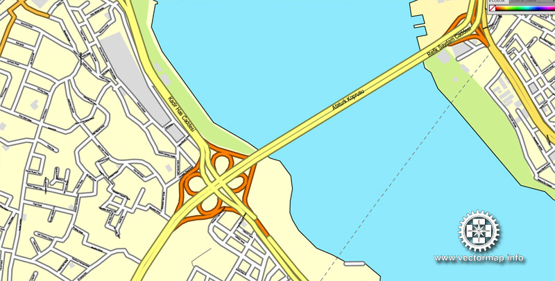
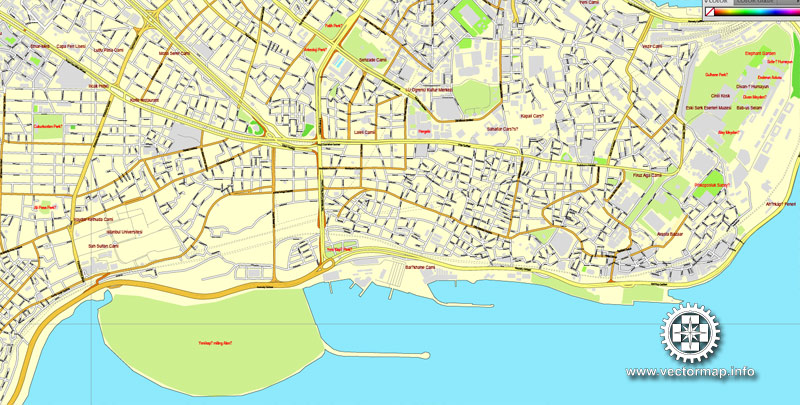
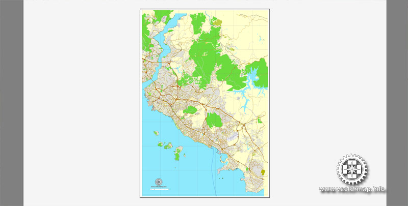
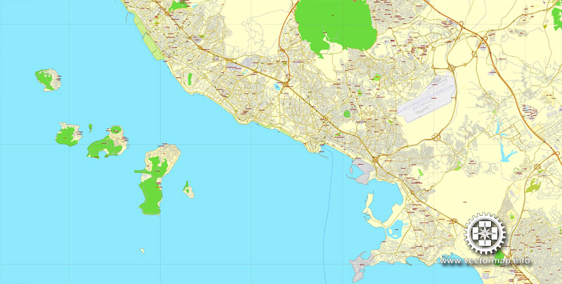
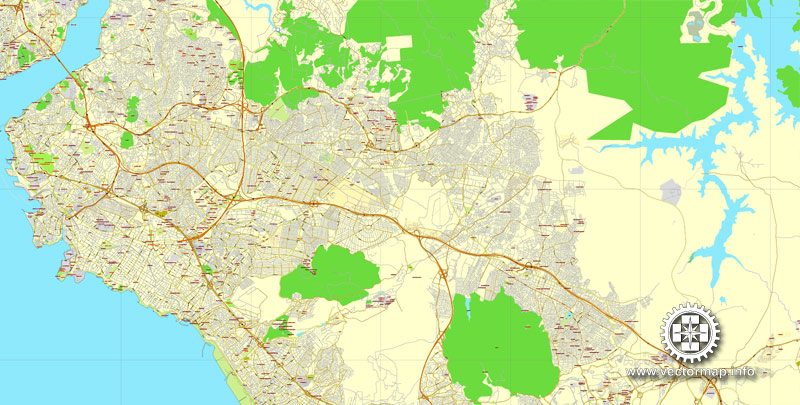
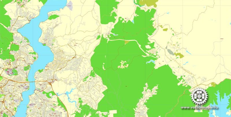
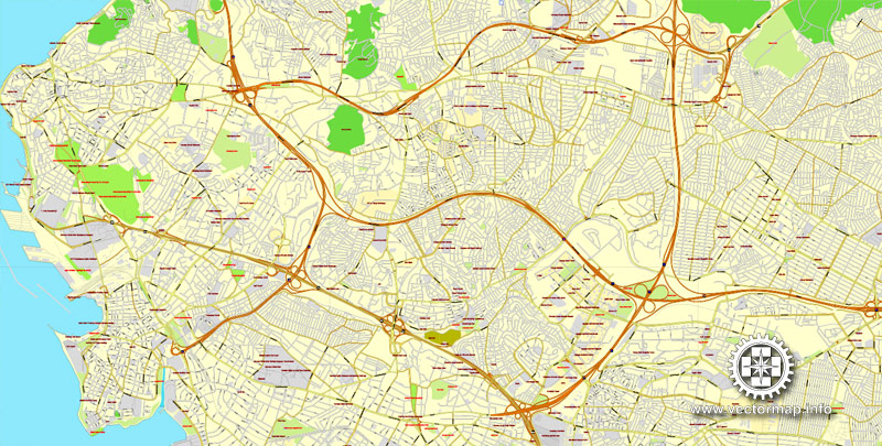
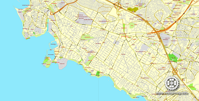
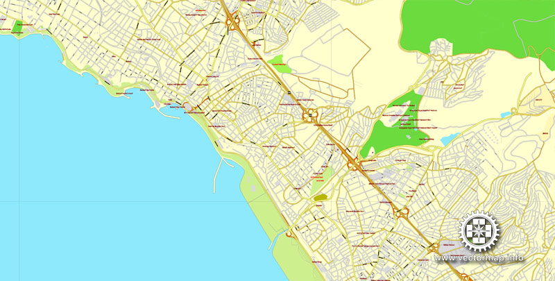
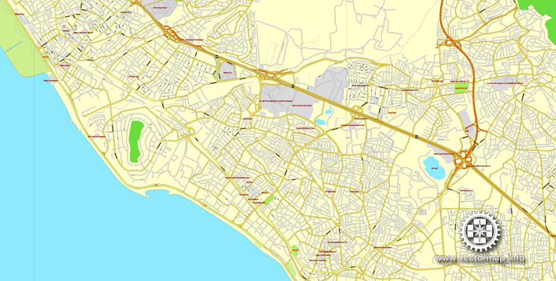
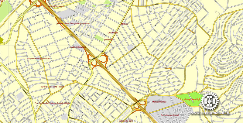
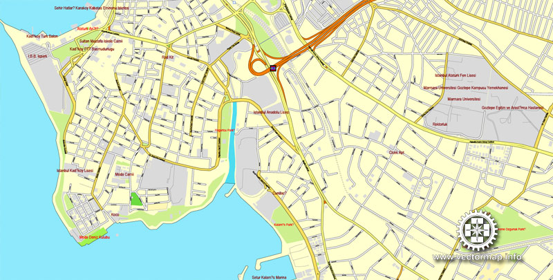
Istanbul, Turkey, printable vector street City Plan map in 2 parts, full editable, Adobe PDF, full vector, scalable, editable, text format street names, 44 mb ZIP
All streets, Some buildings. Map for design, print, arts, projects, presentations.
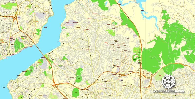
The most accurate and detailed map of the city.
You can edit this file by Adobe Illustrator, Adobe Acrobat, Corel Draw.
DXF, DWG, CDR and other formats – on request, same price, please, contact
Istanbul, Turkey.
This vector map of Istanbul city is used as a basis for design, editing, and further printing.
This is the most detailed, exact map of Istanbul city for high-quality printing and polygraphy. You can always clarify the map development date by contacting us.
For your convenience, all objects on Istanbul vector city map are divided into layers. And the editing is very easy – colors, lines, etc.
You can easily add any objects needed (e.g. shops, salons, sale points, gas station or attraction) on any layer of Istanbul vector map.
Istanbul, historically known as Byzantium and before 1924 as Constantinople, is the most populous city in Turkey and the country’s economic, cultural, and historic center. Istanbul is a transcontinental city in Eurasia, straddling the Bosporus strait (which separates Europe and Asia) between the Sea of Marmara and the Black Sea. Its commercial and historical center lies on the European side and about a third of its population lives on the Asian side.
One of the advantages of Istanbul city vector maps of our production is the relevance of cartographic data, we constantly update all our products.
This vector map of Istanbul city is used by:
designers, layout designers, printers, advertisers and architects. Our product – vector maps – is designed for further editing and printing in large formats – from @Wall format (a few meters) to A-0 and A-1, A-2, A-3.
The Istanbul city map in vector format is used for design, urban planning, presentations and media visualizations.
The advertising and presentation map of Istanbul city (usually the final designer marks the routes, and puts the client’s objects (shops, saloons, gas stations etc.)
The undoubted advantage is that people will NEVER throw out this advertising product – the map. In fact, as an advertising medium, a city map is the most “long-playing” of the well-known polygraphic advertising media, with the longest lifespan, and the maximum number of interactions with the customer.
For travelers, maps are sold at the airports and gas stations around the world. Often the source is our vector maps.
Take a look, who purchases our vector maps of Istanbul city in “Our Clients and Friends” page – these are large and small companies, from super-brands like Volvo and Starbucks, to small design studios and printing houses.
It’s very easy to work with vector maps of Istanbul city, even for a not very experienced designer who can turn on and off the map layers, add new objects, change the colors of fill and lines according to customer requirements.
The undoubted advantage of Istanbul city vector maps in printing is an excellent and detailed visualization, when customer can expand a large paper map and instantly define his location, find a landmark, an object or address on map, unlike using the popular electronic formats of Google and Yandex maps for example.
Printable vector maps of Istanbul city are much more convenient and efficient than any electronic maps on your smartphone, because ALL DETAILS are displayed in the entire space of Istanbul city map.
Useful tips on working with vector maps of cities and countries in Adobe Illustrator.
«V» – launches the Selection tool (cursor, black arrow), which makes active any vector line.
«А» – launches the Direct Selection tool (white cursor), allows you to select curve elements and drag them to the desired place.
«R» – activates the Rotate tool, which helps you rotating selected objects around the center point by 360 degrees.
«E» – gives you the opportunity to use the Eraser tool and erase unnecessary parts.
«X» – switches between Fill and Stroke in the Tools section. Try to get used to this hot key and
you will quickly understand that you can’t live and work without it.
Guides are not limited to vertical and horizontal in Adobe Illustrator. You can also create a diagonal guide for example. Moreover, you can turn any contours into guides. Select the outline and go to View > Guides > Make Guides (Create Guides), or simply press Cmd/Ctrl + 5. You can also turn the guides back into an editable object. Go to menu, View > Guides > Unlock Guides (Release Guides), select the guide you want to edit and select View > Guides > Release Guides (Reset Guides), or just press Cmd/Ctrl + Option / Alt + 5).
The city is the administrative center of the Istanbul Metropolitan Municipality (coterminous with Istanbul Province), both hosting a population of around 15 million residents. Istanbul is one of the world’s most populous cities and ranks as the world’s fourth-largest city proper and the largest European city. Istanbul is viewed as a bridge between the East and West.
You will probably want to change the color scheme used on our Istanbul vector city map.
To quickly and effectively play with colors.
Of course, you can do it manually, all objects in our Istanbul city vector map are divided according to types and layers, and you can easily change the color gamma of vector objects in groups and layers.
But there is more effective way of working with the whole VECTOR MAP of Istanbul city and all layers:
The overview dialog «Edit colors»/«Repaint Graphic Object» (this dialog box name can change depending on the context):
If you have selected a part or a layer of Istanbul city vector map and open the dialog box by clicking the icon in the Control panel, on the Samples palette or the Color Catalog, or if you choose Edit > Edit Colors> Repaint Graphic Object, then the «Repaint Graphic Object» dialog box appears, and you get access to «Assign» and «Edit» tabs.
If a picture or a map fragment is not selected, and you open the dialog box by clicking the icon in the Control panel, on the Samples palette or in the Color Catalog, the «Edit Colors» dialog box appears and you can only access the «Edit» tab.
Regardless of the name at the top of the dialog box, the right-hand side always displays the color group of the current document, as well as two default color groups: Print Color and Grayscale. These color groups can be selected and used any time.
Create and edit color groups of Istanbul city vector map, and also assign colors using the «Edit Colors»/ а «Repaint Graphic Object» dialog box.
A. Creating and editing of a color group on the «Edit» tab
B. Assigning colors on the «Assign» tab
C. Select a group of colors from the «Color groups» list
The option «Repaint a graphic object» in the lower part of the dialog box allows you to preview the colors on a selected layer of Vector map, or a group of elements, and specify whether its colors will be redefined when the dialog box is closed.
The main areas of the dialog box are:
«Edit»
The «Edit» tab is designed to create a new or edit the existing color groups.
The harmony rules Menu and the Color Wheel are used to conduct experiments with color harmonies. The color wheel shows how colors are related in color harmony, and the color bars allow you to view and manipulate an individual color values. In addition, you can adjust the brightness, add and remove colors, save color groups and view colors on the selected Vector Map of Istanbul city or a separated layers.
«Assign»
The «Assign» tab is used to view and control on how the original colors are replaced with colors from the color group like your corporate colors in the Vector Map of Istanbul city.
The assign color ability is provided only if the entire map, layer or fragment is selected in the document. You can specify which of new colors replace the current colors, whether the spot colors should be preserved and how colors are replaced (for example, you can replace colors completely or changing the color tone while maintaining the brightness). The «Assign» tab allows you to redefine colors in the Vector Map of Istanbul city, or in separate layers and fragments using the current color group or reducing the number of colors in the current Vector Map.
Color groups
Is a list of all saved color groups for current document (the same groups appear in the «Samples» palette). You can edit and delete the existing color groups, as well as creating a new ones using the list of “Color Groups” in the dialog box. All changes appear in the «Samples» palette.
The highlighted color group shows, which color group is currently edited.
Any color group can be selected and edited, or used to redefine the colors in the selected vector map of Istanbul city, its fragments or elements.
Saving a color group adds this group to the specified list.
Opening the «Edit Colors»/«Repaint Graphic Object» dialog box.
Open the «Edit Colors»/«Repaint Graphic Object» dialog box using one of the following methods:
«Edit»> «Edit Colors»> «Repaint Graphic object» or «Repaint With Style».
Use these commands if you need to edit the colors in the selected vector map of Istanbul city.
«Repaint Graphic object» button on the «Control» panel.
Use this button if you need to adjust colors of Istanbul city vector map using the а «Repaint graphic object» dialog box.
The specified button is available if the selected vector map or its fragment contains two or more colors.
Note. This color editing method is convenient for global color adjustment in a vector map, if global colors were not used when creating a City Map of Istanbul.
The «Edit colors» button or «Edit or apply colors» on the «Color Catalog» palette
Click this button if you need to edit colors on the «Color Catalog» palette or edit and then apply them to the selected Vector Map of Istanbul city or its fragment.
The «Edit color group» button or «Edit or apply color group» on the «Samples» palette.
Click this button if you need to edit the colors in the specific color group or edit and apply them to the selected Vector Map of Istanbul city or a group of its elements, for example, the whole layer “Streets and lines”. You can also double-click the color group in the Samples panel to open the dialog box.
If the map file is too large and your computer freezes or even can’t open it quickly:
1. Try to reduce the color resolution of the video card (display) to 256 colors while working with a large map.
2. Using Windows Task Manager, select all the application you don’t need, while working with map, just turn them off.
3. Launch Adobe Illustrator. (DO NOT OPEN the vector map file)
4. Start the Windows Task Manager using administrator rights > Find the “Illustrator” process > set the «real time» priority,
5. Open the file. When you see the LEGACY FONT popup window – click “OK” (do not update). You can restore the TEXT later.
6. Can also be useful: When file is opened – Edit > Settings > Basic Settings > disable smoothing. /// It looks scary, but works quickly)))
We recommend saving the file in Adobe Illustrator 10 version. It’s much more stable when working with VERY BIG size files.
Founded under the name of Byzantion (Βυζάντιον) on the Sarayburnu promontory around 660 BCE, the city grew in size and influence, becoming one of the most important cities in history. After its reestablishment as Constantinople in 330 CE, it served as an imperial capital for almost 16 centuries, during the Roman/Byzantine (330–1204), Latin (1204–1261), Palaiologos Byzantine (1261–1453) and Ottoman (1453–1922) empires. It was instrumental in the advancement of Christianity during Roman and Byzantine times, before the Ottomans conquered the city in 1453 CE and transformed it into an Islamic stronghold and the seat of the Ottoman Caliphate.
The city’s strategic position on the historic Silk Road, rail networks to Europe and the Middle East, and the only sea route between the Black Sea and the Mediterranean have produced a cosmopolitan populace. While Ankara was chosen instead as the new Turkish capital after the Turkish War of Independence, and the city’s name was changed to Istanbul, the city has maintained its prominence in geopolitical and cultural affairs. The population of the city has increased tenfold since the 1950s, as migrants from across Anatolia have moved in and city limits have expanded to accommodate them. Arts, music, film, and cultural festivals were established towards the end of the 20th century and continue to be hosted by the city today. Infrastructure improvements have produced a complex transportation network in the city.
Approximately 12.56 million foreign visitors arrived in Istanbul in 2015, five years after it was named a European Capital of Culture, making the city the world’s fifth most popular tourist destination. The city’s biggest attraction is its historic center, partially listed as a UNESCO World Heritage Site, and its cultural and entertainment hub can be found across the city’s natural harbor, the Golden Horn, in the Beyoğlu district. Considered a global city, Istanbul has one of the fastest-growing metropolitan economies in the world. It hosts the headquarters of many Turkish companies and media outlets and accounts for more than a quarter of the country’s gross domestic product. Hoping to capitalize on its revitalization and rapid expansion, Istanbul has bid for the Summer Olympics five times in twenty years.
Geography
Istanbul is located in north-western Turkey within the Marmara Region on a total area of 5,343 square kilometers (2,063 sq mi). The Bosphorus, which connects the Sea of Marmara to the Black Sea, divides the city into a European, Thracian side—comprising the historic and economic centers—and an Asian, Anatolian side. The city is further divided by the Golden Horn, a natural harbor bounding the peninsula where the former Byzantium and Constantinople were founded. The confluence of the Sea of Marmara, the Bosphorus, and the Golden Horn at the heart of present-day Istanbul has deterred attacking forces for thousands of years and remains a prominent feature of the city’s landscape.
Following the model of Rome, the historic peninsula is said to be characterized by seven hills, each topped by imperial mosques.
The easternmost of these hills is the site of Topkapı Palace on the Sarayburnu. Rising from the opposite side of the Golden Horn is another, conical hill, where the modern Beyoğlu district is situated. Because of the topography, buildings in Beyoğlu were once constructed with the help of terraced retaining walls, and roads were laid out in the form of steps. Üsküdar on the Asian side exhibits similarly hilly characteristics, with the terrain gradually extending down to the Bosphorus coast, but the landscape in Şemsipaşa and Ayazma is more abrupt, akin to a promontory. The highest point in Istanbul is Çamlıca Hill, with an altitude of 288 meters (945 ft).
The northern half of Istanbul has a higher mean elevation compared to the south coast, with locations surpassing 200 meters (660 ft), and some coasts with steep cliffs resembling fjords, especially around the northern end of the Bosphorus, where it opens up to the Black Sea.
Istanbul is situated near the North Anatolian Fault, close to the boundary between the African and Eurasian Plates. This fault zone, which runs from northern Anatolia to the Sea of Marmara, has been responsible for several deadly earthquakes throughout the city’s history.
Among the most devastating of these seismic events was the 1509 earthquake, which caused a tsunami that broke over the walls of the city and killed more than 10,000 people.
More recently, in 1999, an earthquake with its epicenter in nearby İzmit left 18,000 people dead, including 1,000 people in Istanbul’s suburbs.
The people of Istanbul remain concerned that an even more catastrophic seismic event may be in the city’s near future, as thousands of structures recently built to accommodate Istanbul’s rapidly increasing population may not have been constructed properly. Seismologists say the risk of a 7.6-magnitude or greater earthquake striking Istanbul by 2030 is more than 60 percent.
Cityscape
The Fatih district, which was named after Sultan Mehmed the Conqueror (Turkish: Fatih Sultan Mehmed), corresponds to what was, until the Ottoman conquest in 1453, the whole of the city of Constantinople (today is the capital district and called the historic peninsula of Istanbul) on the southern shore of the Golden Horn, across the medieval Genoese citadel of Galata on the northern shore.
The Genoese fortifications in Galata were largely demolished in the 19th century, leaving only the Galata Tower, to make way for the northward expansion of the city.
Galata (Karaköy) is today a quarter within the Beyoğlu (Pera) district, which forms Istanbul’s commercial and entertainment center and includes İstiklal Avenue and Taksim Square.
Dolmabahçe Palace, the seat of government during the late Ottoman period, is located in the Beşiktaş district on the European shore of the Bosphorus strait, to the north of Beyoğlu.
The Sublime Porte (Bâb-ı Âli), which became a metonym for the Ottoman government, was originally used to describe the Imperial Gate (Bâb-ı Hümâyûn) at the outermost courtyard of the Topkapı Palace; but after the 18th century, the Sublime Porte (or simply Porte) began to refer to the gate of the Sadrazamlık (Prime Ministry) compound in the Cağaloğlu quarter near Topkapı Palace, where the offices of the Sadrazam (Grand Vizier) and other Viziers were located, and where foreign diplomats were received.
The former village of Ortaköy is situated within Beşiktaş and gives its name to the Ortaköy Mosque on the Bosphorus, near the Bosphorus Bridge.
Lining both the European and Asian shores of the Bosphorus are the historic yalıs, luxurious chalet mansions built by Ottoman aristocrats and elites as summer homes. Farther inland, outside the city’s inner ring road, are Levent and Maslak, Istanbul’s main business districts.
Two- and three-story colored houses with docks and balconies, built directly on the edge of the water
During the Ottoman period, Üsküdar and Kadıköy were outside the scope of urban Istanbul, serving as tranquil outposts with seaside yalıs and gardens. But in the second half of the 20th century, the Asian side experienced major urban growth; the late development of this part of the city led to better infrastructure and tidier urban planning when compared with most other residential areas in the city.
Much of the Asian side of the Bosphorus functions as a suburb of the economic and commercial centers in European Istanbul, accounting for a third of the city’s population but only a quarter of its employment.
As a result of Istanbul’s exponential growth in the 20th century, a significant portion of the city is composed of gecekondus (literally “built overnight”), referring to illegally constructed squatter buildings.
At present, some gecekondu areas are being gradually demolished and replaced by modern mass-housing compounds. Moreover, large scale gentrification and urban renewal projects have been taking place, such as the one in Tarlabaşı; some of these projects, like the one in Sulukule, have faced criticism.
The Turkish government also has ambitious plans for an expansion of the city west and northwards on the European side in conjunction with plans for a third airport; the new parts of the city will include four different settlements with specified urban functions, housing 1.5 m
illion people.
Istanbul does not have a primary urban park, but it has several green areas. Gülhane Park and Yıldız Park were originally included within the grounds of two of Istanbul’s palaces—Topkapı Palace and Yıldız Palace—but they were repurposed as public parks in the early decades of the Turkish Republic.
Another park, Fethi Paşa Korusu, is situated on a hillside adjacent to the Bosphorus Bridge in Anatolia, opposite Yıldız Palace in Europe.
Along the European side, and close to the Fatih Sultan Mehmet Bridge, is Emirgan Park, which was known as the Kyparades (Cypress Forest) during the Byzantine period.
In the Ottoman period, it was first granted to Nişancı Feridun Ahmed Pasha in the 16th century, before being granted by Sultan Murad IV to the Safavid Emir Gûne Han in the 17th century, hence the name Emirgan. The 47-hectare (120-acre) park was later owned by Khedive Ismail Pasha of Ottoman Egypt and Sudan in the 19th century.
Emirgan Park is known for its diversity of plants and an annual tulip festival is held there since 2005. The AKP government’s decision to replace Taksim Gezi Park with a replica of the Ottoman era Taksim Military Barracks (which was transformed into the Taksim Stadium in 1921, before being demolished in 1940 for building Gezi Park) sparked a series of nationwide protests in 2013 covering a wide range of issues.

Free vector map World Robinson Projection, Adobe Illustrator, download now maps vector clipart, Map for design, projects, presentation free to use as you like. World map vector, Vector world map, World vector map, Map western europe, West europe maps, Map of the world modifiable, High resolution world map, World map illustrator, World map PDF editable, World vector map download,
Free vector map World Robinson Projection, Adobe Illustrator, download now maps vector clipart
Map for design, projects, presentation free to use as you like.
Free Vector World Maps here >>>>>>
Istanbul
City in Turkey
Istanbul is a city in Turkey that straddles Europe and Asia across the Bosphorus Strait. The Old City reflects cultural influences of the many empires that once ruled here. In the Sultanahmet district, the open-air, Roman-era Hippodrome was for centuries the site of chariot races, and Egyptian obelisks remain. The iconic Byzantine Hagia Sophia features a soaring dome and Christian mosaics.
Province: Istanbul Province
Population: 14.03 million (Dec 31, 2015)
Istanbul, historically also known as Constantinople and Byzantium, is the most populous city in Turkey and the country’s economic, cultural, and historic center. Istanbul is a transcontinental city in Eurasia, straddling the Bosphorus strait (which separates Europe and Asia) between the Sea of Marmara and the Black Sea. Its commercial and historical center lies on the European side and about a third of its population lives on the Asian side. The city is the administrative center of the Istanbul Metropolitan Municipality (coterminous with Istanbul Province), both hosting a population of around 14 million residents. Istanbul is one of the world’s most populous cities and ranks as the world’s 7th-largest city proper and the largest European city.
Founded under the name of Byzantium on the Sarayburnu promontory around 660 BCE, the city developed to become one of the most significant in history. After its reestablishment as Constantinople in 330 CE, it served as an imperial capital for almost 16 centuries, during the Roman and Byzantine (330–1204 and 1261–1453), the Latin (1204–1261), and the Ottoman (1453–1922) empires. It was instrumental in the advancement of Christianity during Roman and Byzantine times, before the Ottomans conquered the city in 1453 and transformed it into an Islamic stronghold and the seat of the Ottoman Caliphate.
Istanbul’s strategic position on the historic Silk Road, rail networks to Europe and the Middle East, and the only sea route between the Black Sea and the Mediterranean have produced a cosmopolitan populace, although less so since the establishment of the Turkish Republic in 1923. Overlooked for the new capital Ankara during the interwar period, the city has since regained much of its prominence. The population of the city has increased tenfold since the 1950s, as migrants from across Anatolia have moved in and city limits have expanded to accommodate them. Arts, music, film, and cultural festivals were established at the end of the 20th century and continue to be hosted by the city today. Infrastructure improvements have produced a complex transportation network.
Approximately 12.56 million foreign visitors arrived in Istanbul in 2015, five years after it was named a European Capital of Culture, making the city the world’s fifth most popular tourist destination. The city’s biggest attraction is its historic center, partially listed as a UNESCO World Heritage Site, and its cultural and entertainment hub can be found across the city’s natural harbor, the Golden Horn, in the Beyoğlu district. Considered a global city, Istanbul has one of the fastest-growing metropolitan economies in the world. It hosts the headquarters of many Turkish companies and media outlets and accounts for more than a quarter of the country’s gross domestic product. Hoping to capitalize on its revitalization and rapid expansion, Istanbul has bid for the Summer Olympics five times in twenty years.
Small guide: How to work with the vector map?
You can: Mass select objects by type and color – for example, the objects type “building” (they are usually dark gray) – and remove them from the map, if you do not need them in your print or design project. You can also easily change the thickness of lines (streets), just bulk selection the road by the line color.
The streets are separated by type, for example, type “residential road” are usually white with a gray stroke. Highway usually orange with a brown or dark gray stroke.
It is easy to change the font of inscriptions, all or each individually. Also, just can be make and any other manipulation of objects on the vector map in Adobe illustrator format.
Important: All the proportions on the map are true, that is, the relative sizes of the objects are true, because Map is based on an accurate GPS projection, and It transated into the (usual for all) the Mercator projection.
You can easily change the color, stroke and fill of any object on the map, zoom without loss of quality Image Verification.
Select object

Bulk selection the same objects on the vector map

See the bulk selected objects on the vector map

Bulk delete buildungs from the vector map

Select residencial road (small street) on the vector map

Bulk selection the same lines (streets, roads) on the full map

Create fat lines of the streets on the vector maps (bulk action) 1

Create fat lines of the streets on the vector maps (bulk action) 2

Create fat lines of the streets on the vector maps (bulk action) 3

You can easily change the color, stroke and fill of any object on the map, zoom without loss of quality Image Verification.
Probably can also be interesting Turkey cities maps in vector.


 Author: Kirill Shrayber, Ph.D. FRGS

