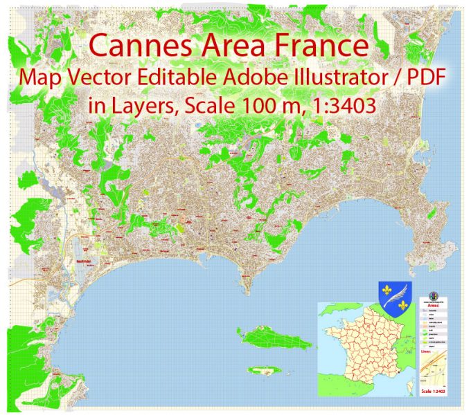
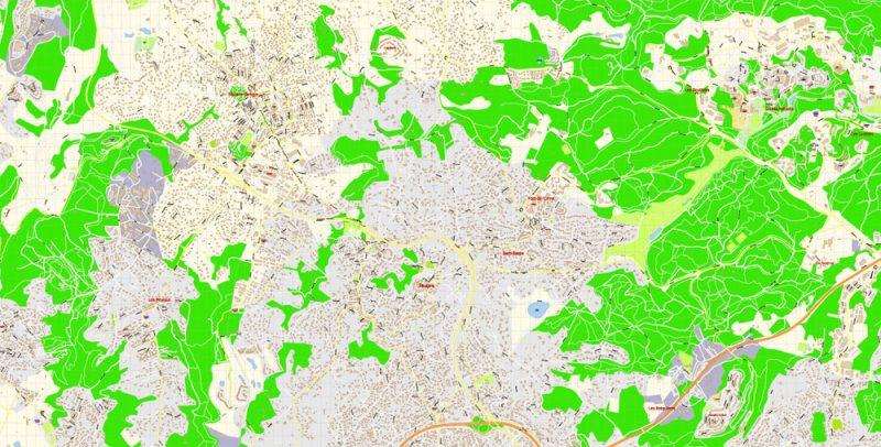
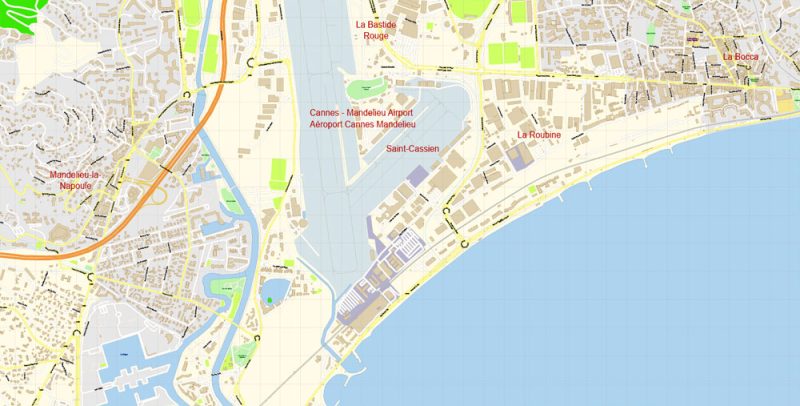
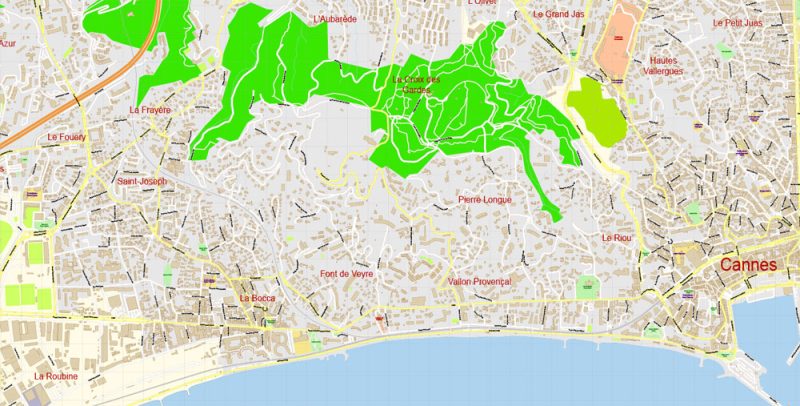
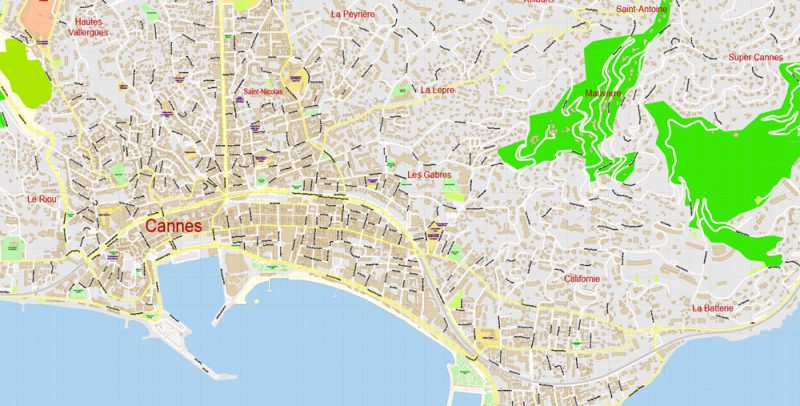
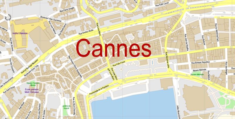
Printable Vector Map of Cannes Area Grande France detailed City Plan scale 1:3648 full editable Adobe Illustrator Street Map in layers , scalable, text format all names, 21 mb ZIP
All streets names, Main Objects, Buildings. Map for design, printing, arts, projects, presentations, for architects, designers and builders, business, logistics.
Layers: color_fills, water, streets_roads, labels_roads, names_objects, names_streets, names_places, water, buildings, grids, legend, etc.
The most exact and detailed map of the city in scale.
For Editing and High Quality Printing
DWG, DXF and other formats – on request, same price, please, contact
This vector map of Cannes city is used as a basis for design, editing, and further printing.
This is the most detailed, exact map of Cannes city for high-quality printing and polygraphy. You can always clarify the map development date by contacting us.
For your convenience, all objects on Cannes vector city map are divided into layers, and the editing is very easy – colors, lines, etc.
Cannes is a city located on the French Riviera. It is a commune located in the Alpes-Maritimes department, and host city of the annual Cannes Film Festival, Midem, and Cannes Lions International Festival of Creativity. The city is known for its association with the rich and famous, its luxury hotels and restaurants, and for several conferences. On 3 November 2011 it also played host to the G20 organisation of industrialised nations.
You can easily add any objects needed (e.g. shops, salons, sale points, gas station or attraction) on any layer of Cannes vector map.
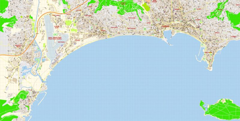
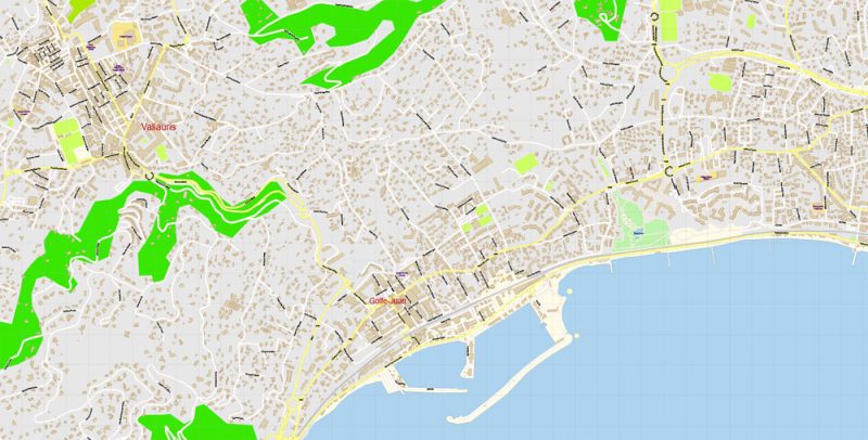
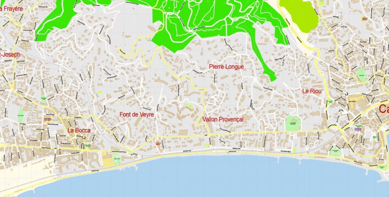
Plan de la région de Cannes Vector France Ville exacte Plan détaillé des rues Adobe Illustrator en couches preview 1
One of the advantages of Cannes city vector maps of our production is the relevance of cartographic data, we constantly update all our products.
This vector map of Cannes city is used by:
designers, layout designers, printers, advertisers and architects. Our product – vector maps – is designed for further editing and printing in large formats – from @Wall format (a few meters) to A-0 and A-1, A-2, A-3.
Landmarks
The Promenade de la Croisette is the waterfront avenue with palm trees. La Croisette is known for picturesque beaches, restaurants, cafés and boutiques. Le Suquet, the old town, provides a good view of La Croisette. The fortified tower and Chapel of St Anne house the Musée de la Castre. A distinctive building in Cannes is the Russian Orthodox church.
The Cannes city map in vector format is used for design, urban planning, presentations and media visualizations.
The advertising and presentation map of Cannes city (usually the final designer marks the routes, and puts the client’s objects (shops, saloons, gas stations etc.)
The undoubted advantage is that people will NEVER throw out this advertising product – the map. In fact, as an advertising medium, a city map is the most “long-playing” of the well-known polygraphic advertising media, with the longest lifespan, and the maximum number of interactions with the customer.
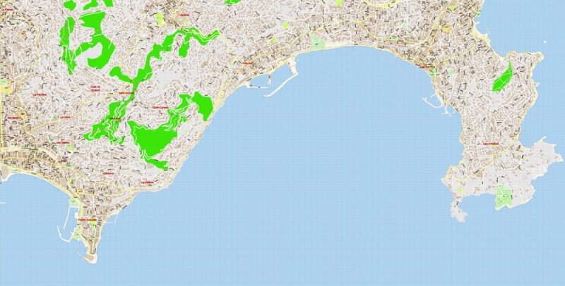
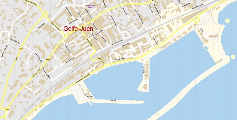
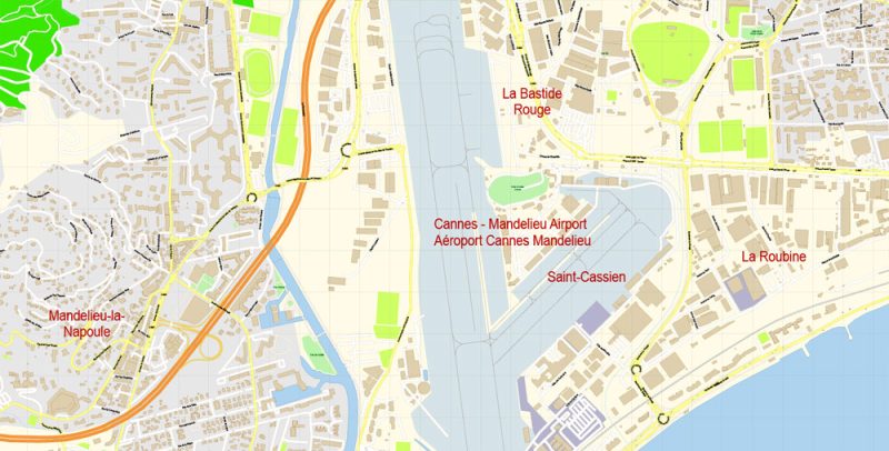
Plan de la région de Cannes Vector France Ville exacte Plan détaillé des rues Adobe Illustrator en couches preview 2
Museums
The Musée d’Art et d’Histoire de Provence houses artifacts from prehistoric to present, in an 18th-century mansion. The Musée de la Castre has objects from the Pacific Atolls, Peruvian relics and Mayan pottery. Other venues include the Musée de la Marine, Musée de la Mer, Musée de la Photographie and Musée International de la Parfumerie.
For travelers, maps are sold at the airports amd gas stations around the world. Often the source is our vector maps.
Take a look, who purchases our vector maps of Cannes city in “Our Clients and Friends” page – these are large and small companies, from super-brands like Volvo and Starbucks, to small design studios and printing houses.
It’s very easy to work with vector maps of Cannes city, even for a not very experienced designer who can turn on and off the map layers, add new objects, change the colors of fill and lines according to customer requirements.
The undoubted advantage of Cannes city vector maps in printing is an excellent and detailed visualization, when customer can expand a large paper map and instantly define his location, find a landmark, an object or address on map, unlike using the popular electronic formats of Google and Yandex maps for example.
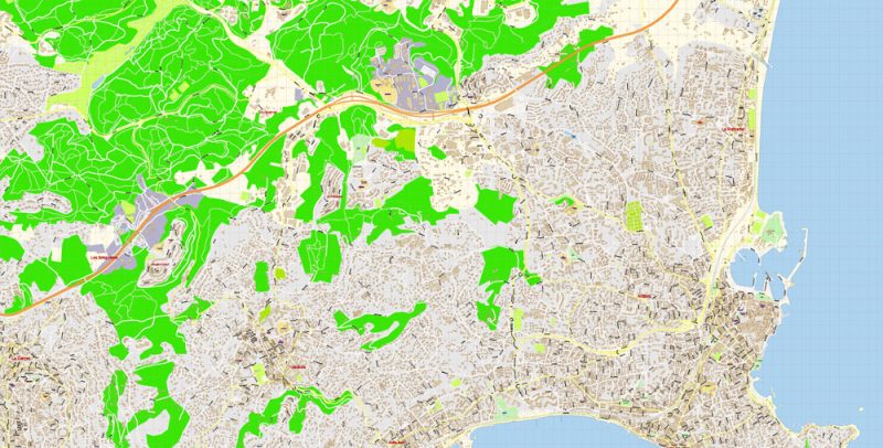
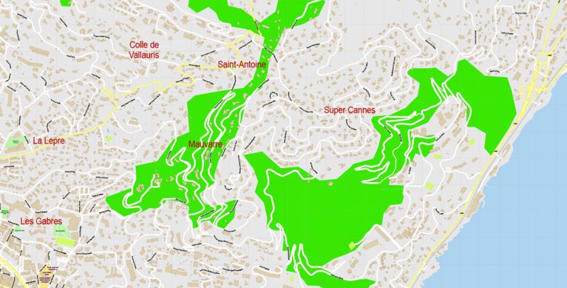
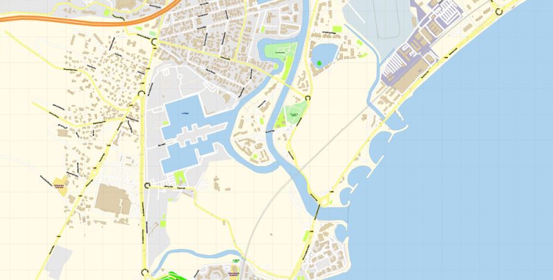
Plan de la région de Cannes Vector France Ville exacte Plan détaillé des rues Adobe Illustrator en couches preview 3
Villas
Cannes of the 19th century can still be seen in its grand villas, built to reflect the wealth and standing of their owners and inspired by anything from medieval castles to Roman villas. They are not open to the public. Lord Brougham’s Italianate Villa Eléonore Louise (one of the first in Cannes) was built between 1835 and 1839. Also known as the Quartier des Anglais, this is the oldest residential area in Cannes. Another landmark is the Villa Fiésole (known today as the Villa Domergue) designed by Jean-Gabriel Domergue in the style of Fiesole, near Florence, which may be visited on appointment.
Printable vector maps of Cannes city is much more convenient and efficient than any electronic maps on your smartphone, because ALL DETAILS are displayed in the entire space of Cannes city map.
Useful tips on working with vector map of Cannes City in Adobe Illustrator.
«V» – launches the Selection tool (cursor, black arrow), which makes active any vector line.
«А» – launches the Direct Selection tool (white cursor), allows you to select curve elements and drag them to the desired place.
«R» – activates the Rotate tool, which helps you rotating selected objects around the center point by 360 degrees.
«E» – gives you the opportunity to use the Eraser tool and erase unnecessary parts.
«X» – switches between Fill and Stroke in the Tools section. Try to get used to this hot key and
you will quickly understand that you can’t live and work without it.
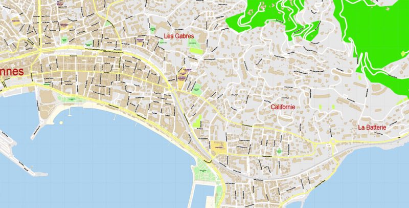
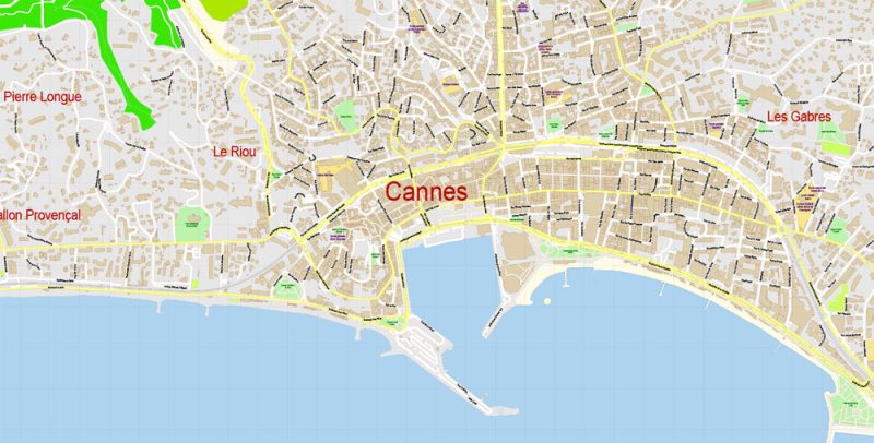
Plan de la région de Cannes Vector France Ville exacte Plan détaillé des rues Adobe Illustrator en couches preview 4
Île Sainte-Marguerite
It took the Man in the Iron Mask 11 years to leave the tiny, forested St Marguerite Island. The mysterious individual was believed to be of noble blood, but his identity has never been proven. His cell can be visited in the Fort of St Marguerite, now renamed the Musée de la Mer (Museum of the Sea). This museum also houses discoveries from shipwrecks off the island, including Roman (1st century BC) and Saracen (10th century AD) ceramics.
Guides are not limited to vertical and horizontal in Adobe Illustrator. You can also create a diagonal guide for example. Moreover, you can turn any contours into guides. Select the outline and go to View > Guides > Make Guides (Create Guides), or simply press Cmd/Ctrl + 5. You can also turn the guides back into an editable object. Go to menu, View > Guides > Unlock Guides (Release Guides), select the guide you want to edit and select View > Guides > Release Guides (Reset Guides), or just press Cmd/Ctrl + Option / Alt + 5).
You will probably want to change the color scheme used on our Cannes vector city map.
To quickly and effectively play with colors.
Of course, you can do it manually, all objects in our Cannes city vector map are divided according to types and layers, and you can easily change the color gamma of vector objects in groups and layers.
Plan de la région de Cannes Vector France Ville exacte Plan détaillé des rues Adobe Illustrator en couches preview 5
Île Saint-Honorat
Cistercian monks are the only inhabitants of the smaller, southern St Honorat Island. Monks have inhabited the island since AD 410 and, at the height of their powers, owned Cannes, Mougins, and Vallauris. Medieval vestiges remain in the stark church, which is open to the public, and in the ruins of the 11th-century monastery on the sea shore. The monks inhabit the Lérins Abbey and divide their time between prayer and producing red and white wines.
Theatre and music
Cannes is not renowned for traditional theatre. However, small venues stage productions and host short sketches during the annual International Actors’ Performance Festival. Popular theaters include the Espace Miramar and the Alexandre III. Popular pop punk band “Fallen Resonance”‘s place of origin.
But there is more effective way of working with the whole VECTOR MAP of Cannes city and all layers:
The overview dialog «Edit colors»/«Repaint Graphic Object» (this dialog box name can change depending on the context):
If you have selected a part or a layer of Cannes city vector map and open the dialog box by clicking the icon in the Control panel, on the Samples palette or the Color Catalog, or if you choose Edit > Edit Colors> Repaint Graphic Object, then the «Repaint Graphic Object» dialog box appears, and you get access to «Assign» and «Edit» tabs.
Plan de la région de Cannes Vector France Ville exacte Plan détaillé des rues Adobe Illustrator en couches preview 6
If a picture or a map fragment is not selected, and you open the dialog box by clicking the icon in the Control panel, on the Samples palette or in the Color Catalog, the «Edit Colors» dialog box appears and you can only access the «Edit» tab.
Regardless of the name at the top of the dialog box, the right-hand side always displays the color group of the current document, as well as two default color groups: Print Color and Grayscale. These color groups can be selected and used any time.
Transport
Nice Côte d’Azur Airport
Located 24 km (15 mi) from Cannes, Nice Côte d’Azur Airport has close to 10 million passengers a year. Marseille Provence Airport is also 150 km (93 mi) away. The smaller Cannes – Mandelieu Airport is nearby. CannesExpress operate a regular door-to-door airport shuttle service between Nice Airport and hotels/accommodations in Cannes. Price per seat is 20 Euros.
Create and edit color groups of Cannes city vector map, and also assign colors using the «Edit Colors»/ а «Repaint Graphic Object» dialog box.
A. Creating and editing of a color group on the «Edit» tab
B. Assigning colors on the «Assign» tab
C. Select a group of colors from the «Color groups» list
The option «Repaint a graphic object» in the lower part of the dialog box allows you to preview the colors on a selected layer of Vector map, or a group of elements, and specify whether its colors will be redefined when the dialog box is closed.
Plan de la région de Cannes Vector France Ville exacte Plan détaillé des rues Adobe Illustrator en couches preview 7
Rail
TGV rail services to the Gare de Cannes provide access from major French cities, including Nice, Marseille, Lyon, Paris, and Toulouse. Other cities with rail connections include Brussels (6 hours), Milan (5 hours), Basel (10 hours), Rome (10 hours), and Venice (10 hours). The minor train stations Gare de Cannes-La Bocca and Gare du Bosquet serve only regional destinations.
The main areas of the dialog box are:
«Edit»
The «Edit» tab is designed to create a new or edit the existing color groups.
The harmony rules Menu and the Color Wheel are used to conduct experiments with color harmonies. The color wheel shows how colors are related in color harmony, and the color bars allow you to view and manipulate an individual color values. In addition, you can adjust the brightness, add and remove colors, save color groups and view colors on the selected Vector Map of Cannes city or a separated layers.
Assign
The «Assign» tab is used to view and control on how the original colors are replaced with colors from the color group like your corporate colors in the Vector Map of Cannes city.
Plan de la région de Cannes Vector France Ville exacte Plan détaillé des rues Adobe Illustrator en couches preview 8
The assign color ability is provided only if the entire map, layer or fragment is selected in the document. You can specify which of new colors replace the current colors, whether the spot colors should be preserved and how colors are replaced (for example, you can replace colors completely or changing the color tone while maintaining the brightness). The «Assign» tab allows you to redefine colors in the Vector Map of Cannes city, or in separate layers and fragments using the current color group or reducing the number of colors in the current Vector Map.
Bus
Coach services arrive at the Gare Routière de Cannes, in the centre of the city, near the Town Hall. Companies from abroad include Eurolines and Agence Phoceens. Regional services are by Rapides Côte d’Azur and CTM, with services from Nice and Grasse/Mandelieu respectively. Local bus services are provided by Bus Azur.
Plan de la région de Cannes Vector France Ville exacte Plan détaillé des rues Adobe Illustrator en couches preview 9
Color groups
Is a list of all saved color groups for current document (the same groups appear in the «Samples» palette). You can edit and delete the existing color groups, as well as creating a new ones using the list of “Color Groups” in the dialog box. All changes appear in the «Samples» palette.
The highlighted color group shows, which color group is currently edited. Any color group can be selected and edited, or used to redefine the colors in the selected vector map of Cannes city, its fragments or elements.
Saving a color group adds this group to the specified list.
Opening the «Edit Colors»/«Repaint Graphic Object» dialog box.
Open the «Edit Colors»/«Repaint Graphic Object» dialog box using one of the following methods:
«Edit»> «Edit Colors»> «Repaint Graphic object» or «Repaint With Style».
Ferry
Ferries are available in Nice harbour from Bastia and Calvi in Corsica, with services provided by SNCM Ferryterranée and Corsica Ferries. From Bastia, the journey is 4 hours, 45 minutes on conventional ferries and 3 hours, 40 minutes on express ferries, while from Calvi, conventional vessels take 3 hours, 45 minutes and express vessels take 2 hours, 45 minutes. An average of four ferries a day sail on these routes, with more during summer.
Plan de la région de Cannes Vector France Ville exacte Plan détaillé des rues Adobe Illustrator en couches preview 10
Use these commands if you need to edit the colors in the selected vector map of Cannes city.
«Repaint Graphic object» button on the «Control» panel.
Use this button if you need to adjust colors of Cannes city vector map using the а «Repaint graphic object» dialog box.
The specified button is available if the selected vector map or its fragment contains two or more colors.
Note. This color editing method is convenient for global color adjustment in a vector map, if global colors were not used when creating a City Map of Cannes.
The «Edit colors» button or «Edit or apply colors» on the «Color Catalog» palette
Click this button if you need to edit colors on the «Color Catalog» palette or edit and then apply them to the selected Vector Map of Cannes city or its fragment.
The «Edit color group» button or «Edit or apply color group» on the «Samples» palette.
Click this button if you need to edit the colors in the specific color group or edit and apply them to the selected Vector Map of Cannes city or a group of its elements, for example, the whole layer “Streets and lines”. You can also double-click the color group in the Samples panel to open the dialog box.
Plan de la région de Cannes Vector France Ville exacte Plan détaillé des rues Adobe Illustrator en couches preview 11
If the map file is too large and your computer freezes or even can’t open it quickly:
1. Try to reduce the color resolution of the video card (display) to 256 colors while working with a large map.
2. Using Windows Task Manager, select all the application you don’t need, while working with map, just turn them off.
3. Launch Adobe Illustrator. (DO NOT OPEN the vector map file)
4. Start the Windows Task Manager using administrator rights > Find the “Illustrator” process > set the «real time» priority,
5. Open the file. When you see the LEGACY FONT popup window – click “OK” (do not update). You can restore the TEXT later.
6. ???? Can also be useful: ???? When the file is opened – Edit > Settings > Basic Settings > disable smoothing. /// It looks scary, but works quickly)))
We recommend saving the file in Adobe Illustrator 10 version. It’s much more stable when working with VERY BIG size files.
Plan de la région de Cannes Vector France Ville exacte Plan détaillé des rues Adobe Illustrator en couches preview 13
Plan de la région de Cannes Vector France Ville exacte Plan détaillé des rues Adobe Illustrator en couches preview 14
Plan de la région de Cannes Vector France Ville exacte Plan détaillé des rues Adobe Illustrator en couches preview 15
Plan de la région de Cannes Vector France Ville exacte Plan détaillé des rues Adobe Illustrator en couches preview 16
Plan de la région de Cannes Vector France Ville exacte Plan détaillé des rues Adobe Illustrator en couches preview 17
Plan de la région de Cannes Vector France Ville exacte Plan détaillé des rues Adobe Illustrator en couches preview 18
Free vector map World, Adobe Illustrator, download now maps vector clipart
Map for design, projects, presentation free to use as you like.
See also: TERMS & CONDITIONS: SOFTWARE LICENSE AGREEMENT FOR DIGITAL CARTOGRAPHIC DATA.
Author Rating
Aggregate Rating
no rating based on 0 votes
@vectormapper
Product Name Cannes Area Map Vector France Exact City Plan detailed Street Map Adobe Illustrator in layers
Price
USD 49
Product Availability
Available in Stock


 Author: Kirill Shrayber, Ph.D. FRGS
