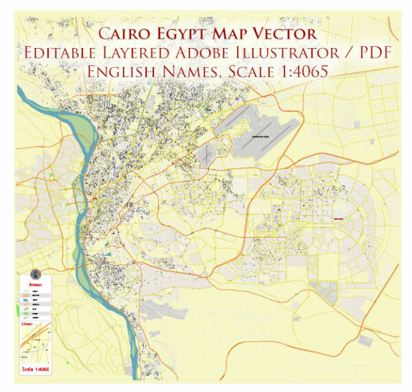
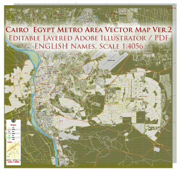
Printable Vector Map of Cairo Ver. 2 Metro Area Egypt high detailed scale 1:4065 full editable Adobe Illustrator Street Map in layers, scalable, text / curves format all names (ENGLISH), 19 MB ZIP
All street names, Main Objects, Admin Areas. Map for design, printing, arts, projects, presentations, for architects, designers, and builders, business, logistics.

Cairo Metro Area Ver.2 Egypt Vector Map High Detailed Street Map (ENGLISH NAMES) Adobe Illustrator in layers
Layers list:
- Legend
- Grids
- Names of places
- Names of places 2 (cities, towns, hamlets)
- Points of places (cities, towns, hamlets)
- Names Admin Areas
- Names of main streets
- Names of secondary streets
- Arrows of streets
- Main Streets, roads,
- Railroads
- Residencial streets
- Airports and heliports
- Water objects (rivers, lakes, ponds)
- Color fills (parks, hospital areas, land use, etc.)
- Admin Areas
- Background
The most exact and detailed map of the city in scale.
For Editing and High-Quality Printing
Cairo, the capital of Egypt and one of the largest cities in Africa and the Middle East, has a rich and complex history that spans thousands of years. Its strategic location near the Nile River has made it a center of political, cultural, and economic power throughout its existence. Below is an overview of Cairo’s history:
Ancient Beginnings
While Cairo itself was not founded until much later, the area where it stands has been inhabited since ancient times. The nearby city of Memphis , located about 20 kilometers south of modern Cairo, was the capital of ancient Egypt during the Old Kingdom (c. 2686–2181 BCE). Memphis served as the administrative and religious center of Egypt for centuries.
Later, during the Greco-Roman period, the city of Heliopolis (located in what is now northeastern Cairo) became a significant religious and intellectual hub. Heliopolis was dedicated to the worship of the sun god Ra and was a center of learning and philosophy.
The Rise of Fustat (641 CE)
Cairo as we know it today began with the Arab conquest of Egypt in 641 CE. After defeating the Byzantine forces, the Muslim general Amr ibn al-As established a military camp called Fustat (“the tent city”) on the eastern bank of the Nile. Fustat became the first Islamic capital of Egypt and grew into a thriving commercial and cultural center.
Over the centuries, Fustat expanded and developed into a major urban center. It was known for its vibrant markets, mosques, and diverse population, which included Arabs, Copts, Jews, and other groups.
The Fatimid Dynasty and the Founding of Cairo (969 CE)
In 969 CE, the Fatimid Caliphate, a Shia Islamic dynasty based in North Africa, conquered Egypt. The Fatimids established a new capital north of Fustat, naming it Al-Qahira (“The Victorious”), which is the origin of the modern name “Cairo.”
Under Fatimid rule, Cairo flourished as a center of Islamic learning, art, and architecture. The Fatimids built grand structures such as Al-Azhar Mosque (founded in 970 CE), which became one of the oldest universities in the world and remains a key institution of Islamic scholarship.
Ayyubid and Mamluk Periods (1171–1517)
In 1171, the Ayyubid dynasty, led by Saladin (Salah al-Din), overthrew the Fatimids and established Sunni Islam as the dominant religion in Egypt. Saladin fortified Cairo and expanded its defenses, including the construction of the Citadel of Cairo , which remains one of the city’s most iconic landmarks.
After the Ayyubids, the Mamluks (a military caste of slave-soldiers) took control of Egypt in 1250. Under the Mamluks, Cairo became one of the wealthiest and most powerful cities in the Islamic world. The Mamluks were prolific builders, constructing many of Cairo’s famous mosques, madrasas (Islamic schools), and caravanserais. However, the city also faced challenges, including the devastating Black Death in the 14th century.
Ottoman Rule (1517–1798)
In 1517, the Ottoman Empire conquered Egypt, and Cairo became part of the vast Ottoman domain. While Cairo remained an important regional center, its political and economic significance declined under Ottoman rule. The city was governed by Ottoman-appointed officials and experienced periods of stagnation.
During this time, Cairo continued to grow as a cultural and religious center. Its markets and bazaars thrived, and it remained a key stop for pilgrims traveling to Mecca.
Napoleon’s Invasion and Modernization (1798–1801)
In 1798, Napoleon Bonaparte invaded Egypt, bringing Cairo under French control for a brief period. Although the French occupation was short-lived, it had a lasting impact on Egypt. Napoleon’s expedition introduced modern scientific and administrative ideas to Egypt, sparking interest in modernization and reform.
After the French withdrawal, power struggles ensued, eventually leading to the rise of Muhammad Ali Pasha , an Albanian officer in the Ottoman army, who became the ruler of Egypt in 1805. Muhammad Ali initiated significant reforms, including the modernization of the military, economy, and infrastructure. He also expanded Cairo, demolishing parts of the old city to create wider streets and new neighborhoods.
19th and Early 20th Century: The Khedival Era
Under Muhammad Ali and his successors, Cairo underwent rapid modernization. The construction of railways, telegraph lines, and public buildings transformed the city. In the late 19th century, during the reign of Khedive Ismail (1863–1879), Cairo was rebuilt in a European style, with wide boulevards, grand palaces, and public gardens. This era saw the establishment of the Opera House and the expansion of the city into new districts like Zamalek and Garden City .
Cairo also hosted the opening of the Suez Canal in 1869, further cementing its importance as a global trade hub.
The 20th Century: Independence and Growth
Egypt gained independence from British colonial rule in 1922, and Cairo became the capital of the newly independent nation. The city experienced rapid population growth and urbanization in the mid-20th century, driven by migration from rural areas.
Key events in Cairo’s 20th-century history include:
- The 1952 Revolution , led by Gamal Abdel Nasser, which overthrew the monarchy and established a republic.
- The construction of the Cairo Metro in the 1980s, one of the first metro systems in Africa.
- The city’s role as a center of Arab nationalism and pan-Arabism during Nasser’s presidency.
Contemporary Cairo
Today, Cairo is a sprawling metropolis with a population of over 20 million people. It serves as Egypt’s political, cultural, and economic heart. The city faces challenges such as overcrowding, traffic congestion, and pollution, but it remains a vibrant and dynamic center of life in the Middle East.
Cairo is home to numerous historical landmarks, including:
- The Pyramids of Giza and the Great Sphinx , located just outside the city.
- The Islamic Cairo district, with its medieval mosques and narrow streets.
- The Coptic Cairo area, where early Christian churches and monasteries are preserved.
Cairo continues to be a bridge between ancient traditions and modern aspirations, reflecting the enduring legacy of its storied past.
Conclusion
Cairo’s history is a testament to its resilience and adaptability. From its origins as a small settlement to its current status as a bustling megacity, Cairo has played a central role in shaping the history of Egypt and the broader region. Its rich cultural heritage and strategic importance ensure that it will remain a vital city for generations to come.

Cairo Metro Area Ver.2 Egypt Vector Map High Detailed Street Map (ENGLISH NAMES) Adobe Illustrator in layers

Cairo Metro Area Ver.2 Egypt Vector Map High Detailed Street Map (ENGLISH NAMES) Adobe Illustrator in layers

Cairo Metro Area Ver.2 Egypt Vector Map High Detailed Street Map (ENGLISH NAMES) Adobe Illustrator in layers

Cairo Metro Area Ver.2 Egypt Vector Map High Detailed Street Map (ENGLISH NAMES) Adobe Illustrator in layers

Cairo Metro Area Ver.2 Egypt Vector Map High Detailed Street Map (ENGLISH NAMES) Adobe Illustrator in layers

Cairo Metro Area Ver.2 Egypt Vector Map High Detailed Street Map (ENGLISH NAMES) Adobe Illustrator in layers

Cairo Metro Area Ver.2 Egypt Vector Map High Detailed Street Map (ENGLISH NAMES) Adobe Illustrator in layers

Cairo Metro Area Ver.2 Egypt Vector Map High Detailed Street Map (ENGLISH NAMES) Adobe Illustrator in layers

Cairo Metro Area Ver.2 Egypt Vector Map High Detailed Street Map (ENGLISH NAMES) Adobe Illustrator in layers

Cairo Metro Area Ver.2 Egypt Vector Map High Detailed Street Map (ENGLISH NAMES) Adobe Illustrator in layers

Cairo Metro Area Ver.2 Egypt Vector Map High Detailed Street Map (ENGLISH NAMES) Adobe Illustrator in layers

Cairo Metro Area Ver.2 Egypt Vector Map High Detailed Street Map (ENGLISH NAMES) Adobe Illustrator in layers

Cairo Metro Area Ver.2 Egypt Vector Map High Detailed Street Map (ENGLISH NAMES) Adobe Illustrator in layers

Cairo Metro Area Ver.2 Egypt Vector Map High Detailed Street Map (ENGLISH NAMES) Adobe Illustrator in layers


 Author: Kirill Shrayber, Ph.D. FRGS
