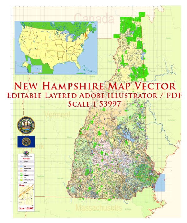
Vectormap.Net provide you with the most accurate and up-to-date vector maps in Adobe Illustrator, PDF and other formats, designed for editing and printing. Please read the vector map descriptions carefully.
Here’s a detailed description of the main cities, towns, and principal roads in the state of New Hampshire:
Main Cities and Towns
1. Manchester
- Overview: The largest city in New Hampshire, Manchester is a significant commercial and cultural hub.
- Population: Approximately 115,000.
- Key Features:
- Downtown Manchester: A vibrant area with numerous shops, restaurants, and cultural attractions. Notable landmarks include the Currier Museum of Art and the Palace Theatre.
- Millyard District: Historically known for its textile mills, this district has been redeveloped into a mixed-use area with businesses and residences.
- Southern New Hampshire University: A major educational institution located in the city.
2. Nashua
- Overview: Located in the southern part of the state, Nashua is known for its growing economy and suburban character.
- Population: Approximately 90,000.
- Key Features:
- Downtown Nashua: Features a range of shops, restaurants, and cultural sites such as the Nashua Historical Society.
- Nashua River: Offers recreational opportunities and scenic views along its banks.
- Anheuser-Busch Brewery: Located in nearby Merrimack, it is a significant local attraction.
3. Concord
- Overview: The state capital of New Hampshire, Concord is the political and administrative center of the state.
- Population: Approximately 43,000.
- Key Features:
- New Hampshire State House: The historic building where the state legislature meets. It is one of the oldest state capitol buildings in the U.S.
- Concord Museum: Offers exhibits related to the city’s history and New Hampshire’s heritage.
- DOWNTOWN: Features shops, restaurants, and historic buildings.
4. Portsmouth
- Overview: A historic city located on the seacoast, Portsmouth is known for its maritime heritage and vibrant cultural scene.
- Population: Approximately 22,000.
- Key Features:
- Portsmouth Historic District: Includes preserved 18th and 19th-century buildings, such as Strawbery Banke Museum.
- Portsmouth Harbor: A key maritime area with historical sites and a popular destination for tourists.
- Market Square: The heart of downtown Portsmouth, known for its shops, restaurants, and historic architecture.
5. Keene
- Overview: A small city located in southwestern New Hampshire, Keene is known for its educational institutions and historic charm.
- Population: Approximately 23,000.
- Key Features:
- Keene State College: An important educational institution in the city.
- Downtown Keene: Features historic buildings, shops, and cultural events such as the Keene Pumpkin Festival.
Principal Roads
1. Interstate 93 (I-93)
- Overview: A major north-south interstate running through the state, connecting the southern cities of Concord and Manchester with the northern regions and extending into Vermont.
- Key Cities: Concord, Manchester, and Franconia.
2. Interstate 89 (I-89)
- Overview: A north-south interstate running through the western part of the state, connecting Concord with Lebanon and continuing into Vermont.
- Key Cities: Concord, Lebanon, and Hanover.
3. Interstate 95 (I-95)
- Overview: This interstate runs along the eastern seaboard of the U.S. and briefly enters New Hampshire along its southern coast.
- Key Cities: Portsmouth.
4. Route 101
- Overview: An east-west highway running from the seacoast through southern New Hampshire to the western border with Massachusetts.
- Key Cities: Portsmouth, Manchester, and Keene.
5. Route 3
- Overview: A major north-south route running from the Massachusetts border through New Hampshire and into the White Mountains region.
- Key Cities: Nashua, Concord, and Littleton.
6. Route 4
- Overview: An east-west route connecting Concord with the seacoast and continuing into the western part of the state.
- Key Cities: Concord, Dover, and Lebanon.
7. Route 9
- Overview: A key east-west route that connects the western part of New Hampshire with the seacoast, passing through towns such as Keene and Hillsborough.
- Key Cities: Keene and Hillsborough.
Summary
New Hampshire’s major cities and towns offer a mix of historical charm, cultural attractions, and modern amenities. Manchester and Nashua serve as economic and cultural hubs, while Concord is the political heart of the state. Portsmouth is known for its historic waterfront, and Keene provides a smaller-city atmosphere with educational and cultural highlights. The principal roads, including I-93, I-89, and I-95, are crucial for connecting these cities and facilitating travel throughout the state. Route 101, Route 3, Route 4, and Route 9 further enhance regional connectivity and access to various parts of New Hampshire.


 Author: Kirill Shrayber, Ph.D. FRGS