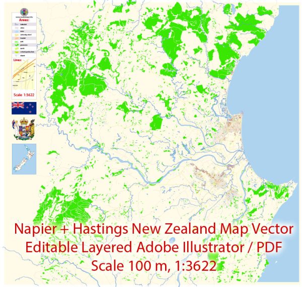
Napier and Hastings are neighboring cities located in the Hawke’s Bay region of New Zealand’s North Island. They are known for their rich history, distinct architectural styles, and well-organized urban layouts.
Vectormap.Net provide you with the most accurate and up-to-date vector maps in Adobe Illustrator, PDF and other formats, designed for editing and printing. Please read the vector map descriptions carefully.
Here’s a detailed description of their districts, communities, and street systems:
Napier
**1. Central Napier
- Description:
- The heart of Napier, characterized by its Art Deco architecture, a legacy of the 1931 earthquake that reshaped the city.
- Key Streets:
- Emerson Street: The main commercial street in Central Napier, lined with Art Deco buildings, shops, cafes, and restaurants.
- Tennyson Street: Known for its vibrant atmosphere, featuring a mix of retail shops, dining options, and historical buildings.
- Marine Parade: A scenic waterfront street offering views of the ocean, gardens, and landmarks like the Napier Aquarium.
**2. Ahuriri
- Description:
- A historic and lively waterfront district with a blend of residential, commercial, and recreational areas.
- Key Features:
- Ahuriri Harbour: A popular area for dining, shopping, and leisure activities, with a mix of modern and historic architecture.
- Harbour Street: Runs along the waterfront, featuring a variety of shops, cafes, and restaurants.
**3. Taradale
- Description:
- A suburban area located to the southeast of Napier’s central business district, known for its residential neighborhoods and local amenities.
- Key Features:
- Taradale Shopping Centre: Provides a range of retail and dining options for residents.
- Taradale Park: A large green space offering recreational facilities, sports fields, and walking paths.
**4. Maraenui
- Description:
- A predominantly residential area situated to the north of Napier’s central district.
- Key Features:
- Maraenui Park: A local park providing open space and recreational opportunities.
- Local Shops and Services: Includes various local businesses and community services.
Hastings
**1. Central Hastings
- Description:
- The central business district of Hastings, featuring a mix of historic and modern buildings, shopping, and cultural sites.
- Key Streets:
- Karamu Road: A major road running through the heart of Hastings, lined with retail shops, offices, and dining options.
- Heretaunga Street: The main commercial street in Hastings, featuring a variety of shops, cafes, and cultural venues.
- Queen Street: Known for its vibrant shopping and dining scene, as well as historic buildings.
**2. Havelock North
- Description:
- A picturesque village located to the southwest of Hastings, known for its charming atmosphere and local amenities.
- Key Features:
- Village Centre: A hub of activity with boutique shops, cafes, and restaurants.
- Havelock North Domain: A large park offering recreational facilities, playgrounds, and walking trails.
**3. Flaxmere
- Description:
- A residential suburb located to the west of Hastings, known for its family-friendly environment and local services.
- Key Features:
- Flaxmere Park: A large park with sports fields, playgrounds, and community facilities.
- Local Amenities: Includes various shops, schools, and community services.
**4. St Leonards
- Description:
- A residential area situated to the north of Hastings, known for its proximity to the coastline and local amenities.
- Key Features:
- St Leonards Beach: A popular spot for beachgoers and recreational activities.
- Local Shops and Services: Includes various local businesses and community services.
Street System
- Napier:
- Emerson Street: Runs through Central Napier, connecting various commercial and cultural sites.
- Tennyson Street: Parallel to Emerson Street, featuring additional shopping and dining options.
- Marine Parade: A scenic waterfront road offering access to the coastline and recreational areas.
- Taradale Road: Connects Napier with the suburban area of Taradale, providing access to residential neighborhoods and local amenities.
- Hastings:
- Karamu Road: A major thoroughfare running through Central Hastings, linking key commercial and business areas.
- Heretaunga Street: Another major street in the central area, featuring a mix of shops, dining, and cultural venues.
- Queen Street: A bustling street known for its shopping and dining options.
- Havelock Road: Connects Hastings with the village of Havelock North and provides access to the surrounding countryside.
Summary
Napier and Hastings each have well-defined districts and communities, with central business areas featuring a mix of historic and modern elements. Napier’s key areas include Central Napier, Ahuriri, Taradale, and Maraenui, with prominent streets such as Emerson Street and Marine Parade. Hastings includes Central Hastings, Havelock North, Flaxmere, and St Leonards, with important streets like Karamu Road and Heretaunga Street. Both cities offer a well-organized street system that supports their vibrant urban and suburban environments.


 Author: Kirill Shrayber, Ph.D. FRGS