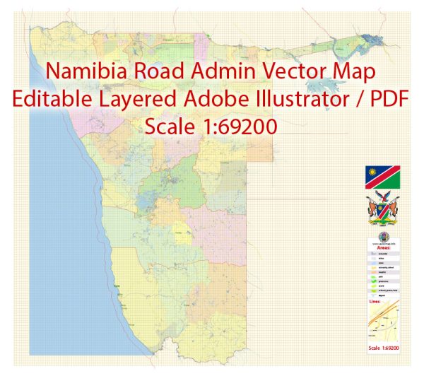
Namibia, located in southwestern Africa, is known for its diverse and dramatic landscapes.
Vectormap.Net provide you with the most accurate and up-to-date vector maps in Adobe Illustrator, PDF and other formats, designed for editing and printing. Please read the vector map descriptions carefully.
Here’s a detailed geographical description of the country:
Geographical Overview
**1. Location and Borders
- Location:
- Namibia is situated on the southwestern coast of Africa, bordered by the Atlantic Ocean to the west. It lies between latitudes 17° and 29°S and longitudes 11° and 25°E.
- Borders:
- To the North: Angola and Zambia
- To the East: Botswana
- To the South: South Africa
**2. Major Geographical Features
- Namib Desert:
- Location:
- Stretching along the western coast of Namibia, from the Angola border southwards to the northern regions of South Africa.
- Features:
- One of the oldest deserts in the world, characterized by vast sand dunes, rocky outcrops, and dry riverbeds. Notable dunes include the iconic Sossusvlei and Deadvlei.
- The desert experiences extreme temperature variations between day and night and is known for its stunning landscapes and unique flora and fauna.
- Location:
- Kalahari Desert:
- Location:
- Extends into Namibia from the east, covering much of the southeastern part of the country.
- Features:
- A semi-arid sandy desert with sparse vegetation. The Kalahari is home to various wildlife species and is characterized by salt pans, such as the Makgadikgadi Pan, which are remnants of ancient lake beds.
- Location:
- Great Escarpment:
- Location:
- Runs parallel to the western coast of Namibia, forming a steep and dramatic transition between the coastal plains and the central plateau.
- Features:
- The escarpment rises abruptly from the coastal plains, creating a striking geological feature with cliffs and rugged terrain. It marks a significant change in elevation from the coastal region to the interior highlands.
- Location:
- Central Plateau:
- Location:
- Covers the central region of Namibia, including the areas between the Namib Desert and the Kalahari Desert.
- Features:
- A highland area with a relatively flat or gently rolling landscape, characterized by sparse vegetation and occasional mountain ranges.
- Location:
- Zambezi Region (formerly Caprivi Strip):
- Location:
- A narrow strip of land in the northeastern part of Namibia, extending between Angola and Botswana.
- Features:
- A region with a more tropical climate, lush vegetation, and numerous rivers and wetlands. It is part of the Zambezi River Basin and includes important wildlife reserves and national parks.
- Location:
**3. Rivers and Water Bodies
- Zambezi River:
- Location:
- Forms part of the northeastern border of Namibia, flowing from Angola into Zambia and then into Zimbabwe.
- Features:
- One of Africa’s major rivers, providing important water resources and supporting diverse ecosystems in the Zambezi Region.
- Location:
- Okavango River:
- Location:
- Originates in Angola and flows into the Kalahari Desert, creating the Okavango Delta in Botswana.
- Features:
- The river provides critical water resources to the region, including parts of Namibia’s northeastern areas.
- Location:
- Kunene River:
- Location:
- Forms part of the northern border between Namibia and Angola.
- Features:
- Provides water for local communities and supports ecosystems in the arid regions along its course.
- Location:
**4. Climate
- General Climate:
- Namibia experiences a range of climatic conditions from arid to semi-arid, with significant variations in temperature and precipitation.
- Coastal Region:
- Influenced by the cold Benguela Current, the coastal areas have a mild, temperate climate with relatively high humidity and cool temperatures.
- Interior Regions:
- Characterized by more extreme temperatures, with hot days and cold nights. The central plateau and desert regions have low annual rainfall and high temperature variability.
Summary
Namibia’s geography is defined by its dramatic landscapes, including the Namib and Kalahari deserts, the Great Escarpment, and the Central Plateau. The country’s diverse terrain ranges from arid desert regions and rugged escarpments to lush wetlands in the Zambezi Region. Major rivers like the Zambezi, Okavango, and Kunene are crucial for water resources and ecosystems. Namibia’s climate varies from coastal temperate conditions to extreme arid conditions inland, reflecting the country’s complex geographical features.


 Author: Kirill Shrayber, Ph.D. FRGS