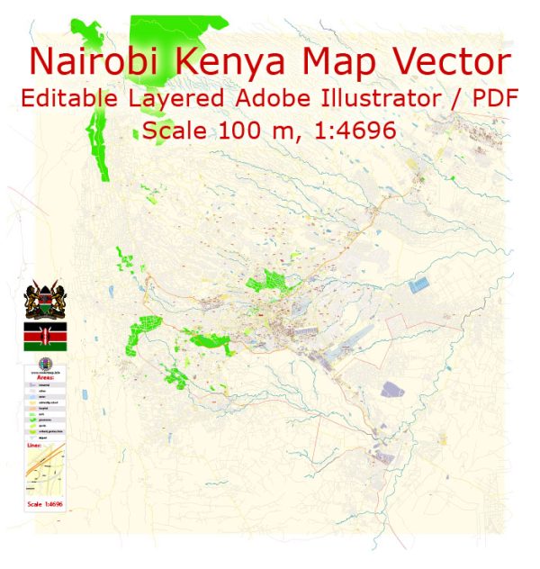
Nairobi, Kenya’s capital city, is a dynamic and diverse metropolis divided into various districts and neighborhoods, each with its own character and significance.
Vectormap.Net provide you with the most accurate and up-to-date vector maps in Adobe Illustrator, PDF and other formats, designed for editing and printing. Please read the vector map descriptions carefully.
Here’s a detailed description of Nairobi’s districts, communities, and main streets:
Districts and Key Areas in Nairobi
1. Central Business District (CBD)
- Description:
- The commercial heart of Nairobi, characterized by high-rise buildings, government offices, banks, and major businesses.
- Key Streets:
- Uhuru Highway: A major thoroughfare forming part of the city’s ring road, connecting key areas within and around the CBD.
- Moi Avenue: A primary street running through the CBD, known for its shopping and business activities.
- Kenyatta Avenue: Another central street, lined with significant government buildings and corporate offices.
- Communities:
- The CBD is primarily a business and administrative zone, with limited residential areas. Surrounding neighborhoods include parts of Westlands and the area near Kenyatta National Hospital.
2. Westlands
- Description:
- A vibrant commercial and residential district located northwest of the CBD, known for its shopping centers, restaurants, and entertainment venues.
- Key Streets:
- Westlands Road: The main street running through the area, featuring numerous commercial establishments.
- Sarit Avenue: Home to the Sarit Mall, a major shopping and entertainment complex.
- Communities:
- Westlands is a mix of residential neighborhoods and commercial zones. It includes upscale apartments and is popular among expatriates and young professionals.
3. Karen
- Description:
- An affluent suburb located southwest of the city center, known for its spacious homes, green spaces, and proximity to Nairobi National Park.
- Key Streets:
- Karen Road: A major road connecting Karen to other parts of Nairobi, lined with residential properties and local amenities.
- Lang’ata Road: Provides access to Karen and connects it to the southern parts of the city.
- Communities:
- Karen is a prestigious residential area with large properties and is popular among Kenya’s elite and expatriates.
4. Upper Hill
- Description:
- A business and residential district situated to the southeast of the CBD, known for its high-rise office buildings and institutions.
- Key Streets:
- Hill Lane: A key street in Upper Hill, featuring offices and medical facilities.
- Chase Bank Road: Home to several corporate offices and hotels.
- Communities:
- Upper Hill includes both commercial and residential areas, with a mix of office buildings and upscale housing.
5. Kilimani
- Description:
- A residential area located to the southwest of the CBD, known for its mix of apartment complexes, shopping centers, and schools.
- Key Streets:
- Yaya Centre Road: Leads to the Yaya Centre, a major shopping and entertainment complex.
- Hurlingham Road: Connects Kilimani with other parts of Nairobi and features local amenities.
- Communities:
- Kilimani is a popular residential area with a diverse population, offering a range of housing options and services.
6. Eastlands
- Description:
- A large and diverse area located to the east of the CBD, known for its vibrant residential neighborhoods and commercial activity.
- Key Streets:
- Jogoo Road: A major road running through Eastlands, connecting various neighborhoods and commercial areas.
- Thika Road: Extends from Nairobi into the surrounding region, serving as a key transportation route.
- Communities:
- Eastlands includes neighborhoods such as Embakasi, Umoja, and Donholm, which are characterized by a mix of residential and commercial properties.
7. Gikambura
- Description:
- A developing residential area located to the west of Nairobi, known for its expanding housing developments.
- Key Streets:
- Gikambura Road: Connects the area to the city and other suburban neighborhoods.
- Communities:
- Gikambura is primarily residential, with new housing developments and suburban amenities.
Main Streets of Nairobi
1. Uhuru Highway
- Description:
- One of Nairobi’s major roads, forming part of the city’s ring road. It connects several key areas and is crucial for traffic flow.
- Features:
- Runs from the western to the eastern parts of the city, linking important zones such as the CBD, Westlands, and the Nairobi National Park area.
2. Moi Avenue
- Description:
- A prominent street in the CBD, known for its commercial activities and business establishments.
- Features:
- Lined with shops, banks, and offices, it is a key commercial artery in Nairobi.
3. Kenyatta Avenue
- Description:
- A major street in the heart of Nairobi, running parallel to Moi Avenue and serving as an important business and administrative route.
- Features:
- Hosts significant government buildings, corporate offices, and cultural institutions.
4. Mombasa Road
- Description:
- A crucial highway connecting Nairobi to the port city of Mombasa, important for trade and transportation.
- Features:
- Provides access to Jomo Kenyatta International Airport (JKIA) and serves as a key commercial corridor.
5. Lang’ata Road
- Description:
- Runs from the city center southward towards the Lang’ata suburb and Nairobi National Park.
- Features:
- Important for accessing residential areas and recreational sites, including the Nairobi National Park.
Summary
Nairobi’s urban landscape is characterized by its diverse districts, each serving different functions and communities. The Central Business District is the city’s commercial core, while neighborhoods like Westlands and Karen offer vibrant residential and commercial environments. Roads like Uhuru Highway and Mombasa Road are crucial for connectivity, while streets such as Moi Avenue and Kenyatta Avenue play key roles in the city’s business and administrative activities. Nairobi’s road system supports its status as a major metropolitan center in East Africa, facilitating both local and regional travel.


 Author: Kirill Shrayber, Ph.D. FRGS