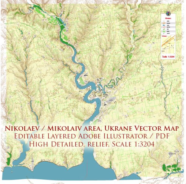
Mykolaiv (or Nikolaev), located in southern Ukraine, is a significant port city on the Black Sea. It has a rich industrial history, a key port facility, and a developed road system.
Vectormap.Net provide you with the most accurate and up-to-date vector maps in Adobe Illustrator, PDF and other formats, designed for editing and printing. Please read the vector map descriptions carefully.
Here’s a detailed description of these aspects:
Industrial History of Mykolaiv
Early Development (18th Century – Early 20th Century)
- Foundation and Early Growth:
- Mykolaiv was founded in 1789 by the Russian Empire as a shipbuilding center and port. The city’s strategic location on the Black Sea made it an essential site for maritime activities and trade.
- Initially, Mykolaiv’s economy was based on shipbuilding and maritime trade. The city’s development was closely tied to its role as a naval base and the establishment of shipyards.
Soviet Era (1917 – 1991)
- Post-Revolution Industrialization:
- During the Soviet period, Mykolaiv’s industrial base expanded significantly. The city became a major center for shipbuilding and heavy industry, with the establishment of large factories and industrial enterprises.
- The Soviet government invested heavily in the city’s infrastructure, including the construction of new industrial facilities, shipyards, and transportation networks.
- World War II Impact:
- Mykolaiv’s industrial capacity was crucial during World War II, particularly in the production of naval vessels and military equipment. The city’s shipyards played a key role in the Soviet war effort.
- Post-War Development:
- After World War II, Mykolaiv continued to develop as an industrial hub, with a focus on shipbuilding, mechanical engineering, and the production of machinery and equipment.
- The city also became known for its agricultural machinery and food processing industries, supporting the region’s agricultural sector.
Modern Era (1991 – Present)
- Transition to a Market Economy:
- The collapse of the Soviet Union in 1991 led to significant changes in Mykolaiv’s industrial landscape. The transition from a planned economy to a market economy resulted in the privatization of many state-owned enterprises and a period of economic instability.
- The shipbuilding industry faced challenges due to reduced orders and competition from international markets. Efforts were made to modernize and adapt to new economic conditions.
- Current Industrial Activities:
- Today, Mykolaiv remains an important industrial center, with key industries including shipbuilding, machinery manufacturing, and food processing.
- The city is home to several large shipyards, including the Mykolaiv Shipbuilding Yard and the Okean Shipyard, which are involved in the construction and repair of various types of vessels.
Port of Mykolaiv
Historical Development
- Early Port Facilities:
- The port of Mykolaiv was established in the late 18th century and quickly became an important maritime hub due to its deep-water harbor and strategic location on the Black Sea.
- The port was initially focused on shipbuilding and trade, serving as a key point for the export of grain and other goods from the region.
- Soviet Era Expansion:
- During the Soviet period, the port of Mykolaiv underwent significant expansion and modernization. New docks, warehouses, and facilities were constructed to handle increased cargo volumes and support industrial activities.
- The port’s capacity was enhanced to accommodate large ships and a wide range of cargo, including industrial goods and military equipment.
Modern Port Facilities
- Commercial and Industrial Ports:
- The port of Mykolaiv remains a vital component of the city’s economy, handling a diverse range of cargo, including grain, metals, and industrial products.
- The port is equipped with modern facilities for cargo handling, including container terminals, bulk cargo facilities, and specialized docks for shipbuilding and repair.
- Strategic Importance:
- The port plays a crucial role in regional trade and transportation, serving as a key gateway for exports and imports to and from southern Ukraine.
- It supports the city’s industrial base and contributes to the development of the surrounding region.
Road System of Mykolaiv
Historical Development
- Early Road Infrastructure:
- The development of Mykolaiv’s road system began in the 19th century, focusing on connecting the city to other parts of Ukraine and facilitating transportation to and from the port.
- Early roads were primarily designed to support maritime trade and industrial activities, linking the port with inland areas and neighboring regions.
Modern Road Network
- Key Roads and Highways:
- H11 Highway: One of the main roads connecting Mykolaiv to other major cities in Ukraine, including Odessa and Kryvyi Rih. The highway is essential for regional transportation and trade.
- M14 Highway: This road connects Mykolaiv to the port city of Odessa and other key locations along the Black Sea coast. It is an important route for both passenger and freight traffic.
- N11 Road: A significant road running through the city, providing access to various districts and industrial areas.
- Local Road Network:
- The local road network in Mykolaiv includes a variety of streets and avenues connecting residential areas, commercial districts, and industrial zones. Key streets include Sovetskaya Street, Gorky Street, and Artyoma Street.
- The city’s road system is designed to facilitate traffic flow and support the movement of goods to and from the port and industrial facilities.
- Transportation Challenges and Developments:
- Mykolaiv’s road system faces challenges related to congestion and maintenance, particularly in areas with high industrial activity and heavy traffic.
- Ongoing efforts are being made to improve road infrastructure, including road repair and expansion projects to enhance connectivity and support economic growth.
Summary
Mykolaiv has a rich industrial history, shaped by its role as a key port and shipbuilding center. The city’s port facilities have evolved from early 18th-century beginnings to a modern, vital component of Ukraine’s maritime trade. The road system in Mykolaiv supports its industrial and commercial activities, with key highways and local roads connecting the city to regional and international markets. Despite challenges, Mykolaiv remains an important industrial hub with ongoing efforts to improve infrastructure and support economic development.


 Author: Kirill Shrayber, Ph.D. FRGS