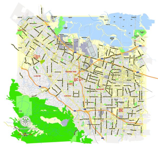
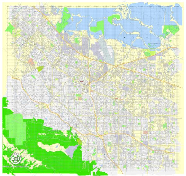
Mountain View, California, is a city located in the heart of Silicon Valley. It’s known for its tech industry presence, particularly as the headquarters of Google, and has a well-organized infrastructure that supports its thriving business and residential communities.
Vectormap.Net provide you with the most accurate and up-to-date vector maps in Adobe Illustrator, PDF and other formats, designed for editing and printing. Please read the vector map descriptions carefully.
Here’s a detailed description of the roads and streets infrastructure in Mountain View:
Principal Roads and Streets
- El Camino Real (State Route 82):
- Description: El Camino Real is one of the most important and historic roads in California, running through Mountain View as part of State Route 82. This major arterial road connects the city with nearby communities like Palo Alto, Sunnyvale, and San Jose. In Mountain View, El Camino Real is lined with various commercial establishments, including shops, restaurants, and hotels. The road serves as a key route for both local traffic and visitors.
- Central Expressway:
- Description: Central Expressway is a major east-west route that runs parallel to the Caltrain railway line. It provides a quick and efficient way to travel through Mountain View and connect to neighboring cities like Santa Clara and Sunnyvale. The expressway is essential for commuting, especially for those working in Silicon Valley’s tech companies.
- Shoreline Boulevard:
- Description: Shoreline Boulevard is a significant north-south arterial road in Mountain View. It begins near the city center and extends northward to the Shoreline Amphitheatre, Shoreline Park, and the Googleplex (Google’s headquarters). This road is vital for accessing some of the city’s most important recreational and cultural venues. It also serves as a main thoroughfare for employees commuting to the tech campuses in the area.
- Rengstorff Avenue:
- Description: Rengstorff Avenue is another major north-south route that connects residential areas with commercial and industrial zones in Mountain View. The road intersects with both El Camino Real and Central Expressway, making it a key connector within the city. Rengstorff Park, a popular recreational area, is located along this avenue.
- Castro Street:
- Description: Castro Street is the heart of downtown Mountain View and is one of the most vibrant streets in the city. It is primarily a pedestrian-friendly area, lined with restaurants, cafes, shops, and entertainment venues. Castro Street is also known for hosting community events, farmers’ markets, and festivals. The street extends from El Camino Real to the Mountain View Caltrain station, making it a central hub for both locals and visitors.
- Moffett Boulevard:
- Description: Moffett Boulevard serves as a key route to Moffett Field, a historic airfield and research center that is now home to NASA Ames Research Center and several tech companies. The boulevard connects to major roads like Central Expressway and U.S. Route 101, providing easy access to the northern parts of Mountain View and beyond.
- Evelyn Avenue:
- Description: Evelyn Avenue runs parallel to Central Expressway and serves as an alternative route for local traffic. It is less busy than the expressway and provides access to residential neighborhoods, schools, and parks. Evelyn Avenue also passes by the Mountain View Caltrain station, making it a crucial road for commuters.
- Middlefield Road:
- Description: Middlefield Road is a significant thoroughfare that runs through several cities in the Peninsula, including Mountain View. In Mountain View, it serves residential and industrial areas, providing connections to parks, schools, and local businesses. The road intersects with major routes like Rengstorff Avenue and Shoreline Boulevard.
Highways and Freeways
- U.S. Route 101 (Bayshore Freeway):
- Description: U.S. Route 101 is a major freeway that runs along the western coast of the United States, and in Mountain View, it serves as a primary route for north-south travel. The freeway provides quick access to San Francisco to the north and San Jose to the south. U.S. 101 is a critical artery for commuters, particularly those working in the tech industry.
- State Route 85 (West Valley Freeway):
- Description: State Route 85 runs through the western part of Mountain View and connects with U.S. 101 to the north and Interstate 280 to the south. It serves as an important bypass for traffic between San Jose and the Peninsula, helping to reduce congestion on other freeways. SR 85 also provides access to residential neighborhoods and parks in Mountain View.
- Interstate 280 (Junipero Serra Freeway):
- Description: While not directly passing through Mountain View, Interstate 280 is nearby and serves as a major north-south route through the Peninsula. It is known for its scenic views as it passes through the hills west of the city. I-280 is often used as an alternative to U.S. 101 for travel to and from San Francisco.
Bicycle and Pedestrian Infrastructure
- Stevens Creek Trail:
- Description: The Stevens Creek Trail is a popular multi-use trail that runs along the Stevens Creek corridor. It connects several parks, residential areas, and the Bay Trail. The trail is heavily used by cyclists, joggers, and walkers, offering a scenic route through the city and access to natural areas.
- Bicycle Lanes and Paths:
- Description: Mountain View is a bicycle-friendly city with a network of dedicated bike lanes and paths that connect major roads, parks, and public facilities. Key roads like Shoreline Boulevard, Castro Street, and Middlefield Road feature bike lanes, making it easy and safe for cyclists to navigate the city.
- Pedestrian-Friendly Streets:
- Description: Downtown Mountain View, particularly around Castro Street, is designed with pedestrians in mind. Wide sidewalks, crosswalks, and pedestrian signals ensure safety and ease of access for those walking through the city. The area is lively and encourages walking, with numerous cafes, shops, and public spaces.
Public Transportation Connections
- Caltrain:
- Description: The Mountain View Caltrain station is a central transportation hub located near Castro Street and Evelyn Avenue. Caltrain provides commuter rail service between San Francisco and San Jose, with stops at key locations in between, including Mountain View. The station is also integrated with other public transit options, such as buses and the VTA Light Rail.
- VTA Light Rail:
- Description: The Santa Clara Valley Transportation Authority (VTA) Light Rail system serves Mountain View with several stops, including the Downtown Mountain View station near Castro Street. The Light Rail provides connections to nearby cities and major destinations, including the Great America amusement park and Levi’s Stadium in Santa Clara.
- Bus Services:
- Description: VTA also operates bus routes throughout Mountain View, connecting residential neighborhoods, business districts, and transit hubs. The bus services are integrated with the Light Rail and Caltrain, offering comprehensive public transportation options for residents and visitors.
Tourism and Recreation Infrastructure
- Shoreline Amphitheatre:
- Description: Located at the northern end of Shoreline Boulevard, the Shoreline Amphitheatre is a major outdoor concert venue that hosts a variety of events, including concerts, festivals, and performances. The surrounding area includes Shoreline Park and the Shoreline Golf Links, making it a popular destination for both entertainment and outdoor recreation.
- Googleplex and Tech Tourism:
- Description: Mountain View is home to the Googleplex, the global headquarters of Google. While the campus itself is not open to the public, the area around it, including the Android Lawn Statues and the nearby Charleston Park, attracts tech enthusiasts and tourists. The city also features several other tech companies and innovation centers, contributing to its reputation as a hub for technology and innovation tourism.
- Parks and Open Spaces:
- Description: Mountain View has numerous parks and open spaces that provide recreational opportunities for residents and visitors. Rengstorff Park, Cuesta Park, and the Mountain View Community Center are popular spots for sports, picnics, and community events. Shoreline Park, with its large lake and scenic views, is a major attraction for outdoor activities like boating, bird watching, and cycling.
Mountain View’s infrastructure reflects its role as a central city in Silicon Valley, balancing modern urban development with green spaces and recreational areas. The city’s roads and transportation networks are well-designed to support its residential, business, and tourism needs.


 Author: Kirill Shrayber, Ph.D. FRGS