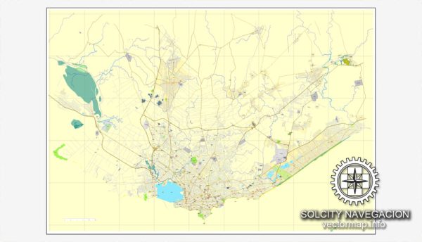
Montevideo, Uruguay, features a well-developed transportation infrastructure that supports both local and intercity travel.
Vectormap.Net provide you with the most accurate and up-to-date vector maps in Adobe Illustrator, PDF and other formats, designed for editing and printing. Please read the vector map descriptions carefully.
Here’s an overview of the city’s key transportation systems:
Roads and Highways
- Ruta Interbalnearia (Interbalnearia Route): A major highway that connects Montevideo with popular beach destinations along Uruguay’s coast, including Punta del Este. It is an important route for both tourism and local travel.
- Ruta 1: This highway connects Montevideo with the western part of Uruguay, including cities like Colonia del Sacramento. It is a crucial route for trade and travel between the capital and the rest of the country.
- Avenida 18 de Julio: A principal avenue running through the city center, serving as a major commercial and transportation corridor.
- Avenida Libertador: This coastal road runs parallel to the Rio de la Plata, connecting various parts of Montevideo and offering scenic views.
- Avenida Brasil: A significant north-south road that links Montevideo with suburban areas and provides access to various residential and commercial zones.
Public Transit
- Buses: Montevideo has an extensive bus network operated by various companies. Buses serve both the city and surrounding areas, with routes covering a wide range of neighborhoods and destinations. The city uses a contactless payment system known as the “MONNET” card for fares.
- Trains: The train system, operated by the state-run company Administración de Ferrocarriles del Estado (AFE), offers limited passenger services primarily connecting Montevideo with the surrounding areas, such as the city of Canelones and the town of Paso de los Toros. Most train services are focused on freight transport.
- Taxis and Ride-Sharing: Taxis are readily available throughout Montevideo and can be hailed on the street or booked via phone. Ride-sharing services such as Uber also operate in the city, providing additional transportation options.
Ports and Airports
- Port of Montevideo: One of the busiest ports in South America, handling both cargo and passenger ships. The port is a key hub for maritime trade and cruise ships, contributing significantly to the city’s economy.
- Carrasco International Airport (Aeropuerto Internacional de Carrasco – MVD): Located about 20 kilometers (12 miles) from downtown Montevideo, this is the primary airport serving the city. It offers both domestic and international flights, connecting Montevideo to major cities in Latin America, the United States, and Europe.
Cycling and Walking
- Bike Paths and Lanes: Montevideo has been expanding its network of bike paths and lanes to promote cycling as an alternative mode of transportation. The city features several dedicated bike lanes and paths, particularly along the Rambla and in central areas.
- Pedestrian Areas: The city center and some other neighborhoods have pedestrian-friendly areas with sidewalks, crossings, and public plazas. Key pedestrian zones include parts of Avenida 18 de Julio and areas around popular attractions like Mercado del Puerto.
Montevideo’s transportation infrastructure supports a range of travel needs, from local commuting and tourism to regional and international connections. The city continues to develop and improve its transportation systems to enhance mobility and connectivity for residents and visitors.


 Author: Kirill Shrayber, Ph.D. FRGS