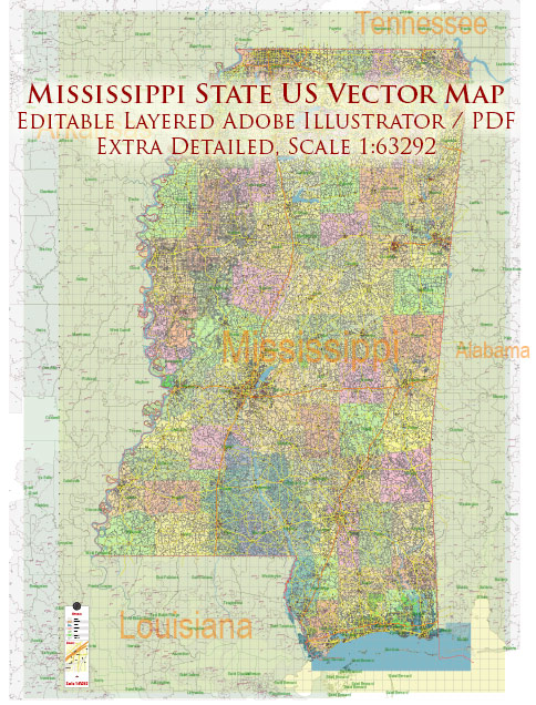
Mississippi, located in the southeastern United States, has a well-established transportation network that includes an extensive highway system and a robust railway network.
Vectormap.Net provide you with the most accurate and up-to-date vector maps in Adobe Illustrator, PDF and other formats, designed for editing and printing. Please read the vector map descriptions carefully.
These systems are crucial for the movement of goods and people within the state and beyond, contributing significantly to Mississippi’s economy and connectivity.
Highway System
Mississippi’s highway system is a vital component of its transportation infrastructure, consisting of interstate highways, U.S. highways, state highways, and county roads.
Interstate Highways
- I-10: Running along the southern edge of Mississippi, I-10 connects the state with neighboring Louisiana to the west and Alabama to the east. It passes through the Gulf Coast region, including cities like Gulfport and Biloxi, and is a key route for both freight and tourism.
- I-20: This interstate runs east-west through the central part of Mississippi, connecting Vicksburg, Jackson (the state capital), and Meridian. I-20 links Mississippi to major urban centers in Louisiana and Alabama.
- I-22: Also known as Corridor X, I-22 connects Memphis, Tennessee, with Birmingham, Alabama, passing through the northern part of Mississippi. It provides a critical east-west corridor in the region.
- I-55: Running north-south through the center of the state, I-55 connects the Gulf of Mexico with the Great Lakes, passing through Jackson and extending to the border with Tennessee near Memphis.
- I-59: This interstate runs from the northeastern part of the state to the southwestern corner, connecting Meridian with New Orleans, Louisiana. It is a major route for travelers heading to the Gulf Coast.
U.S. and State Highways
- U.S. Highways: In addition to interstates, Mississippi has a network of U.S. highways that provide critical links between smaller towns and cities. Notable routes include U.S. Highway 49, which runs from the Gulf Coast to the Arkansas border, and U.S. Highway 82, which crosses the state from east to west.
- State Highways: Mississippi maintains an extensive system of state highways that connect rural areas with larger cities and towns. These highways are essential for local commerce and daily commuting.
Challenges and Developments
- Infrastructure Upgrades: Mississippi has been working on upgrading its highway infrastructure, including widening roads, improving interchanges, and enhancing safety features. These projects are essential for supporting economic growth and reducing traffic congestion.
- Rural Connectivity: Ensuring connectivity in rural areas remains a priority, with ongoing efforts to maintain and improve secondary and rural road networks.
Railway System
Mississippi’s railway system plays a crucial role in freight transportation, with several major rail lines crossing the state. These railways are essential for moving goods such as agricultural products, chemicals, and manufactured goods to markets across the country.
Freight Rail
- Class I Railroads: Mississippi is served by several Class I railroads, which are the largest freight rail operators in the country. These include:
- Canadian National Railway (CN): CN operates a significant north-south route through Mississippi, connecting the Gulf of Mexico with Canada. It is a major conduit for the transport of goods from the Midwest to southern ports.
- CSX Transportation: CSX operates rail lines in the eastern part of Mississippi, providing crucial east-west freight corridors that connect the state to the eastern seaboard and the Midwest.
- Norfolk Southern (NS): Norfolk Southern runs east-west routes across the northern part of the state, linking Mississippi with key markets in the Southeast and beyond.
- Kansas City Southern (KCS): KCS operates lines that connect Mississippi with Mexico and other parts of the southern United States, facilitating international trade.
Passenger Rail
- Amtrak: Passenger rail service in Mississippi is provided by Amtrak, with two main routes:
- The City of New Orleans: This route runs between Chicago, Illinois, and New Orleans, Louisiana, passing through Mississippi cities such as Greenwood, Yazoo City, Jackson, Brookhaven, and McComb. It provides an important north-south connection for passengers traveling through the Mississippi Delta and central regions.
- The Crescent: This route runs between New York City and New Orleans, with stops in Meridian, Laurel, and Hattiesburg. It offers east-west connectivity and serves as a vital link for passengers traveling through the southern and eastern parts of the state.
Challenges and Future Plans
- Rail Infrastructure Maintenance: Maintaining and upgrading rail infrastructure is a constant challenge, with efforts focused on improving track conditions, enhancing safety, and increasing capacity to handle growing freight demands.
- Passenger Rail Expansion: There have been discussions about expanding passenger rail services in Mississippi, including potential new routes and increased frequencies on existing lines to better serve the state’s residents and boost tourism.
Ports and Intermodal Connections
- Ports: Mississippi’s transportation network is further enhanced by its proximity to the Gulf of Mexico, with major ports like the Port of Gulfport and the Port of Pascagoula playing key roles in international trade. These ports are connected to the rail and highway systems, facilitating the efficient movement of goods between sea, rail, and road.
- Intermodal Facilities: Mississippi has several intermodal facilities that allow for the seamless transfer of goods between rail, road, and maritime transport. These facilities are crucial for supporting the state’s logistics and manufacturing industries.
Mississippi’s highway and railway systems are integral to its economy, providing essential connections for the movement of goods and people across the state and beyond. The state’s transportation infrastructure continues to evolve, with ongoing investments aimed at improving efficiency, safety, and connectivity.


 Author: Kirill Shrayber, Ph.D.