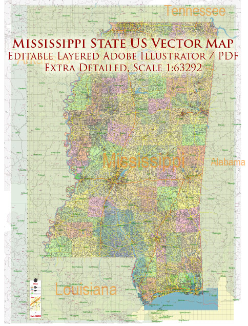
Mississippi State’s transportation infrastructure is a critical component that supports the movement of people, goods, and services throughout the state.
Vectormap.Net provide you with the most accurate and up-to-date vector maps in Adobe Illustrator, PDF and other formats, designed for editing and printing. Please read the vector map descriptions carefully.
The infrastructure encompasses various modes, including highways, railroads, airports, ports, and public transit systems. Here’s an overview:
1. Highways and Roads
- Interstate Highways: Mississippi is served by several major interstate highways, including I-10, I-20, I-55, and I-59. These highways connect the state to neighboring states and are vital for interstate commerce and travel.
- State Highways: The state has an extensive network of state highways that connect rural areas to urban centers. Mississippi Highway 6, 7, and 25 are examples of key state routes.
- Local Roads: County and city roads form the backbone of the rural and urban transportation network, supporting local traffic and connecting smaller communities.
2. Railroads
- Mississippi has a significant rail infrastructure, with several major freight railroads operating in the state, including CSX, Norfolk Southern, and Kansas City Southern. These rail lines are essential for the transportation of agricultural products, chemicals, and manufactured goods.
- Passenger Rail: Amtrak provides limited passenger rail service through the state, with the City of New Orleans line running between New Orleans and Chicago, stopping in several Mississippi cities.
3. Airports
- Commercial Airports: Jackson-Medgar Wiley Evers International Airport (JAN) is the largest airport in the state, offering domestic flights. Other regional airports include Gulfport-Biloxi International Airport (GPT) and Tupelo Regional Airport (TUP).
- General Aviation: Numerous smaller airports across the state serve private, corporate, and cargo flights, playing a critical role in connecting remote areas.
4. Ports and Waterways
- Ports: Mississippi has several ports along the Gulf Coast and the Mississippi River, including the Port of Gulfport, Port of Pascagoula, and the Port of Vicksburg. These ports handle a wide range of cargo, from agricultural products to industrial goods.
- Waterways: The Mississippi River, one of the most significant commercial waterways in the United States, runs along the western border of the state, providing an essential route for the transportation of goods. The Tennessee-Tombigbee Waterway also connects the state to the Gulf of Mexico.
5. Public Transit
- Public transportation options in Mississippi are limited, particularly in rural areas. Larger cities like Jackson, Biloxi, and Hattiesburg offer bus services, but these are relatively modest compared to those in more urbanized states.
- Ridesharing and Taxis: In urban centers, ridesharing services like Uber and Lyft, along with traditional taxis, provide additional transportation options.
6. Challenges and Opportunities
- Maintenance and Upgrades: Mississippi’s transportation infrastructure faces challenges related to maintenance and modernization. Aging bridges, roadways, and rail lines require significant investment to meet future demands.
- Funding: Funding for infrastructure projects is often a challenge, with the state relying on a mix of federal, state, and local funds to maintain and improve the network.
- Resilience: The state’s infrastructure must also be resilient to natural disasters, particularly hurricanes, which can severely impact transportation systems, especially in the coastal regions.
Mississippi’s transportation infrastructure is crucial for the state’s economic vitality, connecting communities, supporting industries, and enabling trade.


 Author: Kirill Shrayber, Ph.D. FRGS