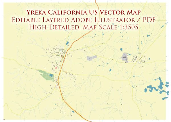
Yreka is a city located in Siskiyou County, California, United States. It is situated in the northern part of the state, near the Oregon border.
Vectormap.Net provide you with the most accurate and up-to-date vector maps in Adobe Illustrator, PDF and other formats, designed for editing and printing. Please read the vector map descriptions carefully.
Here is a brief overview of the history and transportation infrastructure of Yreka:
History:
- Indigenous Peoples: Before European settlers arrived, the region was inhabited by various Native American tribes, including the Shasta people. These indigenous communities had a rich cultural history in the area.
- Gold Rush Era: Yreka’s history is closely tied to the California Gold Rush of the mid-19th century. In 1851, gold was discovered in the area, leading to a rapid influx of miners and settlers. The town of Yreka was officially established in 1857, named after the Shasta word “wáik’a’,” meaning “white mountain,” a reference to nearby Mount Shasta.
- Development and Growth: Yreka grew as a supply and transportation hub for miners in the surrounding region. The town quickly developed with the construction of businesses, homes, and infrastructure to support the growing population.
- Railroad Expansion: The arrival of the Oregon and California Railroad in the late 19th century further boosted Yreka’s growth, connecting the town to larger economic centers. The railroad facilitated the transportation of goods and people, contributing to the town’s prosperity.
Transportation Infrastructure:
- Highways: Yreka is well-connected by highways. Interstate 5, a major north-south route, passes through the area, providing easy access to the town. State Route 3 also intersects Yreka, connecting it to other parts of California.
- Railroads: While the historic Oregon and California Railroad played a crucial role in Yreka’s early development, the town no longer serves as a major rail hub. However, rail transportation remains important for the broader region’s economic activities.
- Airport: The nearest airport to Yreka is Montague-Yreka Rohrer Field Airport (ICAO code: 1O5). While it is a relatively small airport, it serves general aviation needs and contributes to the transportation infrastructure of the area.
- Public Transit: Yreka has a public transit system that provides bus services, connecting the town with neighboring communities. This is particularly important for residents who rely on public transportation for daily commuting and essential services.
- Road Networks: Yreka has a well-developed road network, consisting of local streets and avenues. This infrastructure facilitates local transportation, ensuring easy access to businesses, schools, and residential areas.
In summary, Yreka’s history is rooted in the Gold Rush era, and its transportation infrastructure has evolved to include highways, a historic railroad, an airport, and public transit, supporting the town’s connectivity with the broader region.


 Author: Kirill Shrayber, Ph.D. FRGS