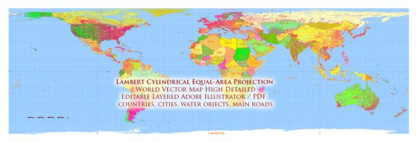
The Lambert Azimuthal Equal-Area Projection is often chosen for specific use cases where equal area representation is a critical factor.
Vectormap.Net provide you with the most accurate and up-to-date vector maps in Adobe Illustrator, PDF and other formats, designed for editing and printing. Please read the vector map descriptions carefully.
Here are some scenarios where using the Lambert azimuthal equal-area projection for a world map might make sense:
- Thematic Mapping:
- Equal Area Distribution: When the distribution of a thematic variable across regions is crucial, such as population density, vegetation cover, or climate zones, the Lambert azimuthal equal-area projection can be beneficial. It ensures that each region’s area is accurately represented on the map.
- Polar Mapping:
- Polar Regions: The projection is well-suited for mapping polar regions. When focusing on the Arctic or Antarctic, where distortions in shape and distance are less critical than maintaining equal area, this projection is a suitable choice.
- Cartograms:
- Population or Statistical Cartograms: Cartograms represent thematic data by distorting areas based on the variable of interest. The Lambert azimuthal equal-area projection can be used for cartograms, ensuring that the distortion primarily affects shape rather than area.
- Comparative Analysis:
- Comparing Regions: When the goal is to compare the relative sizes of regions or countries accurately, this projection can be useful. It allows viewers to make accurate visual comparisons of the areas of different regions on the map.
- Education and Visualization:
- Educational Maps: In educational contexts, where the goal is to teach students about the sizes of countries and continents, the equal-area property of this projection can be valuable. It helps avoid misperceptions caused by distorted map projections.
- Scientific Analysis:
- Biogeography or Ecology Studies: For studies involving the distribution of species or ecosystems, the Lambert azimuthal equal-area projection can provide a more accurate representation of the relative areas of different regions.
- Regional Planning:
- Regional Planning Maps: When creating maps for regional planning, such as resource allocation or environmental impact assessment, the Lambert azimuthal equal-area projection may be suitable for maintaining accurate area relationships.
It’s important to note that the choice of map projection depends on the specific goals of the map and the nature of the data being represented. While the Lambert azimuthal equal-area projection has its advantages, it also comes with trade-offs, such as distortion in shape and distance. Careful consideration of the map’s purpose and the characteristics of the region being mapped is essential when selecting a projection.


 Author: Kirill Shrayber, Ph.D.