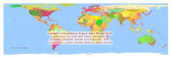
History of the author and creation of the World Lambert’s azimuthal equal-area projection
Vectormap.Net provide you with the most accurate and up-to-date vector maps in Adobe Illustrator, PDF and other formats, designed for editing and printing. Please read the vector map descriptions carefully.
The Lambert azimuthal equal-area projection, also known as Lambert’s equal-area projection, is attributed to Johann Heinrich Lambert, a Swiss mathematician, physicist, and astronomer. Lambert introduced this map projection in 1772 as part of his work on cartography.
Johann Lambert (1728–1777) made substantial contributions to various scientific fields, including mathematics, physics, and astronomy. In cartography, he developed several map projections, and the azimuthal equal-area projection is one of his notable achievements.
The Lambert azimuthal equal-area projection is characterized by its preservation of area, meaning that regions on the map have proportional areas to the corresponding areas on the Earth’s surface. This makes it suitable for thematic maps where accurate representation of the distribution of phenomena is important.
The projection is constructed by placing a plane tangent to the Earth’s surface at a single point, typically at one of the poles or at the center of a chosen region. Distortion increases radially from the tangent point, but the equal-area property is maintained.
Lambert’s work in cartography, including the development of the azimuthal equal-area projection, has had a lasting impact on the field, and his contributions are acknowledged in the history of mapmaking and geospatial science.


 Author: Kirill Shrayber, Ph.D. FRGS