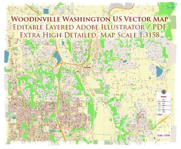
Some information on the districts, communities, and main streets in Woodinville, Washington.
Vectormap.Net provide you with the most accurate and up-to-date vector maps in Adobe Illustrator, PDF and other formats, designed for editing and printing. Please read the vector map descriptions carefully.
Woodinville is known for its wineries, beautiful landscapes, and a mix of residential and commercial areas. Here is a general overview of what you might find in Woodinville:
- Winery District:
- Woodinville is famous for its wine country, and there are several wineries and tasting rooms located in close proximity. The winery district attracts visitors looking to explore and enjoy local wines.
- Downtown Woodinville:
- The downtown area is likely to have a mix of shops, restaurants, and small businesses. This can be a central hub for community events and gatherings.
- Residential Communities:
- Woodinville is likely to have various residential communities with a range of housing options. These could include single-family homes, apartments, and condominiums.
- School Districts:
- Woodinville is served by local school districts. The specific school boundaries can impact the community and the availability of educational facilities.
- Main Streets:
- The main streets in Woodinville could include those with significant commercial activity, shops, and restaurants. These streets are often the focal point for local businesses and community events.
- Parks and Green Spaces:
- Woodinville is likely to have parks and green spaces, contributing to its reputation as a scenic and outdoor-friendly community.
- Transportation Hubs:
- Access to major roads, highways, or public transportation hubs may be important for residents and businesses. It’s common for communities to have key transportation nodes for convenience and connectivity.
For the most current and detailed information, consider checking local government websites, community resources, or contacting the City of Woodinville directly. Local news outlets, community organizations, and real estate listings can also provide insights into the different districts and neighborhoods within Woodinville.


 Author: Kirill Shrayber, Ph.D. FRGS