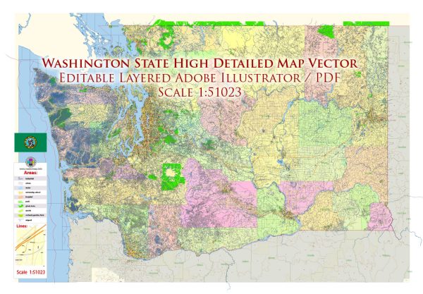
Washington State, located in the Pacific Northwest region of the United States, is known for its diverse landscapes, vibrant cities, and thriving economy.
Vectormap.Net provide you with the most accurate and up-to-date vector maps in Adobe Illustrator, PDF and other formats, designed for editing and printing. Please read the vector map descriptions carefully.
Here is a detailed description of some of the main cities, towns, ports, and principal roads in Washington State:
Cities:
- Seattle:
- Largest city in Washington and the Pacific Northwest.
- Known for the iconic Space Needle, Pike Place Market, and a thriving tech industry.
- Major seaport and the headquarters of several Fortune 500 companies.
- Tacoma:
- Located south of Seattle and known for its port and industrial activities.
- Home to the Museum of Glass and Point Defiance Park.
- Spokane:
- Eastern Washington’s largest city.
- Offers outdoor recreation and cultural attractions, such as Riverfront Park and the Northwest Museum of Arts and Culture.
- Bellevue:
- A suburb of Seattle, known for its thriving business community and upscale neighborhoods.
- Home to Bellevue Square, a prominent shopping and entertainment center.
- Vancouver:
- Not to be confused with the Canadian city of the same name, Vancouver is in Southwest Washington.
- A growing city with a mix of residential and commercial developments.
- Everett:
- Located north of Seattle, known for its aerospace industry.
- Home to the Future of Flight Aviation Center and Boeing Tour.
Towns:
- Olympia:
- The state capital, located in the southern part of the state.
- Rich in history and government institutions.
- Bellingham:
- Situated in the northwest corner of the state.
- Known for its proximity to the San Juan Islands and Western Washington University.
- Yakima:
- In the central part of the state, known for its agriculture, particularly apples and wine.
- Hosts the annual Central Washington State Fair.
- Wenatchee:
- Located in North Central Washington, known for its apple orchards.
- Offers outdoor activities and scenic views.
Ports:
- Port of Seattle:
- One of the largest and busiest ports on the West Coast.
- Handles a diverse range of cargo and is a major gateway for trade with Asia.
- Port of Tacoma:
- Located south of Seattle, it is a major container port and industrial center.
- Port of Everett:
- A deep-water port north of Seattle, primarily known for its aerospace industry and cargo activities.
Principal Roads:
- Interstate 5 (I-5):
- The major north-south interstate highway, connecting cities like Seattle, Tacoma, and Vancouver.
- Interstate 90 (I-90):
- The major east-west interstate highway, connecting Seattle with Spokane and ultimately reaching the East Coast.
- State Route 520 (SR-520):
- Connects Seattle and Bellevue, spanning Lake Washington.
- US Route 2 (US-2):
- An east-west highway connecting Everett and Spokane.
- US Route 97 (US-97):
- Runs north-south through central Washington, passing through cities like Wenatchee and Yakima.
These descriptions provide a broad overview of some of the key cities, towns, ports, and principal roads in Washington State. The state’s geography and infrastructure contribute to its diverse economy and cultural richness.


 Author: Kirill Shrayber, Ph.D. FRGS