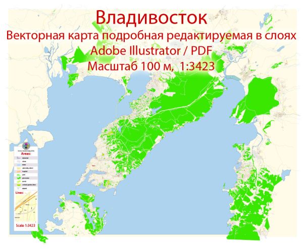
Vladivostok is a major city and the administrative center of Primorsky Krai, Russia. It is located in the Russian Far East, near the borders with China and North Korea.
Vectormap.Net provide you with the most accurate and up-to-date vector maps in Adobe Illustrator, PDF and other formats, designed for editing and printing. Please read the vector map descriptions carefully.
Here’s a detailed overview of the history, port, and transportation infrastructure of Vladivostok:
History:
- Founding and Early History:
- Vladivostok was founded in 1860 as a military outpost by the Russian Empire. The name translates to “Ruler of the East.”
- Initially, it served as a base for the Russian Pacific Fleet and played a crucial role in the development of maritime trade in the region.
- Strategic Importance:
- Vladivostok’s strategic location made it an essential center for trade and military activities, especially during conflicts like the Russo-Japanese War in 1904-1905.
- Soviet Era:
- During the Soviet era, Vladivostok was a closed city due to its proximity to military installations. It only opened to foreign visitors in the 1990s.
- Modern Era:
- In the post-Soviet period, Vladivostok has become an important economic and cultural hub in the Russian Far East, fostering trade and diplomatic relations with neighboring countries.
Port:
- Vladivostok Commercial Seaport:
- Vladivostok is home to the Vladivostok Commercial Seaport, one of the largest and oldest ports in Russia.
- The port handles various types of cargo, including containers, bulk cargo, and general cargo. It plays a significant role in facilitating trade between Russia and the Asia-Pacific region.
- International Connections:
- Vladivostok’s port serves as a key gateway for Russian exports and imports, connecting the country with countries in the Asia-Pacific region, such as China, Japan, and South Korea.
- Free Port Status:
- Vladivostok was granted free port status in 2015, aiming to stimulate economic development by offering various incentives for businesses and investors.
Transportation Infrastructure:
- Rail Transportation:
- Vladivostok is connected to the Trans-Siberian Railway, a major rail network spanning Russia.
- The rail connection enhances the city’s accessibility and facilitates the transportation of goods to and from the interior of Russia.
- Air Transportation:
- Vladivostok International Airport is a major aviation hub, connecting the city with domestic and international destinations.
- The airport has seen growth in passenger traffic, reflecting Vladivostok’s increasing role in regional and global trade.
- Road Network:
- The city is connected by road to other parts of Russia and neighboring countries. Roads facilitate the movement of goods and people within the region.
- Public Transportation:
- Vladivostok has an extensive public transportation system, including buses, trams, and trolleybuses, providing convenient options for residents and visitors to navigate the city.
- Maritime Transportation:
- In addition to the commercial port, Vladivostok also serves as a base for the Russian Pacific Fleet, emphasizing its maritime importance.
In summary, Vladivostok has a rich history shaped by its strategic location and has evolved into a crucial center for trade and transportation in the Russian Far East, with a well-developed port and diverse transportation infrastructure.


 Author: Kirill Shrayber, Ph.D. FRGS