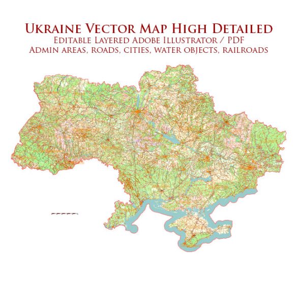
Some information about some of the main cities, nature parks, and principal roads in Ukraine.
Vectormap.Net provide you with the most accurate and up-to-date vector maps in Adobe Illustrator, PDF and other formats, designed for editing and printing. Please read the vector map descriptions carefully.
Main Cities:
- Kyiv (Kiev):
- The capital and largest city of Ukraine.
- Known for its rich history, architecture, and cultural landmarks, including the Kyiv Pechersk Lavra and Saint Sophia Cathedral.
- Kharkiv:
- Ukraine’s second-largest city.
- An important industrial and cultural center.
- Lviv:
- Located in the western part of Ukraine.
- Known for its well-preserved historic architecture and vibrant cultural scene.
- Odessa:
- A major port city on the Black Sea.
- Known for its cultural diversity, historical architecture, and lively atmosphere.
- Dnipro:
- One of the key industrial centers in Ukraine, located on the Dnieper River.
- Donetsk:
- Historically an industrial and coal-mining center, though it has been affected by conflicts in recent years.
- Zaporizhia:
- Located on the Dnieper River, known for its hydroelectric power station and historical sites.
Nature Parks:
- Carpathian National Nature Park:
- Located in the Carpathian Mountains in western Ukraine.
- Known for its diverse flora and fauna, mountain landscapes, and hiking trails.
- Oleshky Sands:
- One of the largest sand dunes in Europe, located in the Kherson Oblast in southern Ukraine.
- Askania-Nova Biosphere Reserve:
- Located in the Kherson Oblast, it is a unique combination of steppe and forest ecosystems.
- Shatsky National Natural Park:
- Situated in the Volyn region, known for its numerous lakes, forests, and biodiversity.
Principal Roads:
- M-01 (E-95):
- Connects Kyiv to the western border with Poland, passing through Lviv.
- M-03:
- Connects Kyiv to Kharkiv in the northeast.
- M-05:
- Connects Kyiv to Odessa in the south.
- M-06:
- Connects Kyiv to the eastern border with Russia, passing through Dnipro.
- M-07:
- Connects Kyiv to the southern border with Moldova, passing through Mykolaiv.
- M-30:
- Connects Kyiv to the eastern city of Sumy.
These roads are part of Ukraine’s extensive road network, which plays a crucial role in connecting various regions of the country. Keep in mind that infrastructure and road networks may have undergone changes or improvements since my last update.


 Author: Kirill Shrayber, Ph.D. FRGS