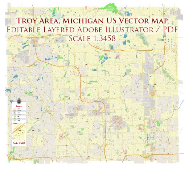
A general overview of the city of Troy, Michigan, including its districts, communities, and main streets.
Vectormap.Net provide you with the most accurate and up-to-date vector maps in Adobe Illustrator, PDF and other formats, designed for editing and printing. Please read the vector map descriptions carefully.
Districts: Troy is a city located in Oakland County, Michigan, and it is known for being a business and commercial hub in the Detroit metropolitan area. While Troy is primarily a suburban community, it does have distinct districts and neighborhoods. Some notable areas include:
- Troy City Center: This area often serves as the downtown district, featuring a mix of businesses, offices, and public spaces. The City Center is home to the Troy Public Library and the Troy Community Center.
- Somerset Collection Area: Troy is home to the upscale shopping destination, Somerset Collection. This area attracts visitors with its high-end retail stores, restaurants, and entertainment options.
- Troy Historic Village: This district preserves the city’s history and includes historic buildings, artifacts, and exhibits that showcase Troy’s development over the years.
Communities: Troy is primarily a residential community with various neighborhoods and subdivisions. Some of the well-known residential areas include:
- Troy Estates: A residential neighborhood with single-family homes.
- Beach Forest: Another residential area with a mix of housing options.
- Boulan Park: This neighborhood is located near Boulan Park Middle School and features a mix of residential properties.
Main Streets: While Troy doesn’t have a traditional downtown with a single main street, several roads and thoroughfares are essential for navigating the city:
- Big Beaver Road (also known as 16 Mile Road): Big Beaver Road is a major east-west artery and is known for its commercial and business developments, including office buildings, shopping centers, and restaurants.
- Rochester Road: Running north-south through Troy, Rochester Road is a key route lined with various businesses, including shopping centers, restaurants, and offices.
- Woodward Avenue: Although Woodward Avenue extends beyond Troy, it is an important route passing through the city, offering access to various amenities and attractions.
- Crooks Road: Another significant north-south road, Crooks Road, provides access to residential areas and commercial establishments.
For the most up-to-date and detailed information about specific districts, communities, and main streets in Troy, it is recommended to check with local sources, city planning departments, or community websites. Local resources such as city maps, community newsletters, and government websites can provide more specific and current details.


 Author: Kirill Shrayber, Ph.D. FRGS