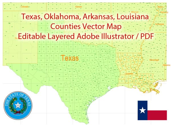
Texas and Louisiana are two large and diverse states in the southern United States, each with its own unique geography, culture, and history.
Vectormap.Net provide you with the most accurate and up-to-date vector maps in Adobe Illustrator, PDF and other formats, designed for editing and printing. Please read the vector map descriptions carefully.
Here’s a detailed description of some of the main cities and towns, as well as principal roads in both states:
Texas:
Major Cities:
- Houston:
- Known for its energy industry, NASA’s Johnson Space Center, and a diverse cultural scene.
- Major highways: I-10, I-45, I-69, I-610.
- Dallas:
- A major business and cultural hub with a thriving arts district.
- Major highways: I-35E, I-30, I-45, I-635.
- Austin:
- The capital of Texas, famous for its live music scene, technology, and a vibrant culture.
- Major highways: I-35, Loop 1 (MoPac), TX-71.
- San Antonio:
- Known for the historic Alamo, the River Walk, and a rich Spanish colonial heritage.
- Major highways: I-10, I-35, Loop 410.
- Fort Worth:
- Part of the Dallas-Fort Worth metroplex, with a strong cowboy and Western heritage.
- Major highways: I-35W, I-30, I-820.
- El Paso:
- Located on the border with Mexico, known for its multicultural influences.
- Major highways: I-10, US-54, Loop 375.
Other Notable Places:
- Galveston: A coastal city known for its historic architecture and Gulf of Mexico beaches.
- Corpus Christi: A port city with beautiful beaches and a significant naval air station.
- Amarillo: Located in the Texas Panhandle, known for its ranching heritage and Cadillac Ranch.
- Lubbock: Home to Texas Tech University and a center for agriculture and education.
Principal Roads:
- Interstate Highways (I): I-10, I-20, I-35, I-45, I-40, I-30, I-635, I-610, I-820.
- US Highways (US): US-59, US-75, US-281, US-77, US-84, US-87.
Louisiana:
Major Cities:
- New Orleans:
- Famous for its vibrant music scene, Creole culture, and annual Mardi Gras celebrations.
- Major highways: I-10, I-610, US-90.
- Baton Rouge:
- The capital city, known for its historical architecture and Louisiana State University.
- Major highways: I-10, I-12, I-110.
- Shreveport:
- Located in the northwest, known for its casinos and cultural events.
- Major highways: I-20, I-49, US-71.
- Lafayette:
- In the heart of Cajun country, known for its distinctive cuisine and cultural heritage.
- Major highways: I-10, I-49, US-90.
Other Notable Places:
- Lake Charles: A city in the southwest with a strong petrochemical industry and cultural festivals.
- Alexandria: Central Louisiana city with historical sites and outdoor recreational opportunities.
- Monroe: Known for the Louisiana Purchase Gardens and Zoo and the Biedenharn Museum and Gardens.
Principal Roads:
- Interstate Highways (I): I-10, I-12, I-20, I-49, I-110.
- US Highways (US): US-61, US-71, US-90, US-190.
Both Texas and Louisiana have extensive highway systems connecting cities and towns, and these roads play a crucial role in transportation and commerce in the region. The descriptions provided here are just a snapshot, and each city and town has its own unique characteristics and attractions.


 Author: Kirill Shrayber, Ph.D. FRGS