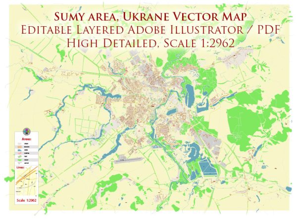
Sumy is a city located in northeastern Ukraine.
Vectormap.Net provide you with the most accurate and up-to-date vector maps in Adobe Illustrator, PDF and other formats, designed for editing and printing. Please read the vector map descriptions carefully.
A general overview of the urban history and street system in Sumy:
Urban History:
Sumy has a rich history that dates back to the 17th century. It was founded as a fortress on the banks of the Psel River in 1652. The city played a significant role in the history of the Cossack Hetmanate and later became a part of the Russian Empire. Throughout its history, Sumy experienced periods of growth, cultural development, and industrialization.
During the Soviet era, Sumy was an important industrial and cultural center in Ukraine. The city suffered during World War II but was subsequently rebuilt. After the dissolution of the Soviet Union in 1991, Sumy became part of an independent Ukraine.
Street System:
Sumy, like many European cities, has a grid-based street system in its central area, with streets running perpendicular and parallel to each other. Some streets in the city may have historical significance, reflecting the city’s past and architectural heritage.
Notable streets and areas in Sumy might include:
- Independence Square (Ploshcha Nezalezhnosti): Often a central square in Ukrainian cities, it’s a common meeting place and may be surrounded by important buildings.
- Rimarska Street: Known for its historical significance and possibly featuring a mix of residential and commercial buildings.
- Petropavlivska Street: This street might host various shops, cafes, and cultural institutions.
- Voskresenska Street: Another potential central street with a mix of businesses and historical sites.
- Psel River Embankment: If Sumy has an embankment along the Psel River, it could be a pleasant area for walking and recreation.
The specifics of the street system may vary, and newer developments or changes in urban planning could have occurred since my last update. For the most accurate and up-to-date information, it’s recommended to check with local sources or city authorities.
To get the most current details about Sumy’s urban history and street system, you may want to explore recent travel guides, city planning documents, or contact the local municipality for the latest information.


 Author: Kirill Shrayber, Ph.D. FRGS