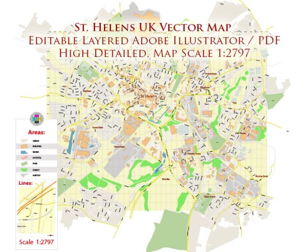
St Helens is a town in Merseyside, North West England. Its urban history is closely tied to the industrial revolution and the development of coal mining and glassmaking industries in the region.
Vectormap.Net provide you with the most accurate and up-to-date vector maps in Adobe Illustrator, PDF and other formats, designed for editing and printing. Please read the vector map descriptions carefully.
Here’s a detailed overview of the urban history and street system of St Helens:
Urban History:
- Industrial Revolution (18th-19th centuries):
- St Helens experienced significant growth during the Industrial Revolution, becoming an important center for coal mining and glass production.
- The abundance of coal in the area led to the establishment of numerous collieries, contributing to the town’s rapid industrialization.
- Glassmaking became another key industry, with several prominent glass manufacturers setting up operations in St Helens.
- Economic Boom:
- The economic boom fueled by coal and glass industries attracted a growing population to St Helens, leading to the expansion of the town.
- The town’s prosperity during this period is reflected in the architecture of some of its historic buildings, including Victorian and Edwardian structures.
- Decline of Traditional Industries:
- In the mid-20th century, the decline of traditional industries, especially coal mining and glassmaking, had a significant impact on St Helens.
- Many collieries were closed, and the economic landscape shifted towards service industries.
- Post-Industrial Era:
- St Helens has undergone a process of regeneration and diversification in the post-industrial era.
- Efforts have been made to revitalize the town, attract new businesses, and improve infrastructure to meet the changing needs of the community.
Street System:
- Town Center:
- The town center of St Helens is the focal point of commercial and civic activities. It features a mix of shopping areas, entertainment venues, and public spaces.
- Historic Streets:
- Some streets in the town center and surrounding areas showcase historic architecture from the Victorian and Edwardian eras.
- Examples include Church Street, Bridge Street, and Duke Street, where you can find a mix of traditional and modern buildings.
- Transportation Network:
- St Helens is well-connected by road and rail. The A580 East Lancashire Road passes through the town, linking it to Liverpool and Manchester.
- St Helens Central railway station provides rail connectivity, and the town has a network of bus services.
- Urban Planning and Redevelopment:
- As part of urban planning efforts, there have been redevelopment projects aimed at improving the town’s infrastructure and creating more attractive public spaces.
- Initiatives include the creation of pedestrian-friendly zones, landscaping, and the development of modern amenities.
- Residential Areas:
- St Helens consists of various residential neighborhoods, each with its own character. Some areas have a mix of housing styles, reflecting the town’s historical development.
In summary, St Helens’ urban history is closely tied to industrialization, and its street system reflects the changes and developments over the years. While the decline of traditional industries posed challenges, ongoing efforts in regeneration and urban planning aim to shape a new and vibrant future for the town.


 Author: Kirill Shrayber, Ph.D. FRGS