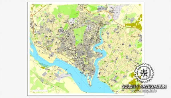
History of Southampton:
Southampton, located on the south coast of England, has a rich history dating back to Roman times. The area was initially settled by the Romans, who established a fortress known as Clausentum around AD 43. Throughout the medieval period, Southampton thrived as a significant port and played a crucial role in trade, particularly during the medieval wool trade.
During the medieval period, Southampton became a prominent port for trade with France and the Channel Islands. The city was also involved in the maritime ventures of the Age of Discovery, with ships like the Mayflower departing from Southampton in the 17th century.
In the modern era, Southampton has continued to be a vital port and played a crucial role during both World Wars, serving as a departure point for troops heading to the Western Front. The city has grown into a major commercial and industrial center, with a strong emphasis on maritime activities and shipbuilding.
Vectormap.Net provide you with the most accurate and up-to-date vector maps in Adobe Illustrator, PDF and other formats, designed for editing and printing. Please read the vector map descriptions carefully.
Port of Southampton:
The Port of Southampton is one of the busiest and most significant ports in the United Kingdom. It has a long history and has evolved into a modern, multi-functional port with various terminals catering to different types of cargo. Some key features of the port include:
- Container Terminals: Southampton has several container terminals, handling a large volume of containerized cargo. These terminals are equipped with state-of-the-art facilities to efficiently load and unload containers from ships.
- Cruise Terminals: Southampton is a major hub for cruise ship travel. It has multiple cruise terminals that cater to the growing cruise industry, providing embarkation and disembarkation facilities for passengers.
- Ro-Ro (Roll-on/Roll-off) Terminals: The port has facilities for the handling of Ro-Ro cargo, facilitating the transport of vehicles and other rolling stock.
- General Cargo Terminals: Facilities for handling general cargo, including bulk cargo and project cargo, contribute to the port’s versatility.
- Logistics and Warehousing: The port area includes extensive logistics and warehousing facilities, supporting the storage and distribution of various goods.
Transportation Infrastructure:
Southampton has a well-developed transportation infrastructure that connects the city and its port to the wider region and beyond.
- Road Network: The city is connected to the national road network through major highways, including the M3 and M27 motorways. These roads facilitate the efficient movement of goods to and from the port.
- Rail Connectivity: Southampton has a railway station providing connections to various destinations across the country. The port is well-connected to the rail network, allowing for the transportation of goods by train.
- Airport: Southampton Airport serves as a regional airport, offering domestic and international flights. It provides air connectivity for both passengers and cargo.
- Public Transport: The city has an extensive public transportation system, including buses that connect different parts of Southampton and the surrounding areas.
Overall, Southampton’s history and port infrastructure reflect its longstanding significance in maritime trade and its continued role as a key transportation hub in the United Kingdom.


 Author: Kirill Shrayber, Ph.D.