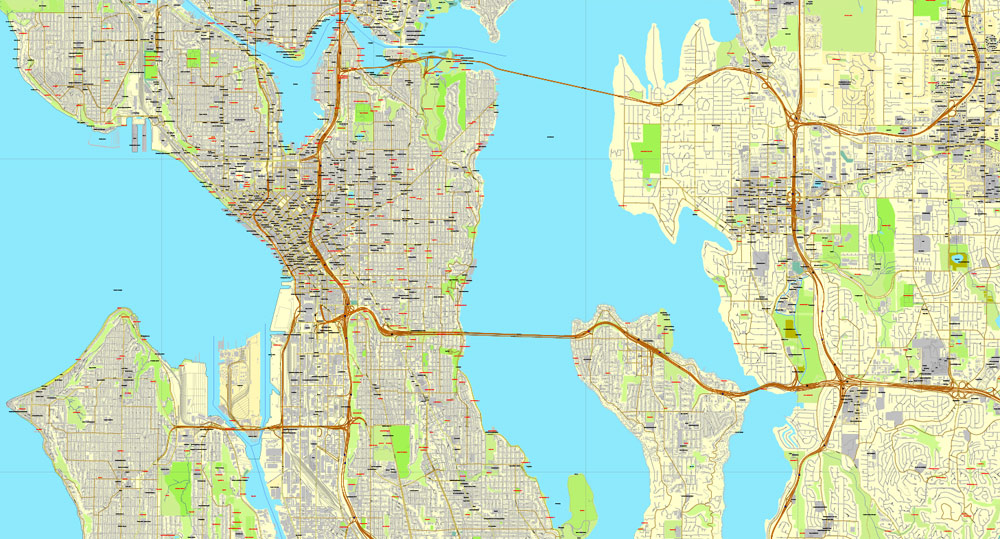
A general overview of the transportation and port infrastructure in the Seattle-Bellevue area in Washington state.
Vectormap.Net provide you with the most accurate and up-to-date vector maps in Adobe Illustrator, PDF and other formats, designed for editing and printing. Please read the vector map descriptions carefully.
Transportation:
- Roadways:
- Seattle and Bellevue are connected by a network of highways and bridges, including Interstate 90 and Interstate 405.
- The Seattle area has a well-developed road system with multiple bridges and tunnels facilitating transportation across bodies of water, such as Lake Washington and Puget Sound.
- Public Transit:
- King County Metro Transit operates bus services in the region, providing public transportation options for residents and visitors.
- Sound Transit oversees regional transit services, including Sounder commuter rail, Link light rail, and express bus services.
- Light Rail:
- The Link light rail system connects various neighborhoods within Seattle and extends to the SeaTac International Airport. Extensions to other areas were under development.
- Railways:
- Freight rail services play a significant role in transporting goods to and from the ports and industrial areas.
- Airports:
- Seattle-Tacoma International Airport (Sea-Tac) is the major airport serving the region. It is one of the busiest airports in the United States, providing domestic and international flights.
- Ports:
- The Port of Seattle is a major seaport handling both cargo and passenger traffic. It plays a crucial role in trade and commerce, connecting the region to global markets.
Port Infrastructure:
- Port of Seattle:
- The Port of Seattle consists of several terminals that handle a variety of cargo, including containers, bulk cargo, and breakbulk cargo.
- It is a gateway for trade with Asia and other international markets.
- The port has facilities for cruise ships, making it a popular departure and arrival point for cruises to Alaska and other destinations.
- Container Terminals:
- The container terminals at the Port of Seattle handle containerized cargo, facilitating the import and export of goods through international shipping.
- Cruise Terminals:
- The cruise terminals in Seattle are essential for the cruise industry, accommodating large cruise ships that operate in the Pacific Northwest and Alaska.
- Logistics and Distribution:
- The port area includes logistics and distribution centers that play a crucial role in the efficient movement of goods within the region.
For the most current information, it’s advisable to check with local transportation authorities or the Port of Seattle for the latest updates on infrastructure and transportation projects.






 Author: Kirill Shrayber, Ph.D. FRGS