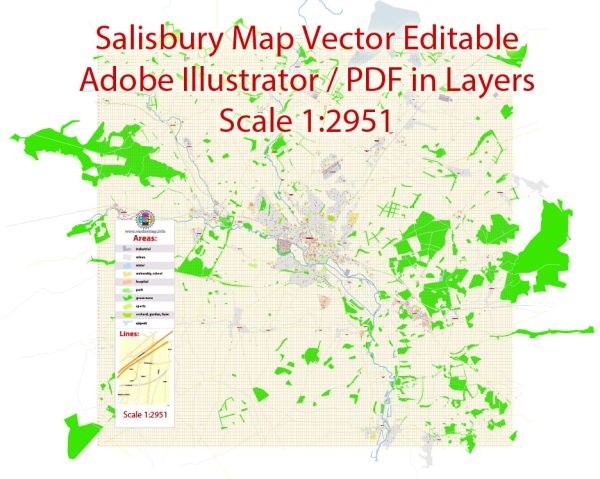
Salisbury, located in Wiltshire, England, is a city with a rich history and boasts several historic places, buildings, streets, and squares. One of the most iconic landmarks is Salisbury Cathedral, but there are many other notable sites to explore.
Vectormap.Net provide you with the most accurate and up-to-date vector maps in Adobe Illustrator, PDF and other formats, designed for editing and printing. Please read the vector map descriptions carefully.
Here’s a detailed description of some of the historic places in Salisbury:
- Salisbury Cathedral:
- Description: Salisbury Cathedral, also known as the Cathedral Church of the Blessed Virgin Mary, is one of the leading examples of Early English architecture. It was built between 1220 and 1258 and is known for its impressive spire, which stands at 123 meters (404 feet) tall, making it the tallest spire in the United Kingdom. The cathedral is home to the Magna Carta, one of the four surviving original copies of the document.
- The Close:
- Description: The Close is the area surrounding Salisbury Cathedral and is a historic precinct with a collection of beautifully preserved buildings, including the Bishop’s Palace, the Deanery, and various residences. The charming architecture and peaceful gardens make it a pleasant area to explore.
- Old Sarum:
- Description: Old Sarum is the site of the original Salisbury settlement, dating back to Iron Age times. It includes the ruins of a medieval castle and cathedral. The site offers panoramic views of the surrounding countryside and provides insight into the city’s early history.
- Mompesson House:
- Description: This 18th-century townhouse is located in the Cathedral Close and is a well-preserved example of Georgian architecture. Mompesson House features period rooms, a delightful walled garden, and a peaceful atmosphere.
- The Poultry Cross:
- Description: The Poultry Cross is an ancient market cross located in the heart of Salisbury. It dates back to the 14th century and served as a central point for market activities. The structure features intricate carvings and is a testament to the city’s medieval past.
- High Street:
- Description: The High Street is the primary shopping street in Salisbury, lined with historic buildings, shops, and restaurants. It’s a bustling area with a mix of architectural styles, including medieval, Tudor, and Georgian.
- Guildhall Square:
- Description: Guildhall Square is a public space in the city center surrounded by historic buildings. The Guildhall itself is an imposing structure dating back to the 18th century and is often used for events and exhibitions.
- Fish Row:
- Description: Fish Row is a charming street in Salisbury known for its narrow, medieval buildings. It has a historic and picturesque atmosphere, providing a glimpse into the city’s past.
These are just a few examples of the historic places, buildings, streets, and squares that contribute to Salisbury’s rich heritage. The city’s blend of medieval and Georgian architecture, coupled with its picturesque surroundings, makes it a fascinating destination for history enthusiasts.


 Author: Kirill Shrayber, Ph.D. FRGS