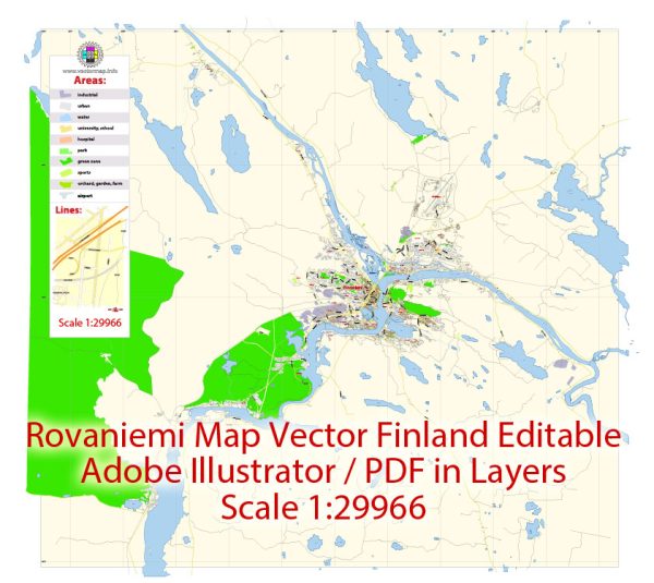
Some district, community, and street in Rovaniemi, Finland, a general overview.
Vectormap.Net provide you with the most accurate and up-to-date vector maps in Adobe Illustrator, PDF and other formats, designed for editing and printing. Please read the vector map descriptions carefully.
Rovaniemi is the capital of Lapland, the northernmost province of Finland, and it is known for being the official hometown of Santa Claus. The city is situated at the confluence of the Kemijoki River and the Ounasjoki River.
Districts and Communities:
- City Center (Keskusta): This is the central area of Rovaniemi, where you can find the main commercial and administrative buildings. The central square, Lordi Square, is a focal point.
- Ounaspaviljonki: This district is located near the Ounasjoki River and is known for its scenic surroundings.
- Korkalovaara: Situated to the northeast of the city center, Korkalovaara is a residential area with housing and services.
- Rinteenkulma: This is another residential area, located south of the city center.
- Santasport: Near the Arctic Circle, Santasport is known for sports facilities and activities.
- Koivusaari: Located on an island in the Kemijoki River, Koivusaari offers a peaceful environment.
Street System: Rovaniemi has a well-planned street system with both main roads and smaller streets. Some notable streets and areas include:
- Rovakatu: A major street running through the city center, lined with shops and businesses.
- Jorma Eton tie: This street is named after a famous Finnish composer and is an essential route in the city.
- Rovaniemen Kirkko (Rovaniemi Church): The area around Rovaniemi Church is a central point in the city.
- Arktikum: A museum and science center in Rovaniemi, located near the Arctic Circle.
- Lapin Yliopisto (University of Lapland): The university is situated in Rovaniemi, contributing to the city’s academic and cultural atmosphere.
Please note that the information provided is a general overview, and for the most accurate and up-to-date information, it’s recommended to refer to local maps, city guides, or official municipal resources.


 Author: Kirill Shrayber, Ph.D. FRGS