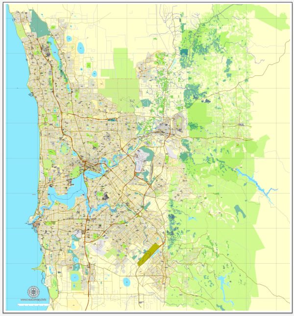
Perth, the capital city of Western Australia, has a rich history, well-developed port facilities, and an extensive transportation infrastructure.
Vectormap.Net provide you with the most accurate and up-to-date vector maps in Adobe Illustrator, PDF and other formats, designed for editing and printing. Please read the vector map descriptions carefully.
Let’s delve into each aspect:
History:
Indigenous History:
- The area around Perth has a long history of Indigenous occupation, with the Noongar people being the traditional custodians of the land.
- Indigenous communities in the region have a rich cultural heritage, with a deep connection to the land and the Swan River, which runs through the city.
European Settlement:
- The first European exploration of the region occurred in the 17th century, with the Dutch exploring the coastline.
- Captain James Stirling founded the Swan River Colony in 1829, establishing the city of Perth as the capital of Western Australia.
- The discovery of gold in the late 19th century led to a population boom, transforming Perth into a major economic hub.
Port Infrastructure:
Fremantle Port:
- Fremantle, located near Perth, is Western Australia’s major port.
- The port has a long history dating back to the 19th century and has played a crucial role in the state’s economic development.
- Fremantle Port handles a diverse range of cargo, including containerized goods, bulk cargo, and general cargo.
Facilities and Services:
- The port is equipped with modern facilities, including container terminals, bulk handling facilities, and roll-on/roll-off (RoRo) facilities.
- It serves as a gateway for Western Australia’s exports, particularly minerals and agricultural products.
Expansion and Upgrades:
- Over the years, Fremantle Port has undergone expansion and upgrades to accommodate the increasing volume of trade.
- Plans for the future involve further development to enhance capacity and efficiency.
Transportation Infrastructure:
Roads:
- Perth has a well-developed road network, with several major highways connecting the city to other parts of Western Australia.
- The Kwinana Freeway, Mitchell Freeway, and Roe Highway are key components of the road system.
Public Transportation:
- Transperth, the public transportation system, includes buses, trains, and ferries.
- The Transperth rail network connects various suburbs to the city center, and the bus network covers a wide area.
Airport:
- Perth Airport is a major international airport, connecting the city to destinations worldwide.
- The airport has multiple terminals, including an international terminal and terminals for domestic flights.
Future Developments:
- Perth continues to invest in its transportation infrastructure to accommodate population growth and economic development.
- Projects like the Perth City Link aim to enhance connectivity within the city, integrating public transportation and urban spaces.
In summary, Perth’s history is marked by Indigenous heritage and European settlement, its port infrastructure centers around Fremantle Port, and the transportation network includes a well-developed road system, public transportation, and a major international airport. Ongoing developments reflect the city’s commitment to accommodating growth and improving connectivity.


 Author: Kirill Shrayber, Ph.D. FRGS