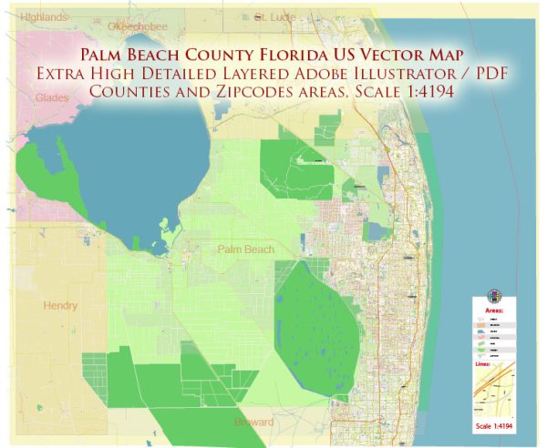
Palm Beach County is a prominent county located in the southeastern part of the U.S. state of Florida.
Vectormap.Net provide you with the most accurate and up-to-date vector maps in Adobe Illustrator, PDF and other formats, designed for editing and printing. Please read the vector map descriptions carefully.
Main Cities and Towns:
- West Palm Beach: The largest city and the county seat of Palm Beach County. It is known for its cultural venues, shopping districts, and proximity to the waterfront.
- Boca Raton: While the southern part of Boca Raton extends into Broward County, a significant portion is in Palm Beach County. It’s a city known for its upscale amenities, including shopping, dining, and cultural attractions.
- Boynton Beach: Located along the Intracoastal Waterway, Boynton Beach offers both coastal and suburban living.
- Delray Beach: A popular coastal city with vibrant cultural scenes, including art galleries and upscale dining.
- Jupiter: Located in the northern part of the county, Jupiter is known for its beautiful beaches and outdoor recreational opportunities. It’s also home to the spring training facilities for the Miami Marlins and St. Louis Cardinals.
- Wellington: Known for its equestrian community and events, Wellington is a village in the western part of the county.
- Lake Worth Beach: A coastal city known for its historic downtown and vibrant arts scene.
- Palm Beach Gardens: Located in the northern part of the county, this city is known for its upscale neighborhoods and the Gardens Mall.
Major Ports:
Palm Beach County doesn’t have major seaports itself, but it is close to the Port of Palm Beach, which is located in Riviera Beach, just north of West Palm Beach. The Port of Palm Beach is a deepwater port with facilities for cargo and cruise ships.
Principal Roads:
- Interstate 95 (I-95): A major north-south highway running along the eastern coast of the United States. It passes through Palm Beach County, connecting its cities and towns.
- Florida’s Turnpike: A toll road that runs north-south through the state of Florida. It provides a more direct route for travelers heading to and from central and southern Florida.
- U.S. Route 1: A major north-south highway that runs along the east coast of the United States. In Palm Beach County, it parallels the coastline.
- State Road A1A: A scenic highway that runs along the Atlantic Ocean, providing beautiful views of the coast.
- Southern Boulevard (U.S. Route 98/441): A major east-west road connecting West Palm Beach to the western communities, including Wellington.


 Author: Kirill Shrayber, Ph.D. FRGS