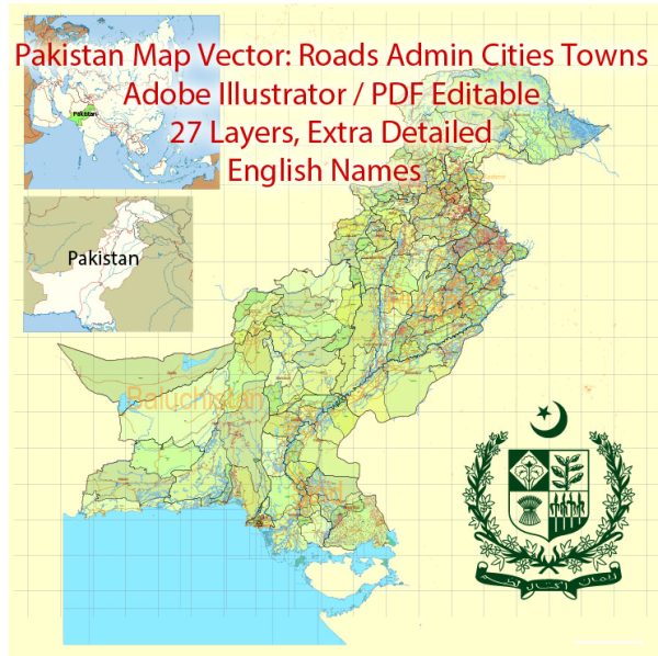
An information about some of the main cities, towns, and principal roads in Pakistan.
Vectormap.Net provide you with the most accurate and up-to-date vector maps in Adobe Illustrator, PDF and other formats, designed for editing and printing. Please read the vector map descriptions carefully.
Additionally, the focus will be on major cities, and there are many more towns and roads across the country.
Main Cities in Pakistan:
- Islamabad: The capital city of Pakistan, located in the northern part of the country. It is known for its modern architecture, government offices, and diplomatic enclaves.
- Karachi: The largest city and economic hub of Pakistan, situated in the southern province of Sindh. It is a major port city and the financial and industrial center of the country.
- Lahore: The cultural capital of Pakistan, located in the province of Punjab. Lahore is known for its rich history, vibrant culture, and historical landmarks.
- Peshawar: The capital of Khyber Pakhtunkhwa province, situated in the northwest near the border with Afghanistan. It has a significant historical and cultural importance.
- Quetta: The capital of Balochistan province, located in the southwestern part of Pakistan. Quetta is known for its scenic landscapes and serves as a trade and communication center.
- Faisalabad: A major industrial city in the province of Punjab, known for its textile and manufacturing industries.
- Multan: One of the oldest cities in the Asian subcontinent, located in the province of Punjab. Multan is famous for its historical monuments and is an important center for trade and commerce.
- Rawalpindi: Located adjacent to Islamabad, Rawalpindi is an important city with a strong military presence and serves as a transportation hub.
Principal Roads in Pakistan:
- Karakoram Highway (KKH): Connecting Islamabad (Pakistan) with Kashgar (China), this is one of the highest paved international roads in the world, passing through the scenic landscapes of the Karakoram Range.
- Grand Trunk Road (GT Road): An ancient road that stretches from Bangladesh through India to Pakistan. In Pakistan, it connects major cities like Lahore, Rawalpindi, and Peshawar.
- Indus Highway: Connecting Karachi with Peshawar, this highway follows the course of the Indus River and is a vital transportation route.
- M-2 Motorway: Connecting Lahore with Islamabad, this is a major toll highway that has reduced travel time between the two cities.
- Motorway M-1 and M-9: These motorways connect Islamabad with Peshawar and Karachi, respectively, providing high-speed transportation.
- National Highway (N-5): Running from Karachi to Torkham, near the Afghan border, this is a major north-south highway passing through important cities like Hyderabad, Sukkur, Multan, and Lahore.
- Lahore-Islamabad Motorway (M-3): Connecting Lahore with Islamabad, providing a faster route between the two major cities.
It’s important to note that Pakistan has an extensive road network, and ongoing infrastructure projects may have introduced new roads or improvements to existing ones. For the latest and most detailed information, consider referring to recent maps or official transportation authorities in Pakistan.


 Author: Kirill Shrayber, Ph.D. FRGS