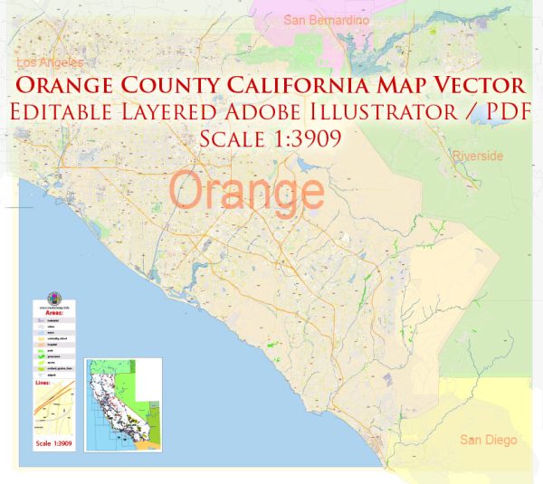
Vector Maps of the Orange County : region in Southern California. It’s known for Anaheim’s Disneyland Resort, a huge complex of rides, restaurants and shops. Nearby, in Buena Park, is Knott’s Berry Farm, a large theme park. Cities with surf beaches include Huntington Beach, with its surfing museum. Newport Beach’s boat-filled harbor sits opposite Balboa Peninsula. Laguna Beach has tide pools and oceanfront Crystal Cove State Park.
Area:
• Total: 948 sq mi (2,460 km2)
• Land: 799 sq mi (2,070 km2)
• Water: 157 sq mi (410 km2)
Vectormap.Net provide you with the most accurate and up-to-date vector maps in Adobe Illustrator, PDF and other formats, designed for editing and printing. Please read the vector map descriptions carefully.
Instant download archives: royalty free, editable vector maps of Orange County California in high resolution digital PDF and Adobe Illustrator format.
All of our editable Orange County California vector maps are digital files,
which can be instantly downloaded in editable PDF or Adobe Illustrator format.
Objects on maps are usually divided into layers according to their types – lines, polygons, street names, object names (see map description!!!!)
Each of our Orange County California digital maps is available in Adobe Illustrator or editable PDF format, (or on request in any other known format for the same price)
which use a vector approach to display images,
you can easily enlarge any part of our maps without compromising text, line or graphic quality,
with any increase or decrease ratio.
Using a vector graphics editor such as Adobe Illustrator, CorelDraw, Inkscape, or Freehand
you can easily crop parts of the map, add custom characters, and change colors and font attributes as needed.
We have a variety of Orange County California vector maps with different levels of detail, from simple empty paths to highly detailed maps with roads and terrain layers.
a general overview of Orange County, California. Keep in mind that some details may have changed since then, so it’s advisable to check more recent sources for the latest information.
Orange County is located in Southern California and is known for its affluent communities, beautiful beaches, and vibrant cultural scene.
Here is a brief description of the cities, towns, roads, and maritime infrastructure in Orange County:
Cities and Towns:
- Santa Ana: The county seat, Santa Ana is the most populous city and serves as the governmental center.
- Anaheim: Known for Disneyland Resort and Anaheim Convention Center, it’s a major tourist destination.
- Irvine: Home to the University of California, Irvine (UCI), and a hub for technology and education.
- Huntington Beach: Famous for its long sandy beaches, surfing culture, and the Huntington Beach Pier.
- Newport Beach: A coastal city known for its upscale neighborhoods, Newport Harbor, and Balboa Island.
- Laguna Beach: Renowned for its artistic community, beautiful beaches, and annual Pageant of the Masters.
- Costa Mesa: Features the South Coast Plaza shopping center and is a center for the arts.
- Mission Viejo: A planned suburban community with a picturesque lake at its center.
- Fullerton: Home to California State University, Fullerton, and has a historic downtown area.
- Orange: Known for its Old Towne Historic District and Chapman University.
Roads and Transportation:
- Interstate 5 (I-5): A major north-south freeway connecting Orange County to Los Angeles and San Diego.
- State Route 55 (SR-55): Connects the coastal cities to inland areas and intersects with I-5.
- State Route 22 (SR-22): An east-west freeway connecting Orange County to Long Beach and the San Gabriel Valley.
- State Route 91 (SR-91): Connects Orange County to Riverside County and the Inland Empire.
- Pacific Coast Highway (PCH or SR-1): Runs along the coast, offering scenic views and access to coastal cities.
- John Wayne Airport (SNA): Located in Irvine, it is the primary airport serving Orange County.
Maritime Infrastructure:
- Newport Harbor: A prominent harbor in Newport Beach, known for its marinas, waterfront homes, and recreational boating.
- Dana Point Harbor: A natural harbor with a marina, shopping, and dining facilities.
- Huntington Beach Pier: A popular spot for fishing, surfing, and strolling along the coastline.
- Balboa Island Ferry: Connects Balboa Island to the Balboa Peninsula, offering scenic views of Newport Harbor.
Orange County’s maritime infrastructure plays a significant role in supporting recreational activities, tourism, and trade along the Southern California coast. Additionally, the region has a network of roads and highways that facilitate transportation within the county and connect it to neighboring areas.
Don’t see exactly what you’re looking for? Contact us to receive a special offer for an individual Orange County California map for your project.


 Author: Kirill Shrayber, Ph.D.