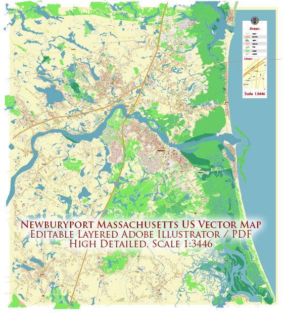
A general overview of Newburyport, Massachusetts. Keep in mind that specific details about districts, communities, and street systems may have changed since then.
Vectormap.Net provide you with the most accurate and up-to-date vector maps in Adobe Illustrator, PDF and other formats, designed for editing and printing. Please read the vector map descriptions carefully.
Overview: Newburyport is a historic city located on the northeast coast of Massachusetts, situated along the Merrimack River. It is known for its well-preserved Federal-style architecture, vibrant downtown area, and maritime heritage. The city is part of Essex County and has a rich history dating back to the colonial era.
Districts and Communities: Newburyport consists of several neighborhoods and districts, each with its own unique character. Some of the notable areas include:
- Downtown: The heart of Newburyport, the downtown area is characterized by brick sidewalks, historic buildings, and a lively atmosphere. It features a variety of shops, restaurants, cafes, and cultural attractions.
- Joppa: Located near the waterfront, Joppa is known for its picturesque views of the Merrimack River and waterfront activities. It has a mix of residential and commercial spaces.
- South End: This residential area is south of downtown and offers a mix of historic homes and newer developments. It has a more suburban feel compared to the bustling downtown area.
- North End: Similar to the South End, the North End is a residential neighborhood with a mix of housing options. It’s known for its proximity to parks and green spaces.
- Plum Island: Connected to Newburyport by a causeway, Plum Island is a barrier island with beautiful beaches, wildlife reserves, and a mix of year-round and seasonal residences.
Street System: Newburyport’s street system is a grid layout typical of many New England towns. The downtown area has narrow, one-way streets with angled parking, contributing to its historic charm. Some of the main streets in Newburyport include State Street, High Street, Merrimac Street, and Water Street.
The street system is designed to accommodate both pedestrian and vehicular traffic, with sidewalks, crosswalks, and pedestrian-friendly areas in the downtown district. The city is easily navigable, and its layout encourages walking and exploring.
For the most current and detailed information, consider checking with the Newburyport City Hall, the local Chamber of Commerce, or other official sources that provide maps and neighborhood guides. Additionally, community websites or local publications may offer insights into specific districts and communities within Newburyport.


 Author: Kirill Shrayber, Ph.D. FRGS