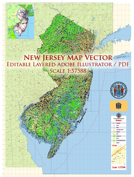
New Jersey, located in the northeastern part of the United States, is a densely populated state known for its diverse landscapes, vibrant cities, and proximity to major metropolitan areas like New York City and Philadelphia.
Vectormap.Net provide you with the most accurate and up-to-date vector maps in Adobe Illustrator, PDF and other formats, designed for editing and printing. Please read the vector map descriptions carefully.
Here’s a detailed overview of some of the main cities, towns, and roads in New Jersey:
Main Cities:
- Newark:
- As the largest city in New Jersey, Newark is a major transportation hub and home to Newark Liberty International Airport.
- It has a rich cultural scene, including museums, theaters, and sports venues.
- Jersey City:
- Situated along the Hudson River waterfront, Jersey City offers stunning views of the Manhattan skyline.
- It is a growing business and residential center with a diverse population.
- Trenton:
- Serving as the capital of New Jersey, Trenton has historical significance and is located along the Delaware River.
- The city is known for its museums, including the New Jersey State Museum.
- Paterson:
- Famous for its Great Falls, Paterson was a significant industrial city during the 19th century.
- The city has a diverse cultural heritage and is known for its silk production history.
- Atlantic City:
- A popular resort destination known for its boardwalk, casinos, and entertainment venues.
- Atlantic City attracts tourists with its beaches, nightlife, and various entertainment options.
Major Towns:
- Princeton:
- Home to Princeton University, this town is known for its historic architecture and intellectual community.
- The downtown area offers charming shops and restaurants.
- Morristown:
- With a rich Revolutionary War history, Morristown has historical sites and museums.
- It is a picturesque town with a vibrant downtown.
- Hoboken:
- Located on the Hudson River waterfront, Hoboken has a lively atmosphere with bars, restaurants, and parks.
- It’s a popular residential area for young professionals.
- Cherry Hill:
- A suburban town in southern New Jersey known for its shopping centers and proximity to Philadelphia.
- Cherry Hill is a family-friendly community with good schools.
Toll Roads:
- New Jersey Turnpike:
- A major toll road that runs north-south through the state, connecting the New York metropolitan area with Delaware.
- It is a key route for interstate travel.
- Garden State Parkway:
- A toll road that stretches the length of New Jersey along the eastern part of the state.
- It provides access to various shore towns and is a scenic route.
Free Roads:
- Interstate 80:
- An east-west highway connecting the Delaware Water Gap in the west to the George Washington Bridge in the east.
- U.S. Route 1:
- A major north-south highway passing through central New Jersey, providing access to various towns and cities.
- State Route 17:
- A north-south highway in northern New Jersey, connecting the New York metropolitan area with the rest of the state.
New Jersey has an extensive network of roads and highways, making it easily accessible and well-connected within the region. The state’s combination of urban centers, suburban communities, and natural attractions contributes to its diverse and dynamic character.


 Author: Kirill Shrayber, Ph.D. FRGS